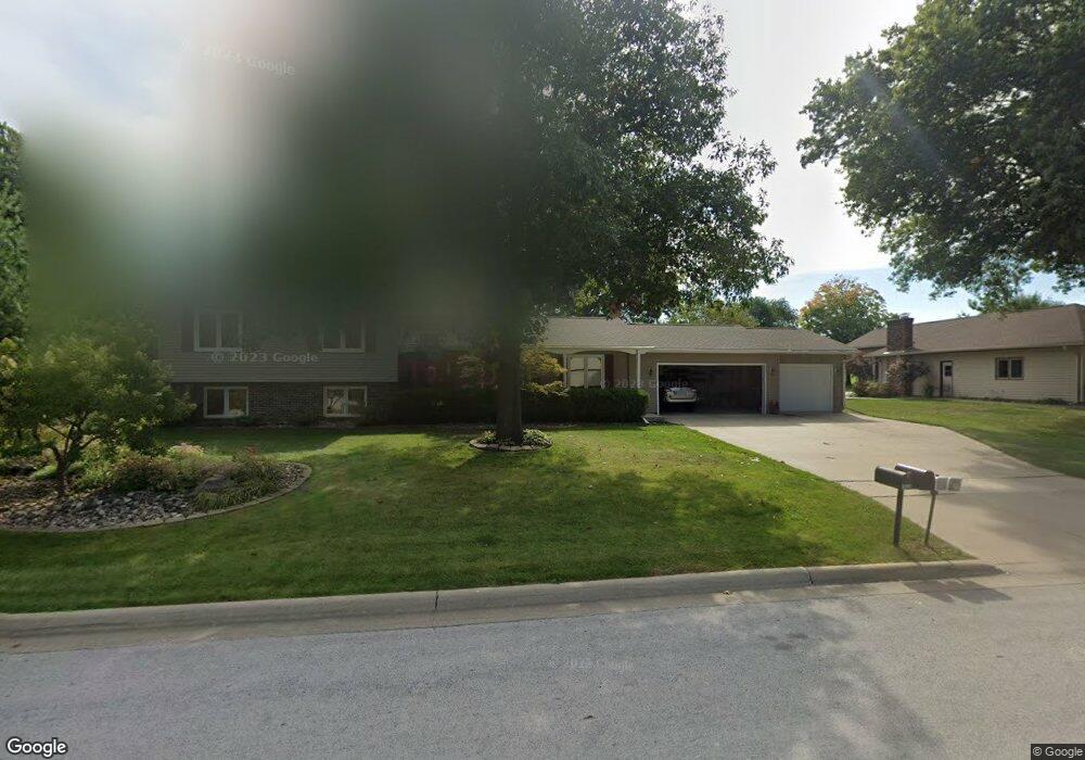
1839 Westchester Rd Waterloo, IA 50701
Estimated Value: $447,239 - $468,000
3
Beds
3
Baths
2,152
Sq Ft
$211/Sq Ft
Est. Value
About This Home
This home is located at 1839 Westchester Rd, Waterloo, IA 50701 and is currently estimated at $454,810, approximately $211 per square foot. 1839 Westchester Rd is a home located in Black Hawk County with nearby schools including Lou Henry Elementary School, Hoover Middle School, and West High School.
Ownership History
Date
Name
Owned For
Owner Type
Purchase Details
Closed on
Aug 26, 2024
Sold by
Bullerman Christopher M and Bullerman Callie
Bought by
Monaghan Matthew and Monaghan Meredith
Current Estimated Value
Home Financials for this Owner
Home Financials are based on the most recent Mortgage that was taken out on this home.
Original Mortgage
$427,500
Outstanding Balance
$422,961
Interest Rate
6.77%
Mortgage Type
New Conventional
Estimated Equity
$31,849
Purchase Details
Closed on
Jun 20, 2024
Sold by
Bullerman Margaret E
Bought by
Bullerman Margaret E and Bullerman Christopher M
Create a Home Valuation Report for This Property
The Home Valuation Report is an in-depth analysis detailing your home's value as well as a comparison with similar homes in the area
Home Values in the Area
Average Home Value in this Area
Purchase History
| Date | Buyer | Sale Price | Title Company |
|---|---|---|---|
| Monaghan Matthew | $450,000 | None Listed On Document | |
| Bullerman Margaret E | -- | None Listed On Document |
Source: Public Records
Mortgage History
| Date | Status | Borrower | Loan Amount |
|---|---|---|---|
| Open | Monaghan Matthew | $427,500 |
Source: Public Records
Tax History Compared to Growth
Tax History
| Year | Tax Paid | Tax Assessment Tax Assessment Total Assessment is a certain percentage of the fair market value that is determined by local assessors to be the total taxable value of land and additions on the property. | Land | Improvement |
|---|---|---|---|---|
| 2024 | $8,050 | $420,190 | $62,320 | $357,870 |
| 2023 | $6,442 | $420,190 | $62,320 | $357,870 |
| 2022 | $6,268 | $302,160 | $62,320 | $239,840 |
| 2021 | $6,524 | $302,160 | $62,320 | $239,840 |
| 2020 | $6,414 | $296,650 | $62,320 | $234,330 |
| 2019 | $6,414 | $296,650 | $62,320 | $234,330 |
| 2018 | $6,418 | $296,600 | $62,320 | $234,280 |
| 2017 | $6,616 | $296,600 | $62,320 | $234,280 |
| 2016 | $6,532 | $296,600 | $62,320 | $234,280 |
| 2015 | $6,532 | $296,600 | $62,320 | $234,280 |
| 2014 | $6,656 | $296,600 | $62,320 | $234,280 |
Source: Public Records
Map
Nearby Homes
- Lot 7 Kimberly Ln
- Lot 9 Kimberly Ln
- Lot 1 Kimberly Ln
- Lot 6 Kimberly Ln
- Lot 11 Kimberly Ln
- Lot 5 Kimberly Ln
- Lot 10 Kimberly Ln
- 1900 Westchester Rd Unit C
- Lot 8 Kimberly Ln
- 3923 Bradley Rd
- Lot 2 - 3455 Marnie Ave - Lot for Sale
- Lot 4 (Lot 11) Marnie Ave
- Lot 4 Marnie Ave
- Lot 3 Marnie Ave
- Lot 2 Marnie Ave
- Lot 1 Marnie Ave
- Lot 1 - 3423 Marnie Ave - Lot for Sale
- Lot 11 Red Tail Dr
- Lot 2 Red Tail Dr
- Lot 1 Red Tail Dr
- 1851 Westchester Rd
- 1831 Pinehurst Ln
- 1819 Pinehurst Ln
- 1846 Westchester Rd
- 1848 Westchester Rd
- 1836 Westchester Rd
- 1856 Westchester Rd
- 1857 Westchester Rd
- 1858 Westchester Rd
- 1845 Pinehurst Ln
- 1805 Pinehurst Ln
- 1828 Pinehurst Ln
- 1866 Westchester Rd
- 1855 Pinehurst Ln
- 1838 Pinehurst Ln
- 1868 Westchester Rd
- 1816 Pinehurst Ln
- 1929 Pinehurst Ct
- 1931 Pinehurst Ct
- 1903 Pinehurst Ln