Estimated Value: $243,771 - $283,000
--
Bed
2
Baths
1,972
Sq Ft
$135/Sq Ft
Est. Value
About This Home
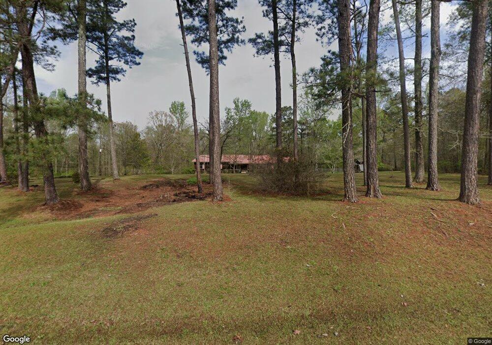
This home is located at 184 Greene Shade Rd, Gray, GA 31032 and is currently estimated at $266,193, approximately $134 per square foot. 184 Greene Shade Rd is a home located in Jones County with nearby schools including Dames Ferry Elementary School, Gray Station Middle School, and Jones County High School.
Ownership History
Date
Name
Owned For
Owner Type
Purchase Details
Closed on
Apr 17, 2013
Sold by
Goldstein Susan H
Bought by
Hadaway Joseph T and Hadaway Cheryl A
Current Estimated Value
Purchase Details
Closed on
Aug 1, 2008
Sold by
Brown Matthew L
Bought by
Goldstein Susan H
Purchase Details
Closed on
Nov 21, 2005
Sold by
Norris Paula K
Bought by
Brown Matthew L and Brown Cambrian L
Home Financials for this Owner
Home Financials are based on the most recent Mortgage that was taken out on this home.
Original Mortgage
$132,720
Interest Rate
6.04%
Mortgage Type
New Conventional
Purchase Details
Closed on
Nov 21, 2001
Sold by
Norris Alan\Paula
Bought by
Norris Paula K
Purchase Details
Closed on
Dec 3, 1993
Bought by
Norris Alan\Paula
Create a Home Valuation Report for This Property
The Home Valuation Report is an in-depth analysis detailing your home's value as well as a comparison with similar homes in the area
Home Values in the Area
Average Home Value in this Area
Purchase History
| Date | Buyer | Sale Price | Title Company |
|---|---|---|---|
| Hadaway Joseph T | $5,700 | -- | |
| Goldstein Susan H | $165,000 | -- | |
| Brown Matthew L | $165,900 | -- | |
| Norris Paula K | -- | -- | |
| Norris Alan\Paula | $115,000 | -- |
Source: Public Records
Mortgage History
| Date | Status | Borrower | Loan Amount |
|---|---|---|---|
| Previous Owner | Brown Matthew L | $132,720 |
Source: Public Records
Tax History Compared to Growth
Tax History
| Year | Tax Paid | Tax Assessment Tax Assessment Total Assessment is a certain percentage of the fair market value that is determined by local assessors to be the total taxable value of land and additions on the property. | Land | Improvement |
|---|---|---|---|---|
| 2024 | $1,483 | $53,706 | $7,819 | $45,887 |
| 2023 | $1,275 | $47,440 | $7,819 | $39,621 |
| 2022 | $1,261 | $47,049 | $7,428 | $39,621 |
| 2021 | $1,262 | $47,049 | $7,428 | $39,621 |
| 2020 | $1,263 | $47,049 | $7,428 | $39,621 |
| 2019 | $1,263 | $47,049 | $7,428 | $39,621 |
| 2018 | $1,083 | $42,035 | $7,428 | $34,607 |
| 2017 | $1,083 | $42,035 | $7,428 | $34,607 |
| 2016 | $1,051 | $41,159 | $7,428 | $33,731 |
| 2015 | $1,005 | $41,159 | $7,428 | $33,731 |
| 2014 | $1,202 | $41,969 | $7,428 | $34,541 |
Source: Public Records
Map
Nearby Homes
- 166 Greene Shade Rd
- 177 Patton Rd
- 5 Points Rd
- 0 Cyler Rd Unit 22357125
- 0 Monticello Hwy Unit 22346708
- 0 5 Points Rd
- 0 Sandra Dr Unit M179018
- 0 Sandra Dr Unit 52382
- 0 Sandra Dr Unit 10487926
- 0 Sandra Dr Unit 252106
- 139 Jackson Ave
- 285 Pippin Rd
- 3331 Trotters Ridge Trail
- 236 Old Clinton Rd
- LOT 1 C Georgia 18
- 191 Henry Dr
- 133 Oakview Cir
- 173 Henry Dr
- 0 Clinton Crossing Unit 10637924
- 266 Clinton Crossing Dr
- 119 Old Town Rd
- 157 Greene Shade Rd
- 111 Old Town Rd
- 143 Greene Shade Rd
- 143 Old Town Rd
- 124 Old Town Rd
- 132 Greene Shade Rd
- 135 Greene Shade Rd
- 149 Old Town Rd
- 127 Greene Shade Rd
- 151 Old Town Rd
- 150 Old Town Rd
- 897 Greene Settlement Rd
- 117 Greene Shade Rd
- 975 Greene Settlement Rd
- 109 Greene Shade Rd
- 106 Greene Shade Rd
- 995 Greene Settlement Rd
- 223 Dye Rd
- 201 Dye Rd