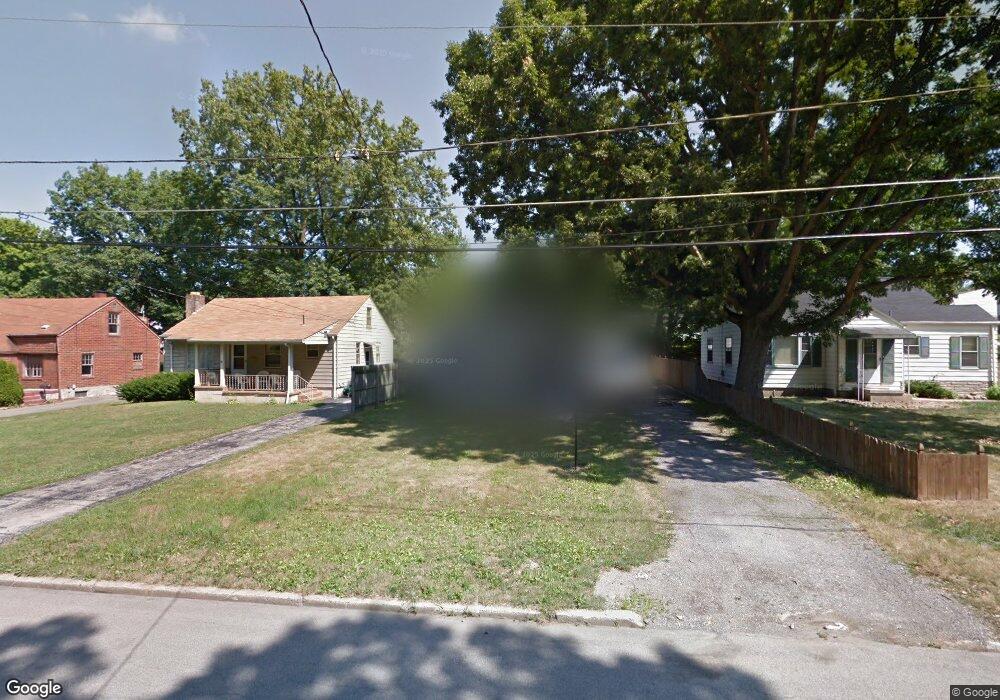
184 Homestead Dr Youngstown, OH 44512
Estimated Value: $113,434 - $132,000
3
Beds
1
Bath
1,120
Sq Ft
$110/Sq Ft
Est. Value
About This Home
This home is located at 184 Homestead Dr, Youngstown, OH 44512 and is currently estimated at $123,609, approximately $110 per square foot. 184 Homestead Dr is a home located in Mahoning County with nearby schools including Boardman Glenwood Junior High School, Boardman High School, and Horizon Science Academy - Youngstown.
Ownership History
Date
Name
Owned For
Owner Type
Purchase Details
Closed on
Oct 14, 2010
Sold by
The Huntington National Bank
Bought by
Mayor James
Current Estimated Value
Purchase Details
Closed on
Sep 17, 2010
Sold by
Tresler Wolf Properties Llc
Bought by
The Huntington National Bank
Purchase Details
Closed on
Feb 15, 2005
Sold by
Cendant Mobility Government Financial Se
Bought by
Tresler Wolfe Properties Llc
Home Financials for this Owner
Home Financials are based on the most recent Mortgage that was taken out on this home.
Original Mortgage
$45,200
Interest Rate
6.05%
Mortgage Type
Unknown
Purchase Details
Closed on
Nov 3, 2004
Sold by
Sauisberry Sheri Yvette
Bought by
Cendant Mobility Government Financial Se
Purchase Details
Closed on
Oct 21, 1996
Sold by
Cole Richard A
Bought by
Saulsberry Sheri Y
Purchase Details
Closed on
Apr 23, 1973
Bought by
Cole Richard A and Cole Mgt E
Create a Home Valuation Report for This Property
The Home Valuation Report is an in-depth analysis detailing your home's value as well as a comparison with similar homes in the area
Home Values in the Area
Average Home Value in this Area
Purchase History
| Date | Buyer | Sale Price | Title Company |
|---|---|---|---|
| Mayor James | $18,700 | Attorney | |
| The Huntington National Bank | $42,000 | Attorney | |
| Tresler Wolfe Properties Llc | $56,000 | -- | |
| Cendant Mobility Government Financial Se | $77,000 | -- | |
| Saulsberry Sheri Y | $56,500 | -- | |
| Cole Richard A | -- | -- |
Source: Public Records
Mortgage History
| Date | Status | Borrower | Loan Amount |
|---|---|---|---|
| Previous Owner | Tresler Wolfe Properties Llc | $45,200 |
Source: Public Records
Tax History Compared to Growth
Tax History
| Year | Tax Paid | Tax Assessment Tax Assessment Total Assessment is a certain percentage of the fair market value that is determined by local assessors to be the total taxable value of land and additions on the property. | Land | Improvement |
|---|---|---|---|---|
| 2024 | $1,314 | $25,270 | $4,190 | $21,080 |
| 2023 | $1,297 | $25,270 | $4,190 | $21,080 |
| 2022 | $1,388 | $20,720 | $3,830 | $16,890 |
| 2021 | $1,388 | $20,720 | $3,830 | $16,890 |
| 2020 | $1,396 | $20,720 | $3,830 | $16,890 |
| 2019 | $1,385 | $18,340 | $3,390 | $14,950 |
| 2018 | $1,197 | $18,340 | $3,390 | $14,950 |
| 2017 | $1,194 | $18,340 | $3,390 | $14,950 |
| 2016 | $1,272 | $19,360 | $3,790 | $15,570 |
| 2015 | $1,248 | $19,360 | $3,790 | $15,570 |
| 2014 | $1,252 | $19,360 | $3,790 | $15,570 |
| 2013 | $1,237 | $19,360 | $3,790 | $15,570 |
Source: Public Records
Map
Nearby Homes
- 175 Homestead Dr
- 148 Clifton Dr
- 83 Beechwood Dr
- 94 Beechwood Dr
- 127 Melrose Ave
- 0 Indianola Rd
- 94 Shadyside Dr
- 4508 Southern Blvd
- 4504 Southern Blvd
- 4552 New England Blvd
- 28 Terrace Dr
- 60 Shadyside Dr
- 81 Melrose Ave
- 429 Tudor Ln
- 167 Afton Ave
- 149 Argyle Ave
- 329 Afton Ave
- 30 Pinehurst Ave
- 4307 Helena Ave
- 4312 Helena Ave
- 182 Homestead Dr
- 194 Homestead Dr
- 178 Homestead Dr
- 168 Homestead Dr
- 189 Terrace Dr
- 185 Terrace Dr
- 193 Terrace Dr
- 181 Terrace Dr
- 164 Homestead Dr
- 185 Homestead Dr
- 177 Terrace Dr
- 193 Homestead Dr
- 173 Terrace Dr
- 166 Homestead Dr
- 173 Homestead Dr
- 169 Terrace Dr
- 160 Homestead Dr
- 167 Homestead Dr
- 165 Terrace Dr
- 161 Homestead Dr