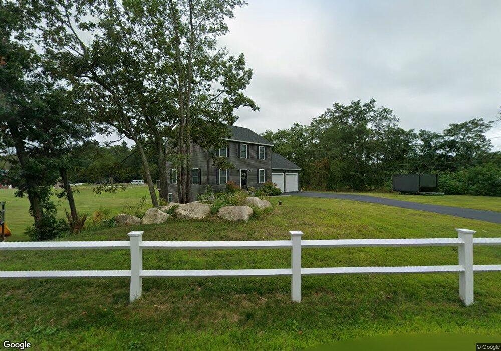
184 Isaac Frye Hwy Wilton, NH 03086
Estimated Value: $544,000 - $570,000
3
Beds
3
Baths
1,664
Sq Ft
$335/Sq Ft
Est. Value
About This Home
This home is located at 184 Isaac Frye Hwy, Wilton, NH 03086 and is currently estimated at $557,192, approximately $334 per square foot. 184 Isaac Frye Hwy is a home with nearby schools including Florence Rideout Elementary School, Wilton-Lyndeborough Cooperative Middle School, and Wilton-Lyndeborough Cooperative High School.
Ownership History
Date
Name
Owned For
Owner Type
Purchase Details
Closed on
Dec 19, 2019
Sold by
Buchanan Contruction Corp
Bought by
Marquis Joshua J and Marquis Courtney L
Current Estimated Value
Home Financials for this Owner
Home Financials are based on the most recent Mortgage that was taken out on this home.
Original Mortgage
$290,000
Outstanding Balance
$255,677
Interest Rate
3.6%
Mortgage Type
New Conventional
Estimated Equity
$301,515
Purchase Details
Closed on
May 24, 2019
Sold by
Mcelreavy Pamela A and Mcelreavy Daniel G
Bought by
Buchanan Const Corp Inc
Purchase Details
Closed on
Jun 14, 2018
Sold by
C & Cs Flume Property Mg
Bought by
Mcelreavy Pamela A and Mcelreavy Daniel G
Create a Home Valuation Report for This Property
The Home Valuation Report is an in-depth analysis detailing your home's value as well as a comparison with similar homes in the area
Home Values in the Area
Average Home Value in this Area
Purchase History
| Date | Buyer | Sale Price | Title Company |
|---|---|---|---|
| Marquis Joshua J | $327,933 | None Available | |
| Buchanan Const Corp Inc | $87,533 | -- | |
| Mcelreavy Pamela A | $63,133 | -- |
Source: Public Records
Mortgage History
| Date | Status | Borrower | Loan Amount |
|---|---|---|---|
| Open | Marquis Joshua J | $290,000 |
Source: Public Records
Tax History Compared to Growth
Tax History
| Year | Tax Paid | Tax Assessment Tax Assessment Total Assessment is a certain percentage of the fair market value that is determined by local assessors to be the total taxable value of land and additions on the property. | Land | Improvement |
|---|---|---|---|---|
| 2024 | $9,620 | $386,800 | $127,300 | $259,500 |
| 2023 | $8,587 | $386,800 | $127,300 | $259,500 |
| 2022 | $7,991 | $386,800 | $127,300 | $259,500 |
| 2021 | $7,434 | $386,800 | $127,300 | $259,500 |
| 2020 | $7,765 | $264,200 | $92,100 | $172,100 |
| 2019 | $2,535 | $87,300 | $87,300 | $0 |
| 2018 | $2,511 | $87,300 | $87,300 | $0 |
| 2017 | $2,372 | $87,300 | $87,300 | $0 |
| 2016 | $2,299 | $87,300 | $87,300 | $0 |
| 2015 | $20 | $775 | $775 | $0 |
| 2014 | $20 | $775 | $775 | $0 |
| 2013 | $20 | $775 | $775 | $0 |
Source: Public Records
Map
Nearby Homes
- 415 Savage Rd
- 18 Richfield Way
- Lot F-88-9 Aria Hill Dr
- F-88-10 Aria Hill Dr
- F-88-11 Aria Hill Dr
- F-88-12 Aria Hill Dr
- F-88-7 Aria Hill Dr
- 21 Ledgewood Rd
- 361 Captain Clark Hwy
- 30 Robbins Rd
- F/88-5 McGettigan Rd
- F/88-4 McGettigan Rd
- 8 Maple St
- 44 Burns Hill Rd
- 25 Burns Hill Rd
- 134 Falcon Ridge Rd Unit 23
- Lots 4 & 7 Gibbons & Robbins Rd
- 294 Mason Rd
- 131 Badger Hill Dr
- 30 Irish Way
- H 56-1 Badger Farm & Isaac Frye Hwy
- 171 Isaac Frye Hwy
- 1 Badger Farm Rd
- 2 Badger Farm Rd
- 157 Isaac Frye Hwy
- 195 Isaac Frye Hwy
- 150 Isaac Frye Hwy
- 31 Badger Farm Rd
- 39 Badger Farm Rd
- 426 Abbot Hill Rd
- 426 Abbot Hill Rd
- 132 Isaac Frye Hwy
- 430 Abbot Hill Rd
- 47 Badger Farm Rd
- 52 Badger Farm Rd
- 122 Isaac Frye Hwy
- 127 Isaac Frye Hwy
- 39 Ritchie Rd
- 19 Sophia Ln
- 125 Isaac Frye Hwy Unit 2