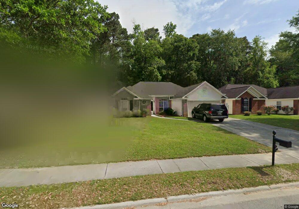
184 Junco Way Savannah, GA 31419
Estimated Value: $334,000 - $350,800
4
Beds
2
Baths
1,753
Sq Ft
$195/Sq Ft
Est. Value
About This Home
This home is located at 184 Junco Way, Savannah, GA 31419 and is currently estimated at $342,700, approximately $195 per square foot. 184 Junco Way is a home located in Chatham County with nearby schools including Windsor Forest High School, Georgetown School, and Butler Academy.
Ownership History
Date
Name
Owned For
Owner Type
Purchase Details
Closed on
Oct 21, 2010
Sold by
The Bank Of New York
Bought by
Mitchell Barry O and Mitchell Lyrinda L
Current Estimated Value
Home Financials for this Owner
Home Financials are based on the most recent Mortgage that was taken out on this home.
Original Mortgage
$99,750
Outstanding Balance
$754
Interest Rate
4.38%
Mortgage Type
New Conventional
Estimated Equity
$341,946
Purchase Details
Closed on
Aug 5, 2009
Sold by
Knox John W
Bought by
The Bank Of New York Mellon Tr
Purchase Details
Closed on
Mar 24, 2005
Sold by
Not Provided
Bought by
Mitchell Barry O and Mitchell Lyrinda L
Home Financials for this Owner
Home Financials are based on the most recent Mortgage that was taken out on this home.
Original Mortgage
$128,800
Interest Rate
5.62%
Mortgage Type
New Conventional
Create a Home Valuation Report for This Property
The Home Valuation Report is an in-depth analysis detailing your home's value as well as a comparison with similar homes in the area
Home Values in the Area
Average Home Value in this Area
Purchase History
| Date | Buyer | Sale Price | Title Company |
|---|---|---|---|
| Mitchell Barry O | $133,000 | -- | |
| The Bank Of New York Mellon Tr | -- | -- | |
| Mitchell Barry O | $161,000 | -- |
Source: Public Records
Mortgage History
| Date | Status | Borrower | Loan Amount |
|---|---|---|---|
| Open | Mitchell Barry O | $99,750 | |
| Previous Owner | Mitchell Barry O | $128,800 |
Source: Public Records
Tax History Compared to Growth
Tax History
| Year | Tax Paid | Tax Assessment Tax Assessment Total Assessment is a certain percentage of the fair market value that is determined by local assessors to be the total taxable value of land and additions on the property. | Land | Improvement |
|---|---|---|---|---|
| 2025 | $5,191 | $142,960 | $21,600 | $121,360 |
| 2024 | $5,191 | $129,880 | $21,600 | $108,280 |
| 2023 | $3,868 | $111,360 | $21,600 | $89,760 |
| 2022 | $3,299 | $94,480 | $17,520 | $76,960 |
| 2021 | $2,902 | $78,200 | $17,520 | $60,680 |
| 2020 | $2,681 | $76,480 | $17,520 | $58,960 |
| 2019 | $2,795 | $73,480 | $17,520 | $55,960 |
| 2018 | $2,200 | $71,400 | $17,520 | $53,880 |
| 2017 | $2,156 | $65,400 | $17,520 | $47,880 |
| 2016 | $2,227 | $64,720 | $17,520 | $47,200 |
| 2015 | $1,987 | $57,400 | $17,520 | $39,880 |
| 2014 | $3,139 | $62,600 | $0 | $0 |
Source: Public Records
Map
Nearby Homes
- 150 Cormorant Way
- 129 Cormorant Way
- 110 Sunrise Ln
- 120 Cormorant Way
- 125 Habitat Dr
- 102 E Sagebrush Ln
- 161 Cherryfield Ln
- 118 Trellis Way
- 12 Bitterroot Ln
- 4 E White Hawthorne Dr
- 506 Wild Heron Rd
- 106 Snowbell Ct
- 179 Cherryfield Ln
- 65 Red Fox Dr
- Spring Mountain II Plan at Sweetwater Station
- Avery Plan at Sweetwater Station
- Richmond Plan at Sweetwater Station
- Dayton Plan at Sweetwater Station
- Spring Valley II Plan at Sweetwater Station
- Crestview Plan at Sweetwater Station