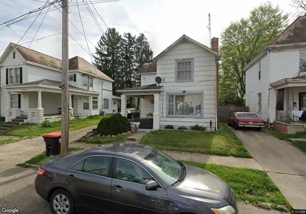
184 N 10th St Newark, OH 43055
Estimated Value: $146,767 - $168,000
2
Beds
1
Bath
1,284
Sq Ft
$124/Sq Ft
Est. Value
About This Home
This home is located at 184 N 10th St, Newark, OH 43055 and is currently estimated at $158,942, approximately $123 per square foot. 184 N 10th St is a home located in Licking County with nearby schools including John Clem Elementary School, Liberty Middle School, and Newark High School.
Ownership History
Date
Name
Owned For
Owner Type
Purchase Details
Closed on
Sep 30, 2005
Sold by
Buxton Gerald E and Buxton Ruth E
Bought by
Heck Eric S and Heck Angela M
Current Estimated Value
Home Financials for this Owner
Home Financials are based on the most recent Mortgage that was taken out on this home.
Original Mortgage
$67,777
Outstanding Balance
$36,551
Interest Rate
5.88%
Mortgage Type
Fannie Mae Freddie Mac
Estimated Equity
$122,391
Create a Home Valuation Report for This Property
The Home Valuation Report is an in-depth analysis detailing your home's value as well as a comparison with similar homes in the area
Home Values in the Area
Average Home Value in this Area
Purchase History
| Date | Buyer | Sale Price | Title Company |
|---|---|---|---|
| Heck Eric S | $67,800 | -- |
Source: Public Records
Mortgage History
| Date | Status | Borrower | Loan Amount |
|---|---|---|---|
| Open | Heck Eric S | $67,777 |
Source: Public Records
Tax History Compared to Growth
Tax History
| Year | Tax Paid | Tax Assessment Tax Assessment Total Assessment is a certain percentage of the fair market value that is determined by local assessors to be the total taxable value of land and additions on the property. | Land | Improvement |
|---|---|---|---|---|
| 2024 | $1,282 | $35,840 | $8,050 | $27,790 |
| 2023 | $1,280 | $35,840 | $8,050 | $27,790 |
| 2022 | $904 | $22,470 | $5,040 | $17,430 |
| 2021 | $948 | $22,470 | $5,040 | $17,430 |
| 2020 | $970 | $22,470 | $5,040 | $17,430 |
| 2019 | $857 | $19,120 | $4,590 | $14,530 |
| 2018 | $858 | $0 | $0 | $0 |
| 2017 | $968 | $0 | $0 | $0 |
| 2016 | $1,091 | $0 | $0 | $0 |
| 2015 | $1,114 | $0 | $0 | $0 |
| 2014 | $1,427 | $0 | $0 | $0 |
| 2013 | $1,057 | $0 | $0 | $0 |
Source: Public Records
Map
Nearby Homes
- 218 Granville St
- 64 N 10th St
- 251 Merchant St
- 75 Columbia St
- 249 W Locust St
- 23 Columbia St
- 247 Buckingham St
- 268 W Church St
- 361 Granville St
- 265 W Church St
- 140 W Locust St
- 333 N 10th St
- 84 Western Ave
- 355 Eddy St
- 63 Chestnut St
- 408 Granville St
- 346 W Main St
- 332 W Main St
- 336 W Main St Unit 334
- 383 Central Ave
- 188 N 10th St
- 182 N 10th St
- 190 N 10th St
- 178 N 10th St
- 192 N 10th St
- 172 N 10th St
- 183 N 10th St
- 201 Granville St
- 168 N 10th St
- 189 N 10th St
- 207 Granville St
- 173 N 10th St
- 211 Granville St
- 219 Granville St
- 242 Merchant St
- 193 N 10th St
- 169 N 10th St
- 235 Granville St
- 246 Merchant St
- 246 Merchant St