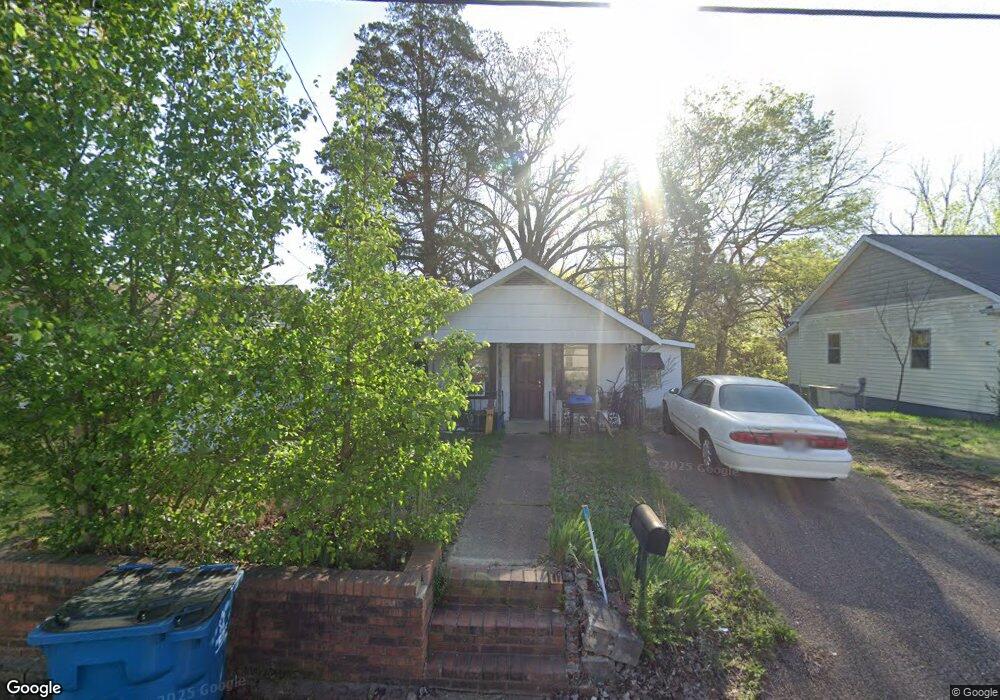
184 N Forrest Ave Camden, TN 38320
Estimated Value: $38,026 - $130,000
Studio
1
Bath
772
Sq Ft
$116/Sq Ft
Est. Value
About This Home
This home is located at 184 N Forrest Ave, Camden, TN 38320 and is currently estimated at $89,507, approximately $115 per square foot. 184 N Forrest Ave is a home located in Benton County with nearby schools including Camden Elementary School, Briarwood School, and Camden Junior High School.
Ownership History
Date
Name
Owned For
Owner Type
Purchase Details
Closed on
Oct 23, 2024
Sold by
Schmitz Robert Henry
Bought by
Schmitz Richard M and Mcintosh Prescilla M
Current Estimated Value
Purchase Details
Closed on
Oct 16, 2018
Sold by
Cole Freeman
Bought by
Schmitz Robert Henry
Purchase Details
Closed on
Sep 24, 2009
Sold by
Laux Robert M
Bought by
Cole Freeman
Purchase Details
Closed on
Mar 4, 2003
Bought by
Laux Robert M
Purchase Details
Closed on
Jun 3, 1992
Bought by
Ward Mark
Create a Home Valuation Report for This Property
The Home Valuation Report is an in-depth analysis detailing your home's value as well as a comparison with similar homes in the area
Home Values in the Area
Average Home Value in this Area
Purchase History
| Date | Buyer | Sale Price | Title Company |
|---|---|---|---|
| Schmitz Richard M | $15,000 | None Listed On Document | |
| Schmitz Richard M | $15,000 | None Listed On Document | |
| Schmitz Robert Henry | -- | -- | |
| Cole Freeman | $22,000 | -- | |
| Laux Robert M | $35,000 | -- | |
| Ward Mark | $4,000 | -- | |
| Cole Freeman | $22,000 | -- |
Source: Public Records
Tax History
| Year | Tax Paid | Tax Assessment Tax Assessment Total Assessment is a certain percentage of the fair market value that is determined by local assessors to be the total taxable value of land and additions on the property. | Land | Improvement |
|---|---|---|---|---|
| 2025 | $302 | $12,875 | $2,525 | $10,350 |
| 2024 | $294 | $8,025 | $1,500 | $6,525 |
| 2023 | $294 | $8,025 | $1,500 | $6,525 |
| 2022 | $294 | $8,025 | $1,500 | $6,525 |
| 2021 | $294 | $8,025 | $1,500 | $6,525 |
| 2020 | $294 | $8,025 | $1,500 | $6,525 |
| 2019 | $246 | $6,225 | $1,500 | $4,725 |
| 2018 | $246 | $6,225 | $1,500 | $4,725 |
| 2017 | $246 | $6,225 | $1,500 | $4,725 |
| 2016 | $246 | $6,225 | $1,500 | $4,725 |
| 2015 | $248 | $6,225 | $1,500 | $4,725 |
| 2014 | $217 | $6,225 | $1,500 | $4,725 |
| 2013 | $217 | $5,518 | $0 | $0 |
Source: Public Records
Map
Nearby Homes
- 181 Washington Ave
- 0 Forrest Ave N
- 134 N Church Ave
- 130 Turnpike Ave
- 120 Magnolia St
- 147 Berry St
- 6100 Old Highway 69s
- 122 W Lake St
- 1 Maple Ave
- 241 Stigall St
- 113 S Forrest Ave
- 129 S Forrest Ave
- 172 W Main St
- 130 Mimosa St
- 0 Higdon Ck Rd Unit RTC2993447
- 0 George St
- 170 Westview St
- 273 Washington Ave
- 000 Wyly St
- 876 Flatwoods Rd
- 182 N Forrest Ave
- 186 N Forrest Ave
- 180 N Forrest Ave
- 110 E Frazier St
- 177 N Forrest Ave
- 192 N Forrest Ave
- 179 N Forrest Ave
- 103 W Frazier St
- 112 E Frazier St
- 194 N Forrest Ave
- 109 E Frazier St
- 114 E Frazier St
- 107 W Frazier St
- 104 W Frazier St
- 115 Hawley St
- 198 N Forrest Ave
- 175 Eastview Ave
- 117 Hawley St
- 173 Eastview Ave
- 115 E Frazier St
Your Personal Tour Guide
Ask me questions while you tour the home.