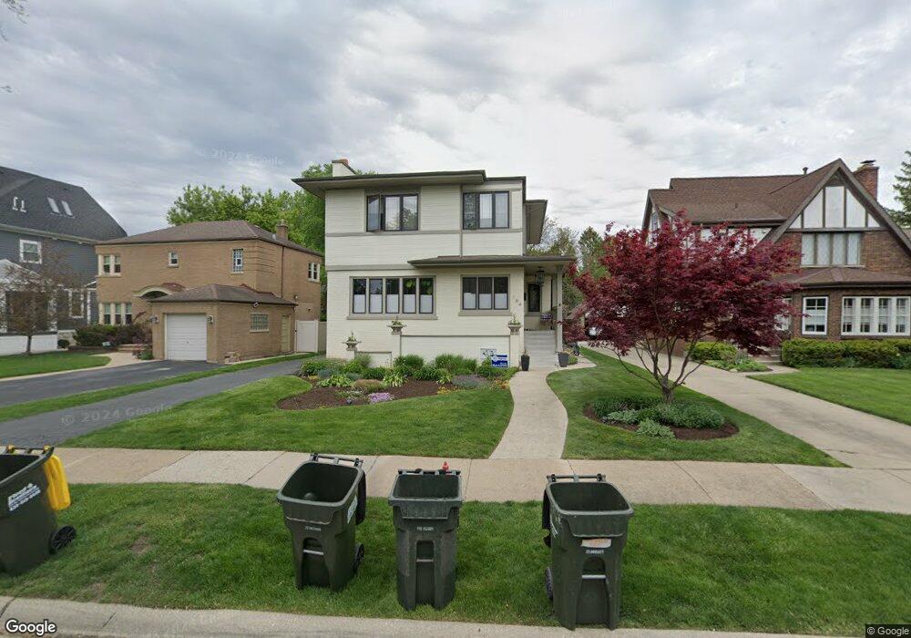
184 Olmsted Rd Riverside, IL 60546
Estimated Value: $708,000 - $751,000
4
Beds
3
Baths
2,340
Sq Ft
$313/Sq Ft
Est. Value
About This Home
This home is located at 184 Olmsted Rd, Riverside, IL 60546 and is currently estimated at $733,163, approximately $313 per square foot. 184 Olmsted Rd is a home located in Cook County with nearby schools including Central Elementary School, L J Hauser Jr High School, and Riverside Brookfield High School.
Ownership History
Date
Name
Owned For
Owner Type
Purchase Details
Closed on
Mar 29, 2010
Sold by
Strubbe Matt D and Strubbe Melanie A
Bought by
Porter Chris and Porter Melissa
Current Estimated Value
Home Financials for this Owner
Home Financials are based on the most recent Mortgage that was taken out on this home.
Original Mortgage
$417,000
Outstanding Balance
$278,149
Interest Rate
5.03%
Mortgage Type
New Conventional
Estimated Equity
$455,014
Purchase Details
Closed on
Mar 31, 2003
Sold by
Wayne Hummer Trust Co Na
Bought by
Strubbe Matt D and Strubbe Melanie A
Home Financials for this Owner
Home Financials are based on the most recent Mortgage that was taken out on this home.
Original Mortgage
$492,000
Interest Rate
6.02%
Mortgage Type
Unknown
Purchase Details
Closed on
Jul 12, 2002
Sold by
Lancaster Scott M and Lancaster Jennifer A
Bought by
Wayne Hummer Trust Co N A and Trust #Let 1390
Home Financials for this Owner
Home Financials are based on the most recent Mortgage that was taken out on this home.
Original Mortgage
$172,600
Interest Rate
6.93%
Mortgage Type
Purchase Money Mortgage
Purchase Details
Closed on
May 22, 2002
Sold by
Langeland Harold Wesley
Bought by
Lancaster Scott M and Lancaster Jennifer A
Home Financials for this Owner
Home Financials are based on the most recent Mortgage that was taken out on this home.
Original Mortgage
$172,600
Interest Rate
6.93%
Mortgage Type
Purchase Money Mortgage
Create a Home Valuation Report for This Property
The Home Valuation Report is an in-depth analysis detailing your home's value as well as a comparison with similar homes in the area
Home Values in the Area
Average Home Value in this Area
Purchase History
| Date | Buyer | Sale Price | Title Company |
|---|---|---|---|
| Porter Chris | $617,500 | Git | |
| Strubbe Matt D | $615,000 | Pntn | |
| Strubbe Matt D | $615,000 | Pntn | |
| Wayne Hummer Trust Co N A | $300,000 | -- | |
| Lancaster Scott M | $215,760 | -- |
Source: Public Records
Mortgage History
| Date | Status | Borrower | Loan Amount |
|---|---|---|---|
| Open | Porter Chris | $417,000 | |
| Previous Owner | Strubbe Matt D | $492,000 | |
| Previous Owner | Lancaster Scott M | $172,600 | |
| Closed | Strubbe Matt D | $61,000 |
Source: Public Records
Tax History Compared to Growth
Tax History
| Year | Tax Paid | Tax Assessment Tax Assessment Total Assessment is a certain percentage of the fair market value that is determined by local assessors to be the total taxable value of land and additions on the property. | Land | Improvement |
|---|---|---|---|---|
| 2024 | $15,217 | $50,883 | $9,882 | $41,001 |
| 2023 | $15,885 | $50,883 | $9,882 | $41,001 |
| 2022 | $15,885 | $44,895 | $8,647 | $36,248 |
| 2021 | $16,922 | $49,310 | $8,646 | $40,664 |
| 2020 | $16,450 | $49,310 | $8,646 | $40,664 |
| 2019 | $12,669 | $39,424 | $7,905 | $31,519 |
| 2018 | $13,857 | $43,997 | $7,905 | $36,092 |
| 2017 | $14,586 | $47,502 | $7,905 | $39,597 |
| 2016 | $13,375 | $40,477 | $6,917 | $33,560 |
| 2015 | $13,026 | $40,477 | $6,917 | $33,560 |
| 2014 | $12,821 | $40,477 | $6,917 | $33,560 |
| 2013 | $13,887 | $47,144 | $6,917 | $40,227 |
Source: Public Records
Map
Nearby Homes
- 172 Olmsted Rd
- 7335 Oakwood Ave Unit P-10
- 7335 Oakwood Ave Unit P-12
- 7335 Oakwood Ave Unit P-8
- 7335 Oakwood Ave Unit P-11
- 7335 Oakwood Ave Unit P-14
- 7316 40th St Unit P-9
- 7316 40th St Unit P-10
- 7316 40th St Unit P-13
- 3515 S Harlem Ave Unit 1B
- 56 Forest Ave Unit 1N
- 269 Shenstone Rd
- 78 Pine Ave
- 3731 Maple Ave
- 7825 41st Place
- 3816 Wisconsin Ave
- 4147 Gage Ave
- 3829 Wisconsin Ave
- 339 Eastgrove Rd
- 7032 Pershing Rd