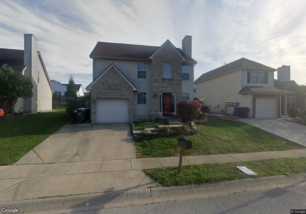
184 Ransom Trace Georgetown, KY 40324
Bradford Place NeighborhoodEstimated Value: $276,000 - $304,000
3
Beds
3
Baths
1,528
Sq Ft
$186/Sq Ft
Est. Value
About This Home
This home is located at 184 Ransom Trace, Georgetown, KY 40324 and is currently estimated at $284,252, approximately $186 per square foot. 184 Ransom Trace is a home located in Scott County with nearby schools including Southern Elementary School, Creekside Elementary School, and Georgetown Middle School.
Ownership History
Date
Name
Owned For
Owner Type
Purchase Details
Closed on
Dec 22, 2005
Sold by
Baker Marvin and Baker Andrea L
Bought by
Hisel Chad L
Current Estimated Value
Home Financials for this Owner
Home Financials are based on the most recent Mortgage that was taken out on this home.
Original Mortgage
$124,975
Outstanding Balance
$69,883
Interest Rate
6.28%
Mortgage Type
New Conventional
Estimated Equity
$214,369
Create a Home Valuation Report for This Property
The Home Valuation Report is an in-depth analysis detailing your home's value as well as a comparison with similar homes in the area
Home Values in the Area
Average Home Value in this Area
Purchase History
| Date | Buyer | Sale Price | Title Company |
|---|---|---|---|
| Hisel Chad L | $136,500 | None Available |
Source: Public Records
Mortgage History
| Date | Status | Borrower | Loan Amount |
|---|---|---|---|
| Open | Hisel Chad L | $124,975 |
Source: Public Records
Tax History Compared to Growth
Tax History
| Year | Tax Paid | Tax Assessment Tax Assessment Total Assessment is a certain percentage of the fair market value that is determined by local assessors to be the total taxable value of land and additions on the property. | Land | Improvement |
|---|---|---|---|---|
| 2024 | $1,942 | $216,000 | $0 | $0 |
| 2023 | $1,868 | $206,000 | $35,000 | $171,000 |
| 2022 | $1,527 | $179,600 | $30,000 | $149,600 |
| 2021 | $1,549 | $164,400 | $30,000 | $134,400 |
| 2020 | $1,321 | $153,700 | $30,000 | $123,700 |
| 2019 | $1,288 | $147,600 | $0 | $0 |
| 2018 | $1,248 | $143,800 | $0 | $0 |
| 2017 | $1,207 | $138,430 | $0 | $0 |
| 2016 | $1,090 | $135,376 | $0 | $0 |
| 2015 | $1,041 | $130,100 | $0 | $0 |
| 2014 | $1,036 | $125,000 | $0 | $0 |
| 2011 | $85 | $136,500 | $0 | $0 |
Source: Public Records
Map
Nearby Homes
- 217 Atwood Dr
- 129 Irving Ln
- 110 Lovett Park Ln
- 102 Wharton Ct
- 151 Hemingway Place
- 235 Ransom Trace
- 106 Stapleton Way
- 1215 Seminole Trail
- 126 Copper Kettle Path
- 247 W Showalter Dr
- 104 Copper Kettle Path
- 107 Oconner Ct
- 1115 Apache Trail
- 212 Pocahontas Trail
- 1020 Parkside Dr
- 115 Hutchins Dr
- 1108 Beth Ct
- The Laurel Square Plan at South Crossing - Trend Collection
- The Sycamore Bend Plan at South Crossing - Trend Collection
- The Newbury Cross Plan at South Crossing - Trend Collection
- 182 Ransom Trace Unit 3A
- 186 Ransom Trace
- 105 Irving Ln
- 180 Ransom Trace
- 188 Ransom Trace Unit 3A
- 103 Irving Ln
- 109 Irving Ln
- 178 Ransom Trace
- 187 Ransom Trace
- 181 Ransom Trace
- 190 Ransom Trace
- 101 Irving Ln
- 111 Irving Ln
- 179 Ransom Trace
- 189 Ransom Trace
- 156 Lovett Park
- 192 Ransom Trace
- 177 Ransom Trace
- 104 Irving Ln
- 113 Irving Ln