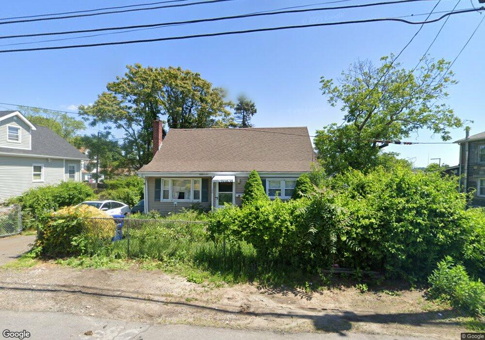
184 Sampson St Bridgeport, CT 06606
Brooklawn-Saint Vincent NeighborhoodEstimated Value: $383,000 - $447,000
4
Beds
2
Baths
1,190
Sq Ft
$348/Sq Ft
Est. Value
About This Home
This home is located at 184 Sampson St, Bridgeport, CT 06606 and is currently estimated at $413,931, approximately $347 per square foot. 184 Sampson St is a home located in Fairfield County with nearby schools including Madison School, Central High School, and Assumption Catholic School.
Ownership History
Date
Name
Owned For
Owner Type
Purchase Details
Closed on
Jul 17, 1998
Sold by
Sogliuzzi Rinaldo
Bought by
Lacoursiere R G and Lacoursiere Regina
Current Estimated Value
Home Financials for this Owner
Home Financials are based on the most recent Mortgage that was taken out on this home.
Original Mortgage
$81,900
Outstanding Balance
$16,731
Interest Rate
6.98%
Mortgage Type
Unknown
Estimated Equity
$397,200
Purchase Details
Closed on
Dec 10, 1997
Sold by
Weinstein Ruth and Butensky Miriam
Bought by
Sogliuzzi Franco
Home Financials for this Owner
Home Financials are based on the most recent Mortgage that was taken out on this home.
Original Mortgage
$46,550
Interest Rate
7.14%
Mortgage Type
Unknown
Create a Home Valuation Report for This Property
The Home Valuation Report is an in-depth analysis detailing your home's value as well as a comparison with similar homes in the area
Home Values in the Area
Average Home Value in this Area
Purchase History
We collect this data history from publicly available records. To have your information removed, we recommend requesting removal directly through your county’s website.
| Date | Buyer | Sale Price | Title Company |
|---|---|---|---|
| Lacoursiere R G | $117,000 | -- | |
| Lacoursiere R G R | $117,000 | -- | |
| Sogliuzzi Franco | $49,000 | -- | |
| Sogliuzzi Franco | $49,000 | -- |
Source: Public Records
Mortgage History
We collect this data history from publicly available records. To have your information removed, we recommend requesting removal directly through your county’s website.
| Date | Status | Borrower | Loan Amount |
|---|---|---|---|
| Open | Sogliuzzi Franco | $81,900 | |
| Closed | Sogliuzzi Franco | $81,900 | |
| Previous Owner | Sogliuzzi Franco | $46,550 |
Source: Public Records
Tax History
| Year | Tax Paid | Tax Assessment Tax Assessment Total Assessment is a certain percentage of the fair market value that is determined by local assessors to be the total taxable value of land and additions on the property. | Land | Improvement |
|---|---|---|---|---|
| 2025 | $6,769 | $155,780 | $75,310 | $80,470 |
| 2024 | $6,769 | $155,780 | $75,310 | $80,470 |
| 2023 | $6,769 | $155,780 | $75,310 | $80,470 |
| 2022 | $6,769 | $155,780 | $75,310 | $80,470 |
| 2021 | $6,769 | $155,780 | $75,310 | $80,470 |
| 2020 | $5,536 | $102,530 | $39,340 | $63,190 |
| 2019 | $5,536 | $102,530 | $39,340 | $63,190 |
| 2018 | $5,575 | $102,530 | $39,340 | $63,190 |
| 2017 | $5,575 | $102,530 | $39,340 | $63,190 |
| 2016 | $5,575 | $102,530 | $39,340 | $63,190 |
| 2015 | $5,500 | $130,320 | $47,600 | $82,720 |
| 2014 | $5,500 | $130,320 | $47,600 | $82,720 |
Source: Public Records
Map
Nearby Homes
- 130 Holroyd St
- 11 Myron Ave
- 25 Myron Ave
- 66-68 Alexander Dr
- 85-89 Alexander Dr
- 610 Hawley Ave
- 252 Harlem Ave Unit C4
- 105 Tremont Ave Unit C
- 1103-1105 Capitol Ave
- 155 Marion St
- 123 Harlem Ave
- 2625 Park Ave Unit PHD
- 2625 Park Ave Unit 14J
- 525 Westfield Ave
- 92 Lincoln Ave
- 34 Harlem Ave
- 248 Salem St
- 228 Westfield Ave
- 26 Marsdale Ave
- 44 Cricket Ln
- 176 Holroyd St
- 142 Holroyd St
- 142 Holroyd St Unit 1
- 142 Holroyd St Unit 2
- 142 Holroyd St Unit 3
- 128 Perth St
- 109 Holroyd St
- 172 Sampson St
- 170 Holroyd St
- 198 Sampson St
- 160 Sampson St
- 214 Sampson St
- 104 Perth St
- 128 Sidney St
- 97 Holroyd St
- 146 Sampson St
- 197 Sampson St
- 224 Sampson St
- 114 Perth St
- 228 Sampson St
Your Personal Tour Guide
Ask me questions while you tour the home.