Estimated Value: $403,134 - $546,000
2
Beds
2
Baths
1,440
Sq Ft
$313/Sq Ft
Est. Value
About This Home
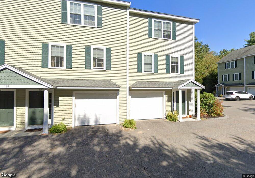
This home is located at 184 W Main St Unit A1, Ayer, MA 01432 and is currently estimated at $450,284, approximately $312 per square foot. 184 W Main St Unit A1 is a home located in Middlesex County with nearby schools including Page Hilltop School, Lura A. White Elementary School, and Ayer Shirley Regional Middle School.
Ownership History
Date
Name
Owned For
Owner Type
Purchase Details
Closed on
May 20, 2015
Sold by
Warila Jonathan R and Justice Celia V
Bought by
Warila Jonathan R
Current Estimated Value
Purchase Details
Closed on
Oct 31, 2005
Sold by
Rd Kanniard Homes Inc
Bought by
Justice Celia and Warila Jonathan R
Home Financials for this Owner
Home Financials are based on the most recent Mortgage that was taken out on this home.
Original Mortgage
$270,000
Interest Rate
5.79%
Mortgage Type
Purchase Money Mortgage
Create a Home Valuation Report for This Property
The Home Valuation Report is an in-depth analysis detailing your home's value as well as a comparison with similar homes in the area
Home Values in the Area
Average Home Value in this Area
Purchase History
| Date | Buyer | Sale Price | Title Company |
|---|---|---|---|
| Warila Jonathan R | -- | -- | |
| Justice Celia | $284,900 | -- |
Source: Public Records
Mortgage History
| Date | Status | Borrower | Loan Amount |
|---|---|---|---|
| Previous Owner | Justice Celia | $270,000 |
Source: Public Records
Tax History
| Year | Tax Paid | Tax Assessment Tax Assessment Total Assessment is a certain percentage of the fair market value that is determined by local assessors to be the total taxable value of land and additions on the property. | Land | Improvement |
|---|---|---|---|---|
| 2025 | $4,428 | $370,200 | $0 | $370,200 |
| 2024 | $4,103 | $334,900 | $0 | $334,900 |
| 2023 | $3,712 | $298,900 | $0 | $298,900 |
| 2022 | $3,657 | $272,500 | $0 | $272,500 |
| 2021 | $3,515 | $248,600 | $0 | $248,600 |
| 2020 | $3,462 | $245,500 | $0 | $245,500 |
| 2019 | $3,155 | $231,500 | $0 | $231,500 |
| 2018 | $3,075 | $213,100 | $0 | $213,100 |
| 2017 | $2,918 | $202,800 | $0 | $202,800 |
| 2016 | $2,878 | $198,100 | $0 | $198,100 |
| 2015 | $2,690 | $184,000 | $0 | $184,000 |
| 2014 | $2,472 | $175,600 | $0 | $175,600 |
Source: Public Records
Map
Nearby Homes
- 31 Independence Dr
- 14 Brook St
- 0ABC Park St
- 23 Nashua St
- 21 High St
- 63 E Main St
- 38 Norwood Ave
- 98 Pleasant St
- 100 Central Ave Unit 4
- 124 Hazen Rd
- 7 Baldwin Ct Unit 7
- 37 Willard St
- 107 Old Mill Rd
- 83 Clark Rd Unit 1
- 83 Clark Rd Unit L-19
- 0 Ayer & Old Mill Rd
- 501 Farmers Row
- 9 Blanchard Rd
- 55 Littleton Rd Unit 8B
- 18A S Shaker Rd
- 184 W Main St Unit B3
- 184 W Main St Unit B1
- 184 W Main St Unit A3
- 184 W Main St Unit A2
- 184 W Main St Unit B2
- 184 W Main St
- 176 W Main St
- 178 W Main St
- 188 W Main St
- 185 W Main St
- 172 W Main St Unit 1
- 187 W Main St
- 183 W Main St
- 179 W Main St Unit 2
- 179 W Main St Unit 1
- 189 W Main St
- 194 W Main St
- 175 W Main St
- 175 W Main St Unit 1
- 175 W Main St Unit 2
Your Personal Tour Guide
Ask me questions while you tour the home.