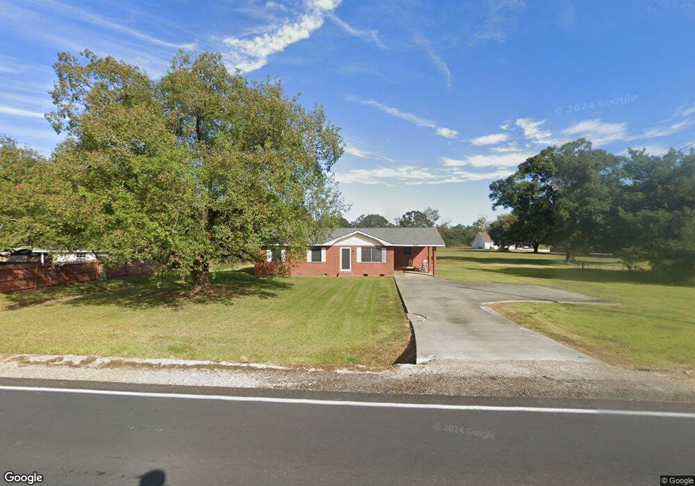
1840 Anse Broussard Hwy Breaux Bridge, LA 70517
Saint Martin Parish NeighborhoodEstimated Value: $100,738 - $162,000
--
Bed
--
Bath
3,871
Sq Ft
$33/Sq Ft
Est. Value
About This Home
This home is located at 1840 Anse Broussard Hwy, Breaux Bridge, LA 70517 and is currently estimated at $126,435, approximately $32 per square foot. 1840 Anse Broussard Hwy is a home located in St. Martin Parish with nearby schools including Breaux Bridge Primary School, Breaux Bridge Junior High School, and Breaux Bridge High School.
Ownership History
Date
Name
Owned For
Owner Type
Purchase Details
Closed on
Jul 17, 2015
Sold by
Fontenot Raymond Paul
Bought by
Boulet Malcolm L
Current Estimated Value
Purchase Details
Closed on
Apr 24, 2013
Sold by
Hollier Larry James
Bought by
Fontenot Raymond Paul
Home Financials for this Owner
Home Financials are based on the most recent Mortgage that was taken out on this home.
Original Mortgage
$2,075
Interest Rate
3.61%
Mortgage Type
Commercial
Create a Home Valuation Report for This Property
The Home Valuation Report is an in-depth analysis detailing your home's value as well as a comparison with similar homes in the area
Home Values in the Area
Average Home Value in this Area
Purchase History
| Date | Buyer | Sale Price | Title Company |
|---|---|---|---|
| Boulet Malcolm L | $78,000 | None Available | |
| Fontenot Raymond Paul | $60,000 | None Available |
Source: Public Records
Mortgage History
| Date | Status | Borrower | Loan Amount |
|---|---|---|---|
| Previous Owner | Fontenot Raymond Paul | $2,075 |
Source: Public Records
Tax History Compared to Growth
Tax History
| Year | Tax Paid | Tax Assessment Tax Assessment Total Assessment is a certain percentage of the fair market value that is determined by local assessors to be the total taxable value of land and additions on the property. | Land | Improvement |
|---|---|---|---|---|
| 2024 | $887 | $9,050 | $960 | $8,090 |
| 2023 | $780 | $7,730 | $960 | $6,770 |
| 2022 | $779 | $7,730 | $960 | $6,770 |
| 2021 | $779 | $7,730 | $960 | $6,770 |
| 2020 | $777 | $7,730 | $960 | $6,770 |
| 2019 | $798 | $7,860 | $920 | $6,940 |
| 2018 | $787 | $7,860 | $920 | $6,940 |
| 2017 | $719 | $7,860 | $920 | $6,940 |
| 2016 | $685 | $26,450 | $3,590 | $22,860 |
| 2015 | $527 | $5,700 | $600 | $5,100 |
| 2014 | $527 | $5,710 | $600 | $5,110 |
| 2013 | $527 | $5,710 | $600 | $5,110 |
Source: Public Records
Map
Nearby Homes
- 637 Griffiths Ct
- 639 Griffiths Ct
- 632 Griffiths Ct
- 103 Casa Bella Ct
- Catahoula Plan at Parc Ridge
- Palmetto Plan at Parc Ridge
- Tensas Plan at Parc Ridge
- Bienville Plan at Parc Ridge
- Remington Plan at Parc Ridge
- Theobold Plan at Parc Ridge
- Weston Plan at Parc Ridge
- Hudson Plan at Parc Ridge
- Emerson Plan at Parc Ridge
- Ventress Plan at Parc Ridge
- 1061 Melrose Dr
- 514 Fontaine Ct
- 638 Griffiths Ct
- 636 Griffiths Ct
- 630 Griffiths Ct
- 635 Griffiths Ct
- 1840 Anse Broussard Hwy
- 1832 Anse Broussard Hwy
- 1000 Rue Bois de Chene
- 1841 Anse Broussard Hwy
- 1008 Rue Bois de Chene
- 1849 Anse Broussard Hwy
- 1831 Anse Broussard Hwy
- 1011 Melrose Dr
- 1016 Rue Bois de Chene
- 1855 Anse Broussard Hwy
- 1828 Anse Broussard Hwy
- 1009 Rue Bois de Chene
- 1020 Rue Bois de Chene
- 1011 Rue Bois de Chene
- 1857 Anse Broussard Hwy
- 1820 Anse Broussard Hwy
- 1821 Anse Broussard Hwy
- 1015 Rue Bois de Chene
- 1024 Rue Bois de Chene
- 1859 Anse Broussard Hwy