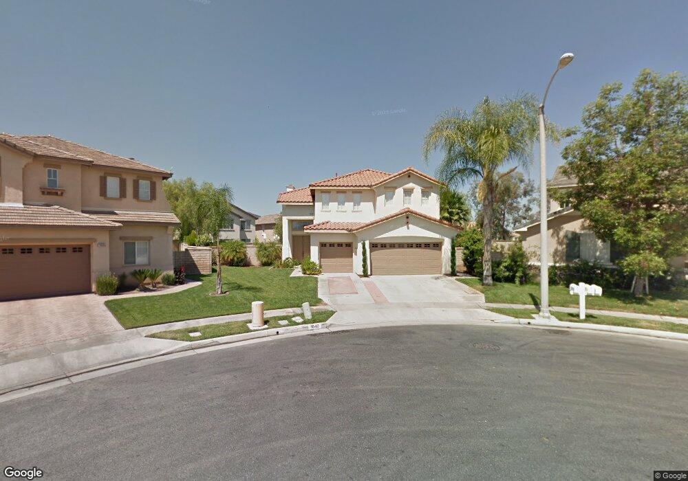
1840 Crenshaw Cir Corona, CA 92883
Eagle Glen NeighborhoodEstimated Value: $948,000 - $1,148,000
About This Home
This home is located at 1840 Crenshaw Cir, Corona, CA 92883 and is currently estimated at $1,016,478, approximately $330 per square foot. 1840 Crenshaw Cir is a home located in Riverside County with nearby schools including Woodrow Wilson Elementary School, El Cerrito Middle School, and Santiago High School.
Ownership History
We collect this data history from publicly available records. To have your information removed, we recommend requesting removal directly through your county’s website.
Purchase Details
Home Financials for this Owner
Home Financials are based on the most recent Mortgage that was taken out on this home.Purchase Details
Home Financials for this Owner
Home Financials are based on the most recent Mortgage that was taken out on this home.Purchase Details
Home Financials for this Owner
Home Financials are based on the most recent Mortgage that was taken out on this home.Home Values in the Area
Average Home Value in this Area
Purchase History
We collect this data history from publicly available records. To have your information removed, we recommend requesting removal directly through your county’s website.
| Date | Buyer | Sale Price | Title Company |
|---|---|---|---|
| $477,500 | First American Title Company | ||
| $463,000 | Orange Coast Title Company | ||
| $345,000 | Fidelity National Title Co |
Mortgage History
We collect this data history from publicly available records. To have your information removed, we recommend requesting removal directly through your county’s website.
| Date | Status | Borrower | Loan Amount |
|---|---|---|---|
| Open | $339,500 | ||
| Closed | $351,400 | ||
| Closed | $409,500 | ||
| Closed | $448,954 | ||
| Previous Owner | $100,000 | ||
| Previous Owner | $60,000 | ||
| Previous Owner | $420,000 | ||
| Previous Owner | $370,400 | ||
| Previous Owner | $35,000 | ||
| Previous Owner | $275,762 |
Tax History
We collect this data history from publicly available records. To have your information removed, we recommend requesting removal directly through your county’s website.
| Year | Tax Paid | Tax Assessment Tax Assessment Total Assessment is a certain percentage of the fair market value that is determined by local assessors to be the total taxable value of land and additions on the property. | Land | Improvement |
|---|---|---|---|---|
| 2025 | $6,650 | $616,350 | $193,614 | $422,736 |
| 2023 | $6,650 | $592,419 | $186,097 | $406,322 |
| 2022 | $6,607 | $580,804 | $182,449 | $398,355 |
| 2021 | $7,209 | $569,417 | $178,872 | $390,545 |
| 2020 | $7,174 | $563,579 | $177,038 | $386,541 |
| 2019 | $7,045 | $552,529 | $173,567 | $378,962 |
| 2018 | $6,925 | $541,696 | $170,164 | $371,532 |
| 2017 | $6,744 | $531,076 | $166,828 | $364,248 |
| 2016 | $6,688 | $520,663 | $163,557 | $357,106 |
| 2015 | $6,566 | $512,844 | $161,101 | $351,743 |
| 2014 | $6,429 | $502,800 | $157,947 | $344,853 |
Map
- 4469 Driving Range Rd
- 4375 Leonard Way
- 4370 Leonard Way
- 4412 Signature Dr
- 4351 Edenwild Ln
- 4260 Powell Way Unit 118
- 4260 Powell Way Unit 119
- 1856 Plainfield Way
- 4231 Adishian Way
- 2336 Bearrs
- 1728 Tamarron Dr
- 4247 #107 Horvath St Unit 107
- 1749 Tamarron Dr
- 1916 Olympia Fields Dr
- 1593 Vandagriff Way
- 1596 Vandagriff Way
- 4132 Crooked Stick Ln
- 4167 Horvath St Unit 108
- 1806 Riverstone St
- 2303 Nova Way
- 4512 Driving Range Rd
- 1820 Crenshaw Cir
- 1860 Crenshaw Cir
- 4565 Garden City Ln Unit 163
- 4545 Garden City Ln
- 4535 Garden City Ln Unit 160
- 4555 Garden City Ln
- 1838 Littler Ln Unit 186
- 4525 Garden City Ln
- 1850 Littler Ln Unit 185
- 1800 Crenshaw Cir Unit 175
- 1880 Crenshaw Cir
- 1862 Littler Ln
- 4575 Garden City Ln Unit 164
- 4484 Driving Range Rd
- 1874 Littler Ln
- 4470 Driving Range Rd Unit 177
- 1886 Littler Ln
- 4526 Driving Range Rd
- 1857 Jupiter Hills Rd
Ask me questions while you tour the home.