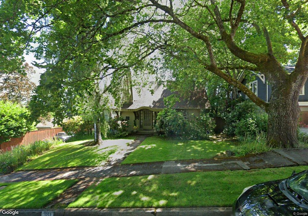
1841 Olive St Eugene, OR 97401
Friendly NeighborhoodEstimated Value: $577,000 - $835,000
3
Beds
2
Baths
1,716
Sq Ft
$395/Sq Ft
Est. Value
About This Home
This home is located at 1841 Olive St, Eugene, OR 97401 and is currently estimated at $678,511, approximately $395 per square foot. 1841 Olive St is a home located in Lane County with nearby schools including Adams Elementary School, Roosevelt Middle School, and South Eugene High School.
Ownership History
Date
Name
Owned For
Owner Type
Purchase Details
Closed on
Feb 25, 2005
Sold by
Banning Keith W
Bought by
Notaro Laurie A and Upton Corbett E
Current Estimated Value
Home Financials for this Owner
Home Financials are based on the most recent Mortgage that was taken out on this home.
Original Mortgage
$165,000
Outstanding Balance
$83,196
Interest Rate
5.73%
Mortgage Type
Purchase Money Mortgage
Estimated Equity
$595,315
Purchase Details
Closed on
Oct 28, 1999
Sold by
Blitz William J
Bought by
Banning Keith W
Home Financials for this Owner
Home Financials are based on the most recent Mortgage that was taken out on this home.
Original Mortgage
$212,700
Interest Rate
7.82%
Create a Home Valuation Report for This Property
The Home Valuation Report is an in-depth analysis detailing your home's value as well as a comparison with similar homes in the area
Home Values in the Area
Average Home Value in this Area
Purchase History
| Date | Buyer | Sale Price | Title Company |
|---|---|---|---|
| Notaro Laurie A | $340,000 | Fidelity National Title Insu | |
| Banning Keith W | $223,900 | Western Pioneer Title Co |
Source: Public Records
Mortgage History
| Date | Status | Borrower | Loan Amount |
|---|---|---|---|
| Open | Notaro Laurie A | $165,000 | |
| Previous Owner | Banning Keith W | $212,700 |
Source: Public Records
Tax History
| Year | Tax Paid | Tax Assessment Tax Assessment Total Assessment is a certain percentage of the fair market value that is determined by local assessors to be the total taxable value of land and additions on the property. | Land | Improvement |
|---|---|---|---|---|
| 2025 | $5,854 | $300,431 | -- | -- |
| 2024 | $5,781 | $291,681 | -- | -- |
| 2023 | $5,781 | $283,186 | $0 | $0 |
| 2022 | $5,416 | $274,938 | $0 | $0 |
| 2021 | $5,087 | $266,931 | $0 | $0 |
| 2020 | $5,104 | $259,157 | $0 | $0 |
| 2019 | $4,930 | $251,609 | $0 | $0 |
| 2018 | $4,640 | $237,166 | $0 | $0 |
| 2017 | $4,433 | $237,166 | $0 | $0 |
| 2016 | $4,323 | $230,258 | $0 | $0 |
| 2015 | $4,199 | $223,551 | $0 | $0 |
| 2014 | $4,114 | $217,040 | $0 | $0 |
Source: Public Records
Map
Nearby Homes
- 1673 Olive Aly
- 2031 Olive St
- 1857 Pearl St
- 181 Civic Dr
- 177 E 20th Ave
- 1600 Pearl St Unit 608
- 193 E 20th Ave
- 1375 Olive St Unit 503
- 1492 Pearl St
- 1733 Mill Aly
- 1313 Lincoln St Unit 503
- 1313 Lincoln St Unit 1005
- 1313 Lincoln St Unit 401
- 1826 Mill St
- 557 W 19th Ave
- 2223 Olive St
- 623 W 18th Ave
- 344 E 14th Ave
- 537 W 14th Ave
- 180 W 23rd Ave
Your Personal Tour Guide
Ask me questions while you tour the home.