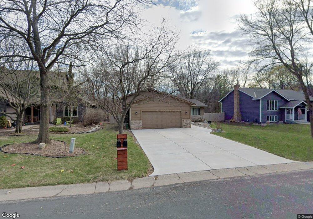
1841 Pheasant Dr Excelsior, MN 55331
Estimated Value: $556,238 - $623,000
4
Beds
3
Baths
2,137
Sq Ft
$270/Sq Ft
Est. Value
About This Home
This home is located at 1841 Pheasant Dr, Excelsior, MN 55331 and is currently estimated at $577,310, approximately $270 per square foot. 1841 Pheasant Dr is a home located in Carver County with nearby schools including Excelsior Elementary School, Minnetonka West Middle School, and Minnetonka Senior High School.
Ownership History
Date
Name
Owned For
Owner Type
Purchase Details
Closed on
May 17, 2021
Sold by
Hoff Charles and Hoff Krisana
Bought by
Gooderum Candace Noreen and Gooderum Mark Patrick
Current Estimated Value
Home Financials for this Owner
Home Financials are based on the most recent Mortgage that was taken out on this home.
Original Mortgage
$420,000
Outstanding Balance
$380,030
Interest Rate
3%
Mortgage Type
New Conventional
Estimated Equity
$197,280
Purchase Details
Closed on
Jul 26, 2007
Sold by
Jones Susan J
Bought by
Hoff Charles and Hoff Krisana
Home Financials for this Owner
Home Financials are based on the most recent Mortgage that was taken out on this home.
Original Mortgage
$289,800
Interest Rate
6.71%
Purchase Details
Closed on
Nov 20, 1997
Sold by
Peterson Timothy C
Bought by
Houck Susan J
Create a Home Valuation Report for This Property
The Home Valuation Report is an in-depth analysis detailing your home's value as well as a comparison with similar homes in the area
Home Values in the Area
Average Home Value in this Area
Purchase History
| Date | Buyer | Sale Price | Title Company |
|---|---|---|---|
| Gooderum Candace Noreen | $525,000 | Titlesmart Inc | |
| Hoff Charles | $322,000 | -- | |
| Houck Susan J | $164,800 | -- | |
| Gooderum Mark Mark | $525,000 | -- |
Source: Public Records
Mortgage History
| Date | Status | Borrower | Loan Amount |
|---|---|---|---|
| Open | Gooderum Candace Noreen | $420,000 | |
| Previous Owner | Hoff Charles | $289,800 | |
| Closed | Gooderum Mark Mark | $420,000 |
Source: Public Records
Tax History Compared to Growth
Tax History
| Year | Tax Paid | Tax Assessment Tax Assessment Total Assessment is a certain percentage of the fair market value that is determined by local assessors to be the total taxable value of land and additions on the property. | Land | Improvement |
|---|---|---|---|---|
| 2025 | $4,962 | $486,500 | $175,800 | $310,700 |
| 2024 | $4,866 | $467,000 | $161,500 | $305,500 |
| 2023 | $4,878 | $467,300 | $161,500 | $305,800 |
| 2022 | $4,060 | $470,500 | $156,000 | $314,500 |
| 2021 | $3,850 | $335,200 | $120,700 | $214,500 |
| 2020 | $3,884 | $331,800 | $120,700 | $211,100 |
| 2019 | $3,728 | $314,900 | $115,000 | $199,900 |
| 2018 | $3,350 | $314,900 | $115,000 | $199,900 |
| 2017 | $3,644 | $283,600 | $104,500 | $179,100 |
| 2016 | $3,788 | $301,700 | $0 | $0 |
| 2015 | $3,502 | $301,100 | $0 | $0 |
| 2014 | $3,502 | $260,400 | $0 | $0 |
Source: Public Records
Map
Nearby Homes
- 1770 Pheasant Cir
- 2150 Crestview Dr
- 6456 Yosemite Ln
- 6480 Yosemite
- 6140 Chaska Rd
- 6040 Oakview Ct
- 6591 Galpin Blvd
- 5910 Minnetonka Dr
- 6430 Bretton Way
- 351 Morse Ave
- 1350 Heather Ct
- 6491 Bretton Way
- 7053 Pearl Dr
- 2125 Longacres Dr
- 6687 Mulberry Cir E
- 205 Mill St Unit S205
- 7266 Fawn Hill Rd
- 5800 Echo Rd
- 5815 Echo Rd
- 151 Bell St
- 1851 1851 Pheasant-Drive-
- 1851 1851 Pheasant Dr
- 1851 Pheasant Dr
- 1840 Pheasant Dr
- 1830 1830 Pheasant Dr
- 1830 Pheasant Dr
- 6411 White Dove Dr
- 1821 Pheasant Dr
- 1901 Moline Cir
- 6311 Steller Cir
- 6301 Steller Cir
- 1820 Pheasant Dr
- 1900 Partridge Cir
- 6410 White Dove Dr
- 1911 Moline Cir
- 1810 Pheasant Dr
- 6420 White Dove Dr
- 6321 Steller Cir
- 1880 Partridge Cir
- 1901 Melody Hill Cir