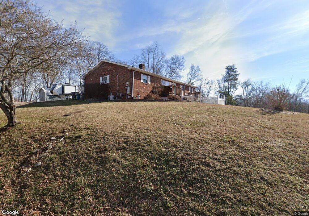
1842 Bouldercrest Dr Dandridge, TN 37725
Estimated Value: $327,302 - $436,000
--
Bed
1
Bath
1,134
Sq Ft
$328/Sq Ft
Est. Value
About This Home
This home is located at 1842 Bouldercrest Dr, Dandridge, TN 37725 and is currently estimated at $371,576, approximately $327 per square foot. 1842 Bouldercrest Dr is a home located in Jefferson County.
Ownership History
Date
Name
Owned For
Owner Type
Purchase Details
Closed on
Jun 2, 2008
Sold by
Satterfield John L
Bought by
Satterfield John L
Current Estimated Value
Purchase Details
Closed on
May 28, 2008
Sold by
Grace Kirk Mary
Bought by
Satterfield John L
Purchase Details
Closed on
Feb 19, 1991
Bought by
Kirk James Edward and Rebecca Joyce
Purchase Details
Closed on
Jun 4, 1985
Bought by
Kirk James Edward and Kirk Anna R
Purchase Details
Closed on
Aug 13, 1979
Purchase Details
Closed on
Jan 23, 1975
Create a Home Valuation Report for This Property
The Home Valuation Report is an in-depth analysis detailing your home's value as well as a comparison with similar homes in the area
Home Values in the Area
Average Home Value in this Area
Purchase History
| Date | Buyer | Sale Price | Title Company |
|---|---|---|---|
| Satterfield John L | -- | -- | |
| Satterfield John L | $150,000 | -- | |
| Kirk James Edward | -- | -- | |
| Kirk James Edward | -- | -- | |
| -- | -- | -- | |
| -- | -- | -- |
Source: Public Records
Tax History Compared to Growth
Tax History
| Year | Tax Paid | Tax Assessment Tax Assessment Total Assessment is a certain percentage of the fair market value that is determined by local assessors to be the total taxable value of land and additions on the property. | Land | Improvement |
|---|---|---|---|---|
| 2025 | $1,114 | $87,875 | $42,500 | $45,375 |
| 2023 | $1,114 | $48,425 | $0 | $0 |
| 2022 | $1,061 | $48,425 | $22,425 | $26,000 |
| 2021 | $1,061 | $48,425 | $22,425 | $26,000 |
| 2020 | $1,061 | $48,425 | $22,425 | $26,000 |
| 2019 | $1,061 | $48,425 | $22,425 | $26,000 |
| 2018 | $777 | $33,075 | $10,250 | $22,825 |
| 2017 | $777 | $33,075 | $10,250 | $22,825 |
| 2016 | $777 | $33,075 | $10,250 | $22,825 |
| 2015 | $777 | $33,075 | $10,250 | $22,825 |
| 2014 | $777 | $33,075 | $10,250 | $22,825 |
Source: Public Records
Map
Nearby Homes
- 1991 Lakebrook Cir
- 1928 Bouldercrest Dr
- 1988 Lakebrook Cir
- 136 Crosslake Ln
- 417 Little Cove Dr
- 1045 Southwind Cir
- 1806 Pheasant Crossing Dr
- 1018 Southwind Cir
- 1887 Lakebrook Cir
- 1710 Ferry Hill Rd
- 344 Economy Cir
- 1614 Sams Dr
- 1635 Sams Dr
- Lots 1&2 Ferry Hill Rd
- 312 Economy Cir
- 539 Morie Rd
- 1920 Mountain Lake Dr
- 428 River Bend Dr
- 323 Eagle Claw Ln
- 450 Riverbend Dr
- 1845 Bouldercrest Dr
- 1833 Bouldercrest Dr
- 1836 Bouldercrest Dr
- 1847 Bouldercrest Dr
- 1847 Bouldercrest Dr
- 757 Bouldercrest Dr
- 1816 Bouldercrest Dr
- 1864 Bouldercrest Dr
- Lot 27 Bouldercrest Dr
- 0 Bouldercrest Rd
- Lot 20 Bouldercrest Dr
- 1859 Bouldercrest Dr
- 725 Waters Edge
- 0 Waters Edge Lot #6 Unit 922232
- 1819 Overlook Dr
- 1873 Bouldercrest Dr
- 1873 Boudercrest Dr
- 721 Waters Edge
- 720 Water's Edge
- 720 Waters Edge