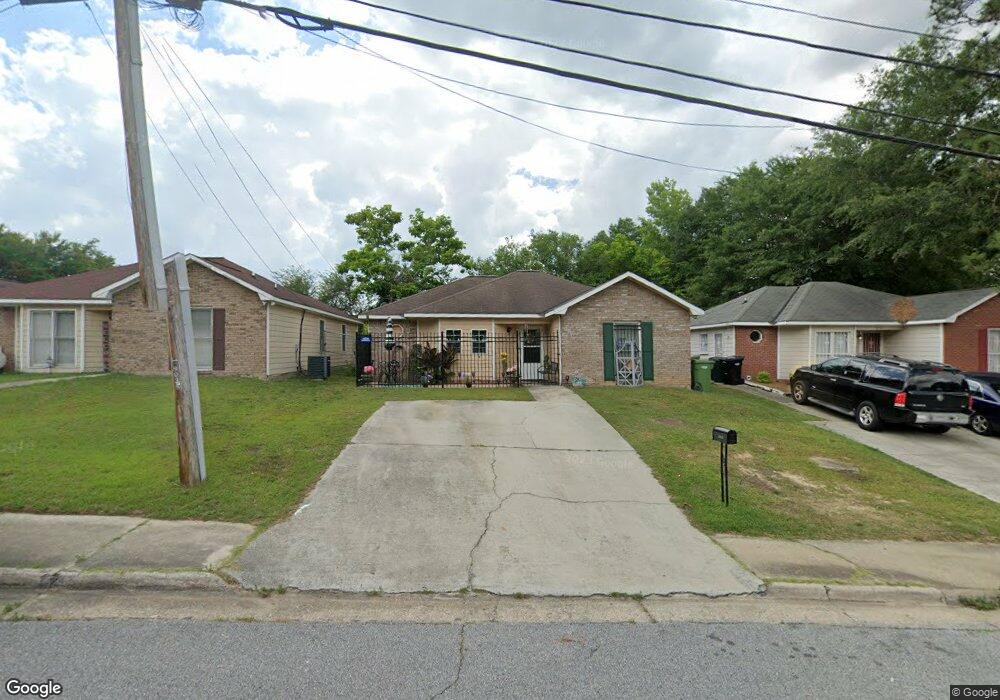
1843 Amber Dr Columbus, GA 31907
Eastern Columbus NeighborhoodEstimated Value: $111,000 - $151,289
3
Beds
3
Baths
1,189
Sq Ft
$108/Sq Ft
Est. Value
About This Home
This home is located at 1843 Amber Dr, Columbus, GA 31907 and is currently estimated at $127,822, approximately $107 per square foot. 1843 Amber Dr is a home located in Muscogee County with nearby schools including Wesley Heights Elementary School, East Columbus Magnet Academy, and Kendrick High School.
Ownership History
Date
Name
Owned For
Owner Type
Purchase Details
Closed on
Mar 16, 2020
Sold by
Speakman William Bernard
Bought by
Speakman William Bernard and Speakman Louvenia
Current Estimated Value
Home Financials for this Owner
Home Financials are based on the most recent Mortgage that was taken out on this home.
Original Mortgage
$71,108
Outstanding Balance
$61,196
Interest Rate
3.4%
Mortgage Type
VA
Estimated Equity
$66,626
Create a Home Valuation Report for This Property
The Home Valuation Report is an in-depth analysis detailing your home's value as well as a comparison with similar homes in the area
Home Values in the Area
Average Home Value in this Area
Purchase History
| Date | Buyer | Sale Price | Title Company |
|---|---|---|---|
| Speakman William Bernard | -- | -- |
Source: Public Records
Mortgage History
| Date | Status | Borrower | Loan Amount |
|---|---|---|---|
| Open | Speakman William Bernard | $71,108 |
Source: Public Records
Tax History Compared to Growth
Tax History
| Year | Tax Paid | Tax Assessment Tax Assessment Total Assessment is a certain percentage of the fair market value that is determined by local assessors to be the total taxable value of land and additions on the property. | Land | Improvement |
|---|---|---|---|---|
| 2025 | $650 | $36,300 | $6,592 | $29,708 |
| 2024 | $649 | $36,300 | $6,592 | $29,708 |
| 2023 | $25 | $36,300 | $6,592 | $29,708 |
| 2022 | $677 | $30,048 | $6,592 | $23,456 |
| 2021 | $670 | $27,908 | $6,592 | $21,316 |
| 2020 | $670 | $27,908 | $6,592 | $21,316 |
| 2019 | $674 | $27,908 | $6,592 | $21,316 |
| 2018 | $674 | $27,908 | $6,592 | $21,316 |
| 2017 | $678 | $27,908 | $6,592 | $21,316 |
| 2016 | $682 | $29,794 | $6,040 | $23,754 |
| 2015 | $683 | $29,794 | $6,040 | $23,754 |
| 2014 | $684 | $29,794 | $6,040 | $23,754 |
| 2013 | -- | $29,794 | $6,040 | $23,754 |
Source: Public Records
Map
Nearby Homes
- 5920 Gleneden Dr
- 5833 Gleneden Dr
- 5929 Gleneden Dr
- 2525 Corineth Dr
- 6032 Cordova Rd
- 5802 Blueridge Dr
- 5834 Blueridge Dr
- 6047 Capri Cir
- 6213 Fitzgerald Dr
- 5500 Amber Dr
- 2807 Doyle Ave
- 6033 Luna Dr
- 5619 Valleybrook Rd
- 6059 Nassau Cir
- 1068 Valencia Dr
- 1524 Hagan Dr
- 6061 Luna Dr
- 2501 White Chapel Dr
- 5906 Forrest Rd
- 2505 White Chapel Dr
- 1839 Amber Dr
- 1847 Amber Dr
- 1835 Amber Dr
- 5779 Marlette Ct
- 5784 Marlette Ct
- 1831 Amber Dr
- 5824 Hunter Rd
- 5818 Hunter Rd
- 5773 Marlette Ct
- 5778 Marlette Ct
- 1900 Amber Dr
- 5812 Hunter Rd
- 1950 Amber Dr
- 5900 Hunter Rd
- 5772 Marlette Ct
- 1810 Amber Dr
- 5761 Marlette Ct
- 5806 Hunter Rd
- 5766 Marlette Ct
- 5912 Hunter Rd