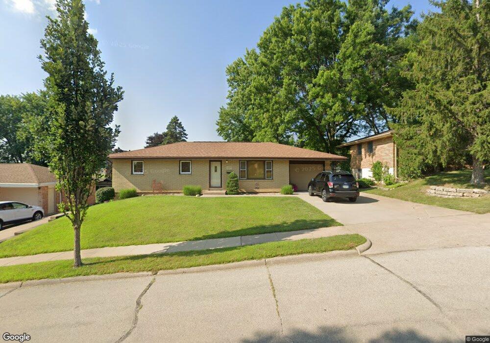
1843 Carter Rd Dubuque, IA 52001
Estimated Value: $255,000 - $308,000
4
Beds
3
Baths
2,076
Sq Ft
$134/Sq Ft
Est. Value
About This Home
This home is located at 1843 Carter Rd, Dubuque, IA 52001 and is currently estimated at $278,925, approximately $134 per square foot. 1843 Carter Rd is a home located in Dubuque County with nearby schools including Hoover Elementary School, Eleanor Roosevelt Middle School, and Dubuque Senior High School.
Ownership History
Date
Name
Owned For
Owner Type
Purchase Details
Closed on
May 7, 2019
Sold by
Conlon Kevin J
Bought by
Conlon Nancy A
Current Estimated Value
Purchase Details
Closed on
Jul 28, 2009
Sold by
Pensel Wallace A and Pensel Faye A
Bought by
Conlon Kevin J and Conlon Nancy A
Home Financials for this Owner
Home Financials are based on the most recent Mortgage that was taken out on this home.
Original Mortgage
$80,000
Outstanding Balance
$52,531
Interest Rate
5.43%
Mortgage Type
Purchase Money Mortgage
Estimated Equity
$226,394
Create a Home Valuation Report for This Property
The Home Valuation Report is an in-depth analysis detailing your home's value as well as a comparison with similar homes in the area
Home Values in the Area
Average Home Value in this Area
Purchase History
| Date | Buyer | Sale Price | Title Company |
|---|---|---|---|
| Conlon Nancy A | -- | None Available | |
| Conlon Kevin J | $160,000 | None Available |
Source: Public Records
Mortgage History
| Date | Status | Borrower | Loan Amount |
|---|---|---|---|
| Open | Conlon Kevin J | $80,000 |
Source: Public Records
Tax History Compared to Growth
Tax History
| Year | Tax Paid | Tax Assessment Tax Assessment Total Assessment is a certain percentage of the fair market value that is determined by local assessors to be the total taxable value of land and additions on the property. | Land | Improvement |
|---|---|---|---|---|
| 2025 | $3,516 | $274,600 | $41,700 | $232,900 |
| 2024 | $3,516 | $244,500 | $37,800 | $206,700 |
| 2023 | $3,414 | $244,500 | $37,800 | $206,700 |
| 2022 | $3,376 | $204,170 | $35,780 | $168,390 |
| 2021 | $3,376 | $204,170 | $35,780 | $168,390 |
| 2020 | $3,318 | $186,530 | $33,790 | $152,740 |
| 2019 | $3,326 | $186,530 | $33,790 | $152,740 |
| 2018 | $3,274 | $178,880 | $31,800 | $147,080 |
| 2017 | $3,186 | $178,880 | $31,800 | $147,080 |
| 2016 | $3,120 | $164,920 | $31,800 | $133,120 |
| 2015 | $3,120 | $164,920 | $31,800 | $133,120 |
| 2014 | $2,986 | $162,310 | $31,800 | $130,510 |
Source: Public Records
Map
Nearby Homes
- 1693 Butterfield Rd
- 3424 Glencove Ln
- 3427 Crestwood Dr
- 3428 Crestwood Dr
- 3080 Saint Anne Dr
- 3455 Daniels St
- 1790 Horizon Ct
- 3130 Ideal Ln
- 1762 Churchill Dr
- 2090 Key Largo Dr
- 1754 Vizaleea Dr
- 3519 Hillcrest Rd
- 3631 Keymeer Dr
- 2035 Broadlawn Rd
- Lot Hillcrest Rd
- 3660 Hillcrest Rd
- 2145 Saint John Dr
- 1730 Chaney Rd
- 1650 Drexel Ave
- 2276 Woodlawn St
- 1845 Carter Rd
- 1839 Carter Rd
- 3258 Saint Anne Dr
- 3254 Saint Anne Dr
- 3258 St Anne Dr
- 1847 Carter Rd
- 3270 Saint Anne Dr
- 1837 Carter Rd
- 3270 St Anne
- 3246 Saint Anne Dr
- 1840 Carter Rd
- 3280 Saint Anne Dr
- 1838 Carter Rd
- 1844 Carter Rd
- 1849 Carter Rd
- 3240 Saint Anne Dr
- 1836 Carter Rd
- 1846 Carter Rd
- 1853 Carter Rd
- 3230 Saint Anne Dr