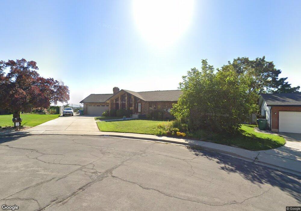
1843 N 470 E Orem, UT 84097
Northridge NeighborhoodEstimated Value: $692,000 - $874,000
5
Beds
4
Baths
5,126
Sq Ft
$155/Sq Ft
Est. Value
About This Home
This home is located at 1843 N 470 E, Orem, UT 84097 and is currently estimated at $794,867, approximately $155 per square foot. 1843 N 470 E is a home located in Utah County with nearby schools including Northridge Elementary School, Oak Canyon Junior High School, and Timpanogos High School.
Ownership History
Date
Name
Owned For
Owner Type
Purchase Details
Closed on
Jul 17, 2014
Sold by
Oh Ann and Oh James
Bought by
Carmack Gary D and Carmack Laura G
Current Estimated Value
Home Financials for this Owner
Home Financials are based on the most recent Mortgage that was taken out on this home.
Original Mortgage
$312,500
Outstanding Balance
$237,495
Interest Rate
4.1%
Mortgage Type
New Conventional
Estimated Equity
$557,372
Purchase Details
Closed on
Apr 29, 2011
Sold by
Oh James
Bought by
Oh Ann and James & Ann Oh Living Trust
Purchase Details
Closed on
Mar 7, 2011
Sold by
Oh James
Bought by
James & Ann Oh Living Trust
Purchase Details
Closed on
Mar 4, 2011
Sold by
Williams Christopher Glenn and Williams Krista Theresa
Bought by
Oh James
Purchase Details
Closed on
Apr 29, 2008
Sold by
Williams Clayton S
Bought by
Williams Clayton S and Clayton S Williams Family Trust
Create a Home Valuation Report for This Property
The Home Valuation Report is an in-depth analysis detailing your home's value as well as a comparison with similar homes in the area
Home Values in the Area
Average Home Value in this Area
Purchase History
| Date | Buyer | Sale Price | Title Company |
|---|---|---|---|
| Carmack Gary D | -- | Bartlett Title Ins Agen | |
| Oh Ann | -- | Keystone Title Insurance Age | |
| James & Ann Oh Living Trust | -- | Keystone Title Insurance Ag | |
| Oh James | -- | Keystone Title Insurance Ag | |
| Williams Clayton S | -- | None Available |
Source: Public Records
Mortgage History
| Date | Status | Borrower | Loan Amount |
|---|---|---|---|
| Open | Carmack Gary D | $312,500 |
Source: Public Records
Tax History
| Year | Tax Paid | Tax Assessment Tax Assessment Total Assessment is a certain percentage of the fair market value that is determined by local assessors to be the total taxable value of land and additions on the property. | Land | Improvement |
|---|---|---|---|---|
| 2025 | $3,400 | $455,620 | -- | -- |
| 2024 | $3,400 | $415,690 | $0 | $0 |
| 2023 | $3,181 | $418,000 | $0 | $0 |
| 2022 | $3,069 | $390,720 | $0 | $0 |
| 2021 | $2,835 | $546,700 | $169,100 | $377,600 |
| 2020 | $2,667 | $505,500 | $135,300 | $370,200 |
| 2019 | $2,565 | $505,500 | $135,300 | $370,200 |
| 2018 | $2,449 | $461,200 | $127,600 | $333,600 |
| 2017 | $2,066 | $208,450 | $0 | $0 |
| 2016 | $108 | $182,600 | $0 | $0 |
| 2015 | $1,855 | $163,185 | $0 | $0 |
| 2014 | $1,619 | $141,790 | $0 | $0 |
Source: Public Records
Map
Nearby Homes
- 540 E Quail Rd
- 695 E 1870 N
- 110 S 1320 E
- 1636 N 160 E
- 1638 N 160 E
- 1480 N 430 E
- 1643 N Mountain Oaks Dr
- 363 E 1395 N Unit 22
- 723 E 1450 N Unit 25
- 1371 N 330 E Unit 8
- 713 E 1500 St N Unit 19
- 713 E 1450 N Unit 23
- 49 W 1880 N
- 747 E 1500 N Unit 13
- 1366 N 750 E
- 733 E 1450 N Unit 5
- 1356 N 750 E Unit 11
- 14 N 850 E
- 1324 N 750 E Unit 3
- 1051 E 100 N
- 474 E 1840 N
- 1802 Heather Dr
- 1851 N 470 E
- 1788 Heather Dr
- 1788 N Heather Dr
- 444 Heather Rd
- 1814 Heather Dr
- 486 E 1840 N
- 1791 Bluebird Rd
- 1774 Heather Dr
- 1774 Heather Dr
- 487 Robin Rd
- 1852 N 470 E
- 1863 N 470 E
- 1803 Heather Dr
- 498 E 1840 N
- 1789 Heather Dr
- 1789 N Heather Dr
- 1771 Bluebird Rd
- 495 E 1840 N
Your Personal Tour Guide
Ask me questions while you tour the home.