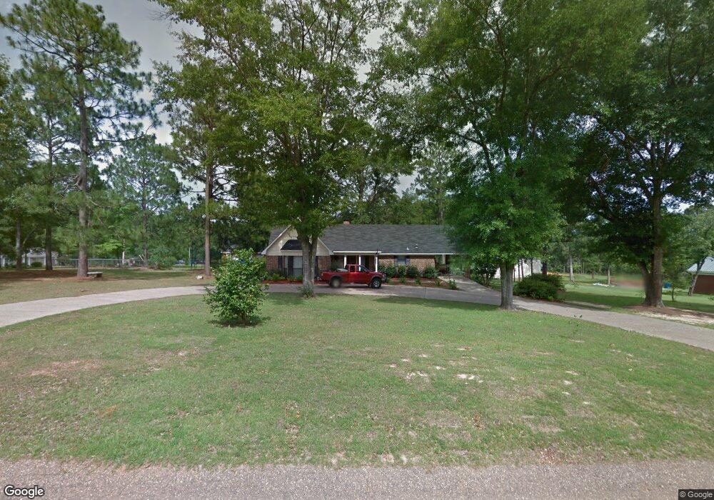
18430 Poplar Ln Citronelle, AL 36522
Estimated Value: $207,000
3
Beds
2
Baths
2,220
Sq Ft
$93/Sq Ft
Est. Value
About This Home
This home is located at 18430 Poplar Ln, Citronelle, AL 36522 and is currently estimated at $207,000, approximately $93 per square foot. 18430 Poplar Ln is a home located in Mobile County with nearby schools including McDavid-Jones Elementary School, Lott Middle School, and Citronelle High School.
Ownership History
Date
Name
Owned For
Owner Type
Purchase Details
Closed on
Jun 8, 2022
Sold by
Brian Graham
Bought by
Graham Family Trust
Current Estimated Value
Purchase Details
Closed on
Apr 27, 2022
Sold by
Lee Pippin Jeffrey and Janise Deborah
Bought by
Graham Brian
Purchase Details
Closed on
Sep 30, 2009
Sold by
Craft Joseph P and Craft Denise P
Bought by
Pippin Jeffrey Lee and Pippin Deborah Janise
Home Financials for this Owner
Home Financials are based on the most recent Mortgage that was taken out on this home.
Original Mortgage
$3,900
Interest Rate
5.05%
Mortgage Type
New Conventional
Create a Home Valuation Report for This Property
The Home Valuation Report is an in-depth analysis detailing your home's value as well as a comparison with similar homes in the area
Home Values in the Area
Average Home Value in this Area
Purchase History
| Date | Buyer | Sale Price | Title Company |
|---|---|---|---|
| Graham Family Trust | $3,000 | Williams Law Llc | |
| Graham Brian | $3,000 | Overton William G | |
| Pippin Jeffrey Lee | -- | None Available |
Source: Public Records
Mortgage History
| Date | Status | Borrower | Loan Amount |
|---|---|---|---|
| Previous Owner | Pippin Jeffrey Lee | $3,900 | |
| Previous Owner | Pippin Jeffrey Lee | $127,645 |
Source: Public Records
Tax History Compared to Growth
Tax History
| Year | Tax Paid | Tax Assessment Tax Assessment Total Assessment is a certain percentage of the fair market value that is determined by local assessors to be the total taxable value of land and additions on the property. | Land | Improvement |
|---|---|---|---|---|
| 2024 | $109 | $2,000 | $2,000 | $0 |
| 2023 | $109 | $2,700 | $2,700 | $0 |
| 2022 | $180 | $3,300 | $3,060 | $240 |
| 2021 | $703 | $13,490 | $1,530 | $11,960 |
| 2020 | $711 | $13,640 | $1,530 | $12,110 |
| 2019 | $694 | $13,340 | $0 | $0 |
| 2018 | $710 | $13,640 | $0 | $0 |
| 2017 | $734 | $14,080 | $0 | $0 |
| 2016 | $743 | $14,240 | $0 | $0 |
| 2013 | $677 | $12,780 | $0 | $0 |
Source: Public Records
Map
Nearby Homes
- 00000 Beverly Jeffries Hwy
- 0 Dogwood Dr Unit LOT 2 10608062
- 0 Dogwood Dr Unit 7179557
- 10805 Mitt Dr
- 10835 Mitt Dr
- 10645 Dogwood Dr
- 11135 Hickory Ct
- 0 Wilson Dr Unit 7179706
- 19335 Robert Walker Rd
- 0 Robert Walker Rd
- 12950 Beverly Jeffries Hwy
- 8770 State St
- 8525 South St
- 8800 W Williams St
- 8520 W Lebaron Ave
- 8375 Lloyd Ln
- 19645 N 5th St
- 18280 S 6th St
- 18975 S 3rd St
- 8185 Faye St
- 10805 Bayleaf Dr
- 0 Bayleaf Dr Unit 604628
- 0 Bayleaf Dr Unit 5,6 0604322
- 0 Bayleaf Dr Unit 5,6 0604164
- 0 Bayleaf Dr Unit 5 & 6 0540632
- 0 Bayleaf Dr Unit 5,6
- 18410 Poplar Ln
- 10855 Bayleaf Dr
- 10830 Bayleaf Dr
- 10785 Bayleaf Dr
- 10790 Bayleaf Dr
- 00 Poplar Ln
- 18400 Bayleaf Ln Unit LNR
- 10720 Bayleaf Dr
- 10870 Bayleaf Dr
- 10765 Bayleaf Dr
- 18440 Magnolia Ln
- 10755 Bayleaf Dr
- 18380 Magnolia Ln
- 10890 Bayleaf Dr