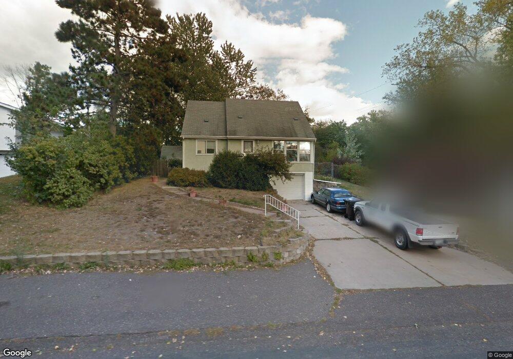
1844 Walter St Saint Paul, MN 55109
Gladstone NeighborhoodEstimated Value: $314,274 - $362,000
4
Beds
2
Baths
1,520
Sq Ft
$218/Sq Ft
Est. Value
About This Home
This home is located at 1844 Walter St, Saint Paul, MN 55109 and is currently estimated at $331,569, approximately $218 per square foot. 1844 Walter St is a home located in Ramsey County with nearby schools including Weaver Elementary School, John Glenn Middle School, and Face to Face Academy Online.
Ownership History
Date
Name
Owned For
Owner Type
Purchase Details
Closed on
Mar 20, 2021
Sold by
Easterday Matthew C and Easterday Kristen J
Bought by
Thompson Darren A
Current Estimated Value
Home Financials for this Owner
Home Financials are based on the most recent Mortgage that was taken out on this home.
Original Mortgage
$257,500
Outstanding Balance
$230,948
Interest Rate
2.73%
Mortgage Type
New Conventional
Estimated Equity
$100,621
Purchase Details
Closed on
Jun 14, 2004
Sold by
Fischer Scott and Fischer Jennifer
Bought by
Easterday Mathew and Easterday Kristen
Purchase Details
Closed on
Dec 21, 2000
Sold by
Anderson Patrick S and Anderson Heather A
Bought by
Fischer Jennifer L and Fischer Scott A
Create a Home Valuation Report for This Property
The Home Valuation Report is an in-depth analysis detailing your home's value as well as a comparison with similar homes in the area
Home Values in the Area
Average Home Value in this Area
Purchase History
| Date | Buyer | Sale Price | Title Company |
|---|---|---|---|
| Thompson Darren A | $265,500 | Legacy Title | |
| Easterday Mathew | $199,000 | -- | |
| Fischer Jennifer L | $159,900 | -- | |
| Thompson Darren Darren | $265,500 | -- |
Source: Public Records
Mortgage History
| Date | Status | Borrower | Loan Amount |
|---|---|---|---|
| Open | Thompson Darren A | $257,500 | |
| Closed | Thompson Darren Darren | $257,500 |
Source: Public Records
Tax History
| Year | Tax Paid | Tax Assessment Tax Assessment Total Assessment is a certain percentage of the fair market value that is determined by local assessors to be the total taxable value of land and additions on the property. | Land | Improvement |
|---|---|---|---|---|
| 2025 | $3,806 | $308,800 | $58,200 | $250,600 |
| 2023 | $3,806 | $277,600 | $58,200 | $219,400 |
| 2022 | $2,892 | $252,500 | $58,200 | $194,300 |
| 2021 | $2,872 | $208,700 | $58,200 | $150,500 |
| 2020 | $3,014 | $211,200 | $58,200 | $153,000 |
| 2019 | $2,834 | $206,900 | $58,200 | $148,700 |
| 2018 | $2,742 | $198,900 | $58,200 | $140,700 |
| 2017 | $2,694 | $188,700 | $58,200 | $130,500 |
| 2016 | $2,612 | $0 | $0 | $0 |
| 2015 | $2,426 | $174,500 | $53,400 | $121,100 |
| 2014 | $1,994 | $0 | $0 | $0 |
Source: Public Records
Map
Nearby Homes
- 1083 Gordon Ave
- 1800 Edward St
- 1745 Duluth St
- 2180 N English St
- 2022 English St
- 1290 Belmont Ln E
- 1855 Birmingham St
- 1544 Duluth St
- 1200 Leland Rd E
- 1633 Etna St
- 1563 Clarence St
- 1561 Clarence St
- 1563 Arcade St
- 695 Idaho Ave E
- 1592 Greenbrier St
- 1460 Hoyt Ave E
- 742 Nebraska Ave E
- 2125 Hazelwood St
- 1571 Christie Place
- 1581 Christie Place
- 1852 Walter St
- 1828 Walter St
- 1107 Gordon Ave
- 1843 Phalen Place
- 1835 Phalen Place
- 1860 Walter St
- 1109 Gordon Ave
- 1843 Walter St
- 1857 Phalen Place
- 1855 Walter St
- 1111 Gordon Ave
- 1053 Gordon Ave
- 1865 Phalen Place
- 1865 Walter St
- 1113 Gordon Ave
- 1100 Fenton St
- 1115 Gordon Ave
- 1119 Ripley Ave
- 1844 Phalen Place
- 1871 Phalen Place
Your Personal Tour Guide
Ask me questions while you tour the home.