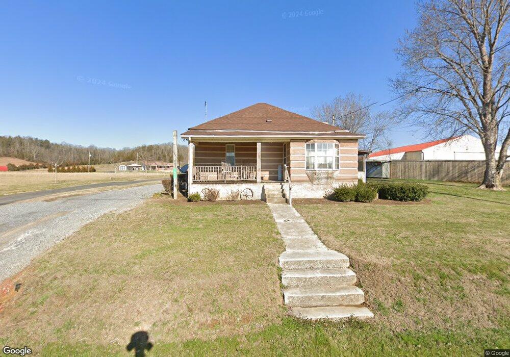
1845 Highway 66 Bulls Gap, TN 37711
Estimated Value: $126,357 - $169,000
--
Bed
1
Bath
845
Sq Ft
$172/Sq Ft
Est. Value
About This Home
This home is located at 1845 Highway 66, Bulls Gap, TN 37711 and is currently estimated at $145,089, approximately $171 per square foot. 1845 Highway 66 is a home located in Hawkins County with nearby schools including Bulls Gap School and Cherokee High School.
Ownership History
Date
Name
Owned For
Owner Type
Purchase Details
Closed on
May 31, 2006
Sold by
Federal National Mortgage Association
Bought by
Richard King
Current Estimated Value
Home Financials for this Owner
Home Financials are based on the most recent Mortgage that was taken out on this home.
Original Mortgage
$47,000
Outstanding Balance
$27,539
Interest Rate
6.51%
Estimated Equity
$117,550
Purchase Details
Closed on
Sep 21, 2005
Sold by
Smith Thomas J
Bought by
Regison Bank Dba Regions Mortg
Purchase Details
Closed on
Sep 21, 1993
Bought by
Smith Thomas J
Purchase Details
Closed on
Aug 11, 1992
Bought by
Smith Joyce Ann
Purchase Details
Closed on
Jun 4, 1992
Bought by
Smith Joyce Ann
Create a Home Valuation Report for This Property
The Home Valuation Report is an in-depth analysis detailing your home's value as well as a comparison with similar homes in the area
Home Values in the Area
Average Home Value in this Area
Purchase History
| Date | Buyer | Sale Price | Title Company |
|---|---|---|---|
| Richard King | $44,000 | -- | |
| Regison Bank Dba Regions Mortg | $47,013 | -- | |
| Smith Thomas J | -- | -- | |
| Smith Joyce Ann | -- | -- | |
| Smith Joyce Ann | $27,000 | -- |
Source: Public Records
Mortgage History
| Date | Status | Borrower | Loan Amount |
|---|---|---|---|
| Open | Smith Joyce Ann | $47,000 |
Source: Public Records
Tax History Compared to Growth
Tax History
| Year | Tax Paid | Tax Assessment Tax Assessment Total Assessment is a certain percentage of the fair market value that is determined by local assessors to be the total taxable value of land and additions on the property. | Land | Improvement |
|---|---|---|---|---|
| 2024 | $337 | $13,200 | $2,400 | $10,800 |
| 2023 | $307 | $13,200 | $0 | $0 |
| 2022 | $306 | $13,200 | $2,400 | $10,800 |
| 2021 | $286 | $13,200 | $2,400 | $10,800 |
| 2020 | $258 | $13,200 | $2,400 | $10,800 |
| 2019 | $258 | $10,200 | $2,400 | $7,800 |
| 2018 | $258 | $10,200 | $2,400 | $7,800 |
| 2017 | $258 | $10,200 | $2,400 | $7,800 |
| 2016 | $258 | $10,200 | $2,400 | $7,800 |
| 2015 | $251 | $10,200 | $2,400 | $7,800 |
| 2014 | $269 | $10,925 | $2,400 | $8,525 |
Source: Public Records
Map
Nearby Homes
- 334 S Fork Branch Rd
- 113 Old Highway Rd
- 2586 Highway 66 S
- 140 Roberts Rd
- TBD Gap Creek Rd
- 887 Berry Rd
- Lot 2 Longtown Rd
- 0 Seay Hollow Rd
- Tbd Seay Hollow Rd
- Tbd Lashay Ln
- Lot 1 Walkers Church Rd
- Lot 2 Walkers Church Rd
- 251 Speedwell Ln
- 0 Walkers Church
- 104 Bacon Rd
- Lot 6 Cantrell Rd
- Lot 3 Cantrell Rd
- Lot 2 Cantrell Rd
- Lot 1 Cantrell Rd
- 299 Lauderback Gap Trail
- 1845 S Unit 1
- 1845 Highway 66
- 1853 Highway 66
- 1853 Tennessee 66
- 1847 Highway 66
- 1847 Highway 66
- 1849 Highway 66
- 1842 Highway 66 S
- 1846 Highway 66
- 1821 Highway 66
- 210 Freeman Rd
- 1795 Highway 66
- 1896 Highway 66
- 1896 Tennessee 66
- 1900 Highway 66
- 1914 Highway 66 S
- 120 Speedwell Rd
- 143 Berry Rd
- 129 Berry Rd
- 151 Berry Rd