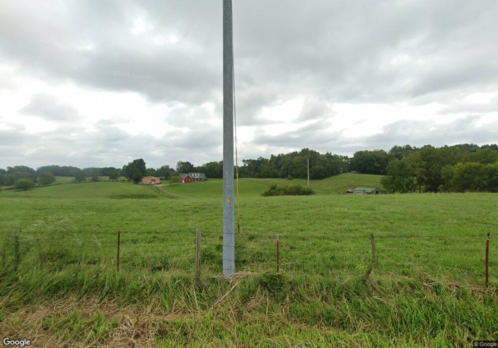
Estimated Value: $818,000 - $904,000
--
Bed
3
Baths
3,520
Sq Ft
$244/Sq Ft
Est. Value
About This Home
This home is located at 1845 Highway 76 W, Adams, TN 37010 and is currently estimated at $859,256, approximately $244 per square foot. 1845 Highway 76 W is a home located in Robertson County with nearby schools including Jo Byrns Elementary School and Jo Byrns High School.
Ownership History
Date
Name
Owned For
Owner Type
Purchase Details
Closed on
Jan 28, 2025
Sold by
Gatley Michael W and Gatley Jennifer A
Bought by
Gatley Family Trust and Gatley
Current Estimated Value
Purchase Details
Closed on
Mar 24, 2021
Sold by
Jacobs Mike T and Jacobs Monica J
Bought by
Gatley Michael W and Gatley Jennifer A
Home Financials for this Owner
Home Financials are based on the most recent Mortgage that was taken out on this home.
Original Mortgage
$585,000
Interest Rate
2.73%
Mortgage Type
New Conventional
Purchase Details
Closed on
May 13, 2004
Sold by
George Moss
Bought by
Mike Jacobs
Purchase Details
Closed on
Jan 26, 2004
Sold by
Christopher Burchett
Bought by
Moss Barbara A and Moss George W
Purchase Details
Closed on
Jul 10, 2002
Bought by
Burchett Christopher and Burchett Kelly L
Create a Home Valuation Report for This Property
The Home Valuation Report is an in-depth analysis detailing your home's value as well as a comparison with similar homes in the area
Home Values in the Area
Average Home Value in this Area
Purchase History
| Date | Buyer | Sale Price | Title Company |
|---|---|---|---|
| Gatley Family Trust | -- | None Listed On Document | |
| Gatley Family Trust | -- | None Listed On Document | |
| Gatley Michael W | $650,000 | Tennessee Title Services Llc | |
| Mike Jacobs | $44,000 | -- | |
| Moss Barbara A | $40,600 | -- | |
| Burchett Christopher | $40,800 | -- |
Source: Public Records
Mortgage History
| Date | Status | Borrower | Loan Amount |
|---|---|---|---|
| Previous Owner | Gatley Michael W | $585,000 |
Source: Public Records
Tax History Compared to Growth
Tax History
| Year | Tax Paid | Tax Assessment Tax Assessment Total Assessment is a certain percentage of the fair market value that is determined by local assessors to be the total taxable value of land and additions on the property. | Land | Improvement |
|---|---|---|---|---|
| 2024 | $3,465 | $192,525 | $36,775 | $155,750 |
| 2023 | $3,465 | $192,525 | $36,775 | $155,750 |
| 2022 | $3,179 | $123,400 | $15,150 | $108,250 |
| 2021 | $3,179 | $123,400 | $15,150 | $108,250 |
| 2020 | $3,179 | $123,400 | $15,150 | $108,250 |
| 2019 | $3,179 | $123,400 | $15,150 | $108,250 |
| 2018 | $3,179 | $123,400 | $15,150 | $108,250 |
| 2017 | $3,462 | $112,225 | $14,000 | $98,225 |
| 2016 | $3,462 | $112,225 | $14,000 | $98,225 |
| 2015 | $3,322 | $112,225 | $14,000 | $98,225 |
| 2014 | $3,322 | $112,225 | $14,000 | $98,225 |
Source: Public Records
Map
Nearby Homes
- 5016 Caney Sink Rd
- 2856 Highway 76 W
- 0 Port Royal Unit RTC2976722
- 0 Port Royal Unit RTC2926688
- 2160 Trieste Trail
- 0 W Bellar Rd
- 258 Woodruff Rd
- 5055 S Bell Cross Rd
- 7898 Highway 41 N
- 3900 Sadlersville Rd
- 1097 Landing Ln
- 1073 Landing Ln
- 1085 Landing Ln
- 240 Hall Ct
- 230 Hall Ct
- 1057 Landing Ln
- 1015 Landing Ln
- 1035 Landing Ln
- 1047 Landing Ln
- 104 E Pond St
- 1833 Highway 76 W
- 4667 Highway 76 W
- 4667 Tennessee 76
- 1827 Highway 76 W
- 46 Meadowland
- 17 Bradbury Rd
- 1834 Highway 76 W
- 1821 Highway 76 W
- 1826 Highway 76 W
- 4427 Tennessee 76
- 4668 Highway 76 W
- 4427 Highway 76 W
- 4488 Highway 76 W
- 1819 Highway 76 W
- 4927 Highway 76 W
- 4280 Highway 76 W
- 7181 Tolleson Rd
- 1615 Port Royal Rd
- 2008 Highway 76 W
- 7284 Tolleson Rd
