Estimated Value: $304,169 - $363,000
5
Beds
3
Baths
1,344
Sq Ft
$251/Sq Ft
Est. Value
About This Home
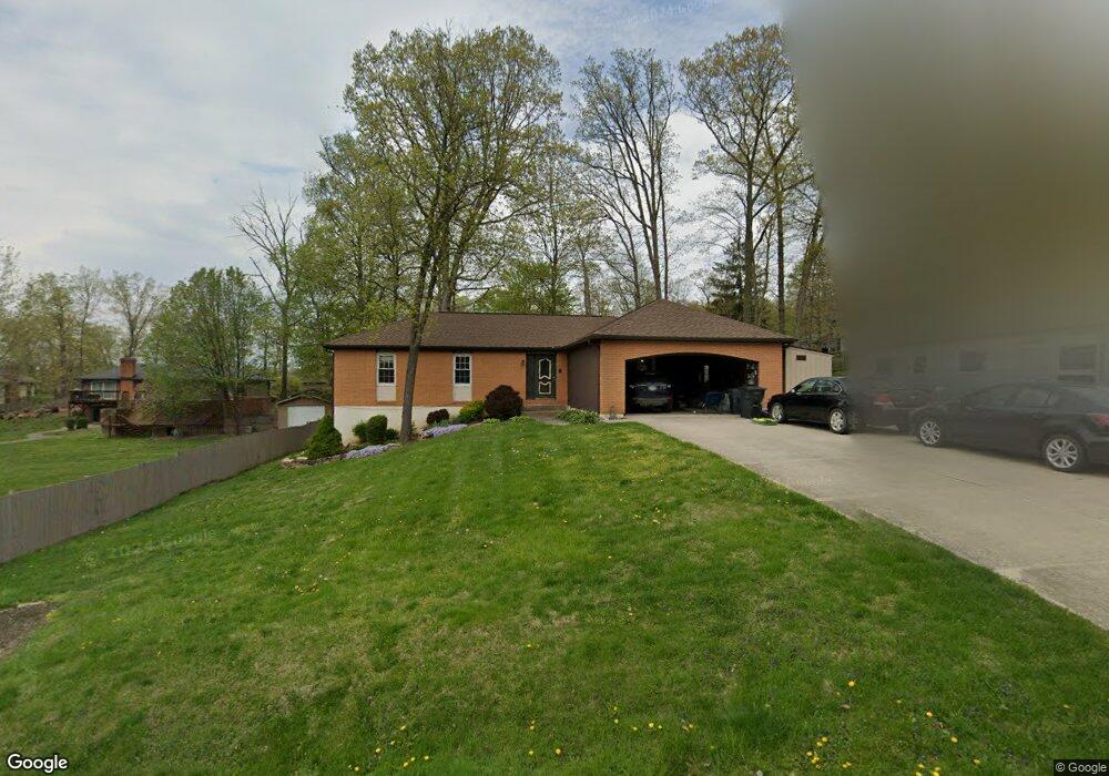
This home is located at 1846 Maple Ct, Heath, OH 43056 and is currently estimated at $336,792, approximately $250 per square foot. 1846 Maple Ct is a home located in Licking County with nearby schools including Garfield Elementary School, Stevenson Elementary School, and Heath Middle School.
Ownership History
Date
Name
Owned For
Owner Type
Purchase Details
Closed on
Mar 15, 2012
Sold by
Mcqueen Wesley S and Lane Tracy L
Bought by
Mcqueen Wesley S and Mcqueen Tracy L
Current Estimated Value
Home Financials for this Owner
Home Financials are based on the most recent Mortgage that was taken out on this home.
Original Mortgage
$157,964
Outstanding Balance
$110,457
Interest Rate
4.25%
Mortgage Type
FHA
Estimated Equity
$226,335
Purchase Details
Closed on
Dec 23, 2005
Sold by
Homman Rick A and Homman Ami S
Bought by
Mcqueen Wesley S and Lane Tracy L
Home Financials for this Owner
Home Financials are based on the most recent Mortgage that was taken out on this home.
Original Mortgage
$168,568
Interest Rate
6.48%
Mortgage Type
FHA
Purchase Details
Closed on
Aug 4, 1999
Sold by
Patton Seth
Bought by
Homman Rick A and Homman Ann S
Create a Home Valuation Report for This Property
The Home Valuation Report is an in-depth analysis detailing your home's value as well as a comparison with similar homes in the area
Home Values in the Area
Average Home Value in this Area
Purchase History
| Date | Buyer | Sale Price | Title Company |
|---|---|---|---|
| Mcqueen Wesley S | -- | None Available | |
| Mcqueen Wesley S | $169,900 | -- | |
| Homman Rick A | $138,000 | -- |
Source: Public Records
Mortgage History
| Date | Status | Borrower | Loan Amount |
|---|---|---|---|
| Open | Mcqueen Wesley S | $157,964 | |
| Previous Owner | Mcqueen Wesley S | $168,568 | |
| Closed | Homman Rick A | -- |
Source: Public Records
Tax History
| Year | Tax Paid | Tax Assessment Tax Assessment Total Assessment is a certain percentage of the fair market value that is determined by local assessors to be the total taxable value of land and additions on the property. | Land | Improvement |
|---|---|---|---|---|
| 2024 | $3,548 | $82,460 | $21,210 | $61,250 |
| 2023 | $3,926 | $82,460 | $21,210 | $61,250 |
| 2022 | $3,468 | $64,020 | $12,390 | $51,630 |
| 2021 | $3,539 | $64,020 | $12,390 | $51,630 |
| 2020 | $3,561 | $64,020 | $12,390 | $51,630 |
| 2019 | $3,131 | $57,300 | $12,390 | $44,910 |
| 2018 | $3,165 | $0 | $0 | $0 |
| 2017 | $3,265 | $0 | $0 | $0 |
| 2016 | $3,311 | $0 | $0 | $0 |
| 2015 | $3,367 | $0 | $0 | $0 |
| 2014 | $4,736 | $0 | $0 | $0 |
| 2013 | $3,105 | $0 | $0 | $0 |
Source: Public Records
Map
Nearby Homes
- 5185 Linnville Rd
- 1871 Blue Jay Rd
- 1933 Blue Jay Rd
- 123 Misty Meadows Dr
- 0 Cumberland Crest
- 1782 Cumberland Crest
- 748 Francis Dr
- 722 Francis Dr
- 723 Francis Dr
- 731 Francis Dr
- 733 Francis Dr
- 767 Francis Dr
- 1306 Kasey Ct
- 621 S 2nd St
- 611 S 2nd St
- 150 Linnridge Dr Unit Lot 28
- 146 Linnridge Dr Unit Lot 27
- 142 Linnridge Dr Unit Lot 26
- 161 Linnridge Dr Unit Lot 20
- 149 Linnridge Dr Unit Lot 23
Your Personal Tour Guide
Ask me questions while you tour the home.