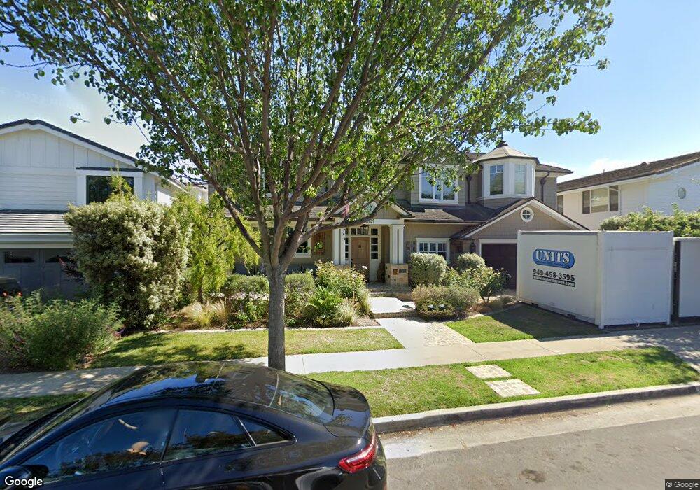
1847 Port Margate Place Newport Beach, CA 92660
Harbor View Homes NeighborhoodEstimated Value: $3,664,000 - $5,784,000
4
Beds
4
Baths
4,017
Sq Ft
$1,228/Sq Ft
Est. Value
About This Home
This home is located at 1847 Port Margate Place, Newport Beach, CA 92660 and is currently estimated at $4,934,584, approximately $1,228 per square foot. 1847 Port Margate Place is a home located in Orange County with nearby schools including Roy O. Andersen Elementary School, Corona del Mar Middle and High School, and Newport Christian School.
Ownership History
Date
Name
Owned For
Owner Type
Purchase Details
Closed on
Oct 19, 2018
Sold by
Cottrell Richard L and Cottrell Alison
Bought by
Cottrell Richard Lang and Cottrell Alison Leslie
Current Estimated Value
Purchase Details
Closed on
May 5, 1998
Sold by
Ann Cunningham Marjorie
Bought by
Cottrell Richard L and Cottrell Alison
Home Financials for this Owner
Home Financials are based on the most recent Mortgage that was taken out on this home.
Original Mortgage
$492,000
Outstanding Balance
$96,218
Interest Rate
7.11%
Estimated Equity
$4,838,367
Create a Home Valuation Report for This Property
The Home Valuation Report is an in-depth analysis detailing your home's value as well as a comparison with similar homes in the area
Home Values in the Area
Average Home Value in this Area
Purchase History
| Date | Buyer | Sale Price | Title Company |
|---|---|---|---|
| Cottrell Richard Lang | -- | None Available | |
| Cottrell Richard L | $615,000 | Chicago Title Co |
Source: Public Records
Mortgage History
| Date | Status | Borrower | Loan Amount |
|---|---|---|---|
| Open | Cottrell Richard L | $492,000 |
Source: Public Records
Tax History Compared to Growth
Tax History
| Year | Tax Paid | Tax Assessment Tax Assessment Total Assessment is a certain percentage of the fair market value that is determined by local assessors to be the total taxable value of land and additions on the property. | Land | Improvement |
|---|---|---|---|---|
| 2025 | $14,926 | $1,415,954 | $789,172 | $626,782 |
| 2024 | $14,926 | $1,388,191 | $773,698 | $614,493 |
| 2023 | $14,574 | $1,360,972 | $758,527 | $602,445 |
| 2022 | $14,329 | $1,334,287 | $743,654 | $590,633 |
| 2021 | $14,054 | $1,308,125 | $729,073 | $579,052 |
| 2020 | $13,918 | $1,294,712 | $721,597 | $573,115 |
| 2019 | $13,705 | $1,269,326 | $707,448 | $561,878 |
| 2018 | $13,359 | $1,244,438 | $693,577 | $550,861 |
| 2017 | $13,122 | $1,220,038 | $679,978 | $540,060 |
| 2016 | $12,828 | $1,196,116 | $666,645 | $529,471 |
| 2015 | $12,705 | $1,178,150 | $656,632 | $521,518 |
| 2014 | $12,405 | $1,155,072 | $643,769 | $511,303 |
Source: Public Records
Map
Nearby Homes
- 1845 Port Westbourne Place
- 1812 Port Margate Place
- 1736 Port Sheffield Place
- 1977 Port Cardiff Place
- 58 Victoria
- 15 Boardwalk
- 10 Seabluff
- 515 Bay Hill Dr
- 2 Royal Saint George Rd
- 17 Monaco Unit 12
- 29 Augusta Ln
- 4 Huntington Ct
- 5 Hillsborough
- 2703 Hillside Dr Unit 36
- 15 Cypress Point Ln
- 56 Royal Saint George Rd
- 49 Canyon Island Dr
- 51 Sea Pine Ln Unit 59
- 2720 Hilltop Dr Unit 58
- 1935 Port Bishop Place
- 1853 Port Margate Place
- 1838 Port Charles Place
- 1844 Port Charles Place
- 1832 Port Charles Place
- 1859 Port Margate Place
- 1835 Port Margate Place
- 1850 Port Charles Place
- 1842 Port Margate Place
- 1836 Port Margate Place
- 1826 Port Charles Place
- 1848 Port Margate Place
- 1865 Port Margate Place
- 1829 Port Margate Place
- 1830 Port Margate Place
- 1856 Port Charles Place
- 1854 Port Margate Place
- 1820 Port Charles Place
- 1824 Port Margate Place
- 1821 Port Margate Place
- 1871 Port Margate Place