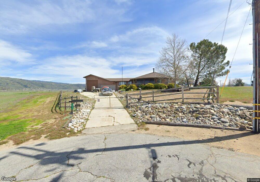
18490 Burning Tree Ct Tehachapi, CA 93561
Estimated Value: $356,000 - $398,000
3
Beds
2
Baths
1,312
Sq Ft
$284/Sq Ft
Est. Value
About This Home
This home is located at 18490 Burning Tree Ct, Tehachapi, CA 93561 and is currently estimated at $373,250, approximately $284 per square foot. 18490 Burning Tree Ct is a home located in Kern County with nearby schools including Cummings Valley Elementary School, Jacobsen Middle School, and Tehachapi High School.
Ownership History
Date
Name
Owned For
Owner Type
Purchase Details
Closed on
May 24, 2010
Sold by
Cavanaugh Daniel E
Bought by
Cavanaugh Daniel E and Cavanaugh Revocable L Daniel E
Current Estimated Value
Purchase Details
Closed on
Apr 8, 2008
Sold by
Cavanaugh Michael A
Bought by
Cavanaugh Daniel E
Purchase Details
Closed on
Jun 3, 1997
Sold by
Ann Sillman Delton E and Ann Mary
Bought by
Cavanaugh Michael A
Home Financials for this Owner
Home Financials are based on the most recent Mortgage that was taken out on this home.
Original Mortgage
$103,500
Interest Rate
7.61%
Purchase Details
Closed on
Nov 24, 1992
Sold by
Sillman Delton E and Sillman Mary Ann
Bought by
Sillman Delton E and Sillman Mary Ann
Create a Home Valuation Report for This Property
The Home Valuation Report is an in-depth analysis detailing your home's value as well as a comparison with similar homes in the area
Home Values in the Area
Average Home Value in this Area
Purchase History
| Date | Buyer | Sale Price | Title Company |
|---|---|---|---|
| Cavanaugh Daniel E | -- | None Available | |
| Cavanaugh Daniel E | -- | Chicago Title | |
| Cavanaugh Michael A | $115,000 | Chicago Title Co | |
| Sillman Delton E | -- | -- |
Source: Public Records
Mortgage History
| Date | Status | Borrower | Loan Amount |
|---|---|---|---|
| Previous Owner | Cavanaugh Michael A | $103,500 |
Source: Public Records
Tax History
| Year | Tax Paid | Tax Assessment Tax Assessment Total Assessment is a certain percentage of the fair market value that is determined by local assessors to be the total taxable value of land and additions on the property. | Land | Improvement |
|---|---|---|---|---|
| 2025 | $2,502 | $183,599 | $23,934 | $159,665 |
| 2024 | $2,420 | $180,000 | $23,465 | $156,535 |
| 2023 | $2,420 | $176,471 | $23,005 | $153,466 |
| 2022 | $2,395 | $173,011 | $22,554 | $150,457 |
| 2021 | $2,354 | $169,619 | $22,112 | $147,507 |
| 2020 | $2,354 | $167,881 | $21,886 | $145,995 |
| 2019 | $2,354 | $167,881 | $21,886 | $145,995 |
| 2018 | $2,280 | $161,364 | $21,037 | $140,327 |
| 2017 | $2,277 | $158,201 | $20,625 | $137,576 |
| 2016 | $2,173 | $155,100 | $20,221 | $134,879 |
| 2015 | $2,128 | $152,771 | $19,918 | $132,853 |
| 2014 | $2,108 | $149,779 | $19,528 | $130,251 |
Source: Public Records
Map
Nearby Homes
- 18461 Santa Anita St
- 0 Burning Tree Dr
- 0 Burlingame Ct Unit 9993801
- 0 Burlingame Ct Unit 202603302
- 18101 Ghost Town St
- 27961 Stallion Springs Dr
- 27712 Stallion Springs Dr
- 18461 Branding Iron Ct
- 0 Lot Number: 28 Tract:3427 Unit 202513529
- 18140 Flare Dr
- 0 Stallion Springs and Spyglass Unit 25599401
- 28261 Preakness Dr
- 17161 Bold Venture Dr
- 28841 Delaware Dr
- 28881 Shannon Ct Unit 27
- 28881 Shannon Ct Unit 4
- 28341 Carry Back Ct
- 0 High Echelon Ct
- 28151 Preakness Dr
- 28701 Delaware Dr
- 0 Burning Tree Ct
- 18450 Burning Tree Ct
- 28881 Burning Tree Ct
- 18401 Santa Anita St
- 0 Burning Tree Lot 24 Dr Unit 9991706
- 27950 Crofun Rd
- 28881 Burning Tree Dr
- 28100 Burning Tree Dr
- 27951 Rustler Ave
- 28150 Burning Tree Dr
- 27940 Crofun Rd
- 27941 Rustler Ave
- 28180 Burning Tree Dr
- 18420 Santa Anita St
- 18400 Santa Anita St
- 27930 Crofun Rd
- 28000 Burning Tree Dr
- 27920 Crofun Rd
- 18390 Santa Anita St
- 18441 Ghost Town St
Your Personal Tour Guide
Ask me questions while you tour the home.