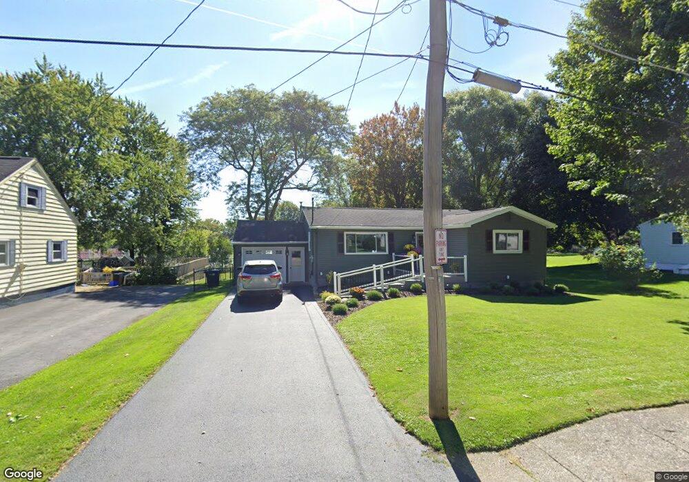
185 Granger St Canandaigua, NY 14424
Estimated Value: $262,000 - $326,000
3
Beds
2
Baths
1,298
Sq Ft
$219/Sq Ft
Est. Value
About This Home
This home is located at 185 Granger St, Canandaigua, NY 14424 and is currently estimated at $284,096, approximately $218 per square foot. 185 Granger St is a home located in Ontario County with nearby schools including Canandaigua Primary-Elementary School, Canandaigua Middle School, and Canandaigua Academy.
Ownership History
Date
Name
Owned For
Owner Type
Purchase Details
Closed on
Aug 11, 2021
Sold by
Romeo Richard E and Romeo Tamara D
Bought by
Chester Family Irt
Current Estimated Value
Purchase Details
Closed on
Apr 23, 1998
Purchase Details
Closed on
Oct 10, 1996
Create a Home Valuation Report for This Property
The Home Valuation Report is an in-depth analysis detailing your home's value as well as a comparison with similar homes in the area
Home Values in the Area
Average Home Value in this Area
Purchase History
| Date | Buyer | Sale Price | Title Company |
|---|---|---|---|
| Chester Family Irt | $200,000 | None Available | |
| -- | -- | -- | |
| Romeo Richard E | $82,000 | -- | |
| -- | -- | -- |
Source: Public Records
Mortgage History
| Date | Status | Borrower | Loan Amount |
|---|---|---|---|
| Previous Owner | Romeo Richard E | $120,000 | |
| Previous Owner | Romeo Richard E | $15,000 | |
| Previous Owner | Romeo Richard E | $134,340 | |
| Previous Owner | Romeo Richard E | $103,472 |
Source: Public Records
Tax History Compared to Growth
Tax History
| Year | Tax Paid | Tax Assessment Tax Assessment Total Assessment is a certain percentage of the fair market value that is determined by local assessors to be the total taxable value of land and additions on the property. | Land | Improvement |
|---|---|---|---|---|
| 2024 | $4,714 | $234,900 | $28,000 | $206,900 |
| 2023 | $4,111 | $169,500 | $23,900 | $145,600 |
| 2022 | $4,061 | $169,500 | $23,900 | $145,600 |
| 2021 | $3,603 | $167,500 | $23,900 | $143,600 |
| 2020 | $3,518 | $154,000 | $23,000 | $131,000 |
| 2019 | $4,212 | $154,000 | $23,000 | $131,000 |
| 2018 | $2,356 | $154,000 | $23,000 | $131,000 |
| 2017 | $2,380 | $154,000 | $23,000 | $131,000 |
| 2016 | $2,266 | $147,000 | $23,000 | $124,000 |
| 2015 | $2,267 | $147,000 | $23,000 | $124,000 |
| 2014 | -- | $147,000 | $23,000 | $124,000 |
Source: Public Records
Map
Nearby Homes
- 120 Fort Hill Ave
- 55 Fort Hill Ave
- 40 Dungan St
- 135 Deseyn Dr
- 34 Dungan St
- 177 Gibson St
- 182 Kennedy St
- 104 N Main St
- 0 Route 21 S Unit R1587258
- 0 County Road 4
- 23 Keuka Ln
- 16 Keuka Ln
- 74 Pleasant St
- 0 Cr-32 Unit R1614194
- 0 Cr-32 Unit R1614204
- 87 Phoenix St
- 38 Chapin St
- 146 Pleasant St
- 154 W Gibson St
- 127 Park Ave
- 189 Granger St
- 175 Granger St
- 193 Granger St
- 166 Granger St
- 190 Granger St
- 192 Granger St
- 273 N Pleasant St
- 269 N Pleasant St
- 160 Granger St
- 279 N Pleasant St
- 281 N Pleasant St
- 259 N Pleasant St
- 283 N Pleasant St
- 249 N Pleasant St
- 285 N Pleasant St
- 287 N Pleasant St
- 155 Granger St
- 266 N Pleasant St
- 262 N Pleasant St
- 299 N Pleasant St