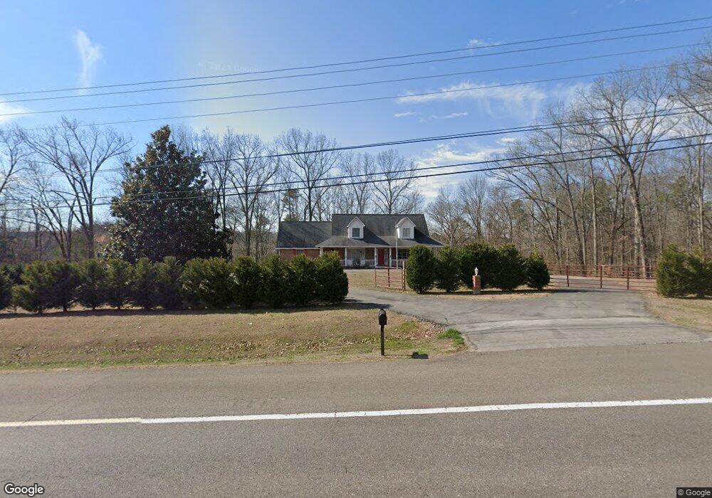
185 John J Duncan Pkwy Athens, TN 37303
Estimated Value: $314,000 - $455,000
3
Beds
2
Baths
2,080
Sq Ft
$190/Sq Ft
Est. Value
About This Home
This home is located at 185 John J Duncan Pkwy, Athens, TN 37303 and is currently estimated at $395,078, approximately $189 per square foot. 185 John J Duncan Pkwy is a home located in McMinn County with nearby schools including Ingleside Elementary School, City Park Elementary School, and North City Elementary School.
Ownership History
Date
Name
Owned For
Owner Type
Purchase Details
Closed on
Mar 11, 2016
Sold by
Gentry Sudie Mae
Bought by
Collins Michael A and Collins Rodelyn N
Current Estimated Value
Home Financials for this Owner
Home Financials are based on the most recent Mortgage that was taken out on this home.
Original Mortgage
$166,730
Outstanding Balance
$131,605
Interest Rate
3.65%
Mortgage Type
VA
Estimated Equity
$263,473
Purchase Details
Closed on
Sep 4, 1992
Bought by
Gentry Ottis J and Gentry Sadie M
Purchase Details
Closed on
Sep 20, 1990
Bought by
Gentry Ottis J
Purchase Details
Closed on
Nov 18, 1989
Bought by
Gentry Ottis J and Gentry Sadie M
Create a Home Valuation Report for This Property
The Home Valuation Report is an in-depth analysis detailing your home's value as well as a comparison with similar homes in the area
Home Values in the Area
Average Home Value in this Area
Purchase History
| Date | Buyer | Sale Price | Title Company |
|---|---|---|---|
| Collins Michael A | $168,480 | -- | |
| Gentry Ottis J | -- | -- | |
| Gentry Ottis J | -- | -- | |
| Gentry Ottis J | $65,000 | -- |
Source: Public Records
Mortgage History
| Date | Status | Borrower | Loan Amount |
|---|---|---|---|
| Open | Collins Michael A | $166,730 |
Source: Public Records
Tax History Compared to Growth
Tax History
| Year | Tax Paid | Tax Assessment Tax Assessment Total Assessment is a certain percentage of the fair market value that is determined by local assessors to be the total taxable value of land and additions on the property. | Land | Improvement |
|---|---|---|---|---|
| 2025 | $1,809 | $86,550 | $0 | $0 |
| 2024 | $1,809 | $86,550 | $11,600 | $74,950 |
| 2023 | $1,809 | $86,550 | $11,600 | $74,950 |
| 2022 | $1,583 | $54,700 | $7,325 | $47,375 |
| 2021 | $1,583 | $54,700 | $7,325 | $47,375 |
| 2020 | $1,539 | $54,700 | $7,325 | $47,375 |
| 2019 | $1,539 | $54,700 | $7,325 | $47,375 |
| 2018 | $1,539 | $54,700 | $7,325 | $47,375 |
| 2017 | $1,390 | $46,650 | $6,450 | $40,200 |
| 2016 | $1,390 | $46,650 | $6,450 | $40,200 |
| 2015 | -- | $46,650 | $6,450 | $40,200 |
| 2014 | $1,282 | $46,645 | $0 | $0 |
Source: Public Records
Map
Nearby Homes
- Lot 8 Willow Trace
- Lot 7 Willow Trace
- 2042 Willow Springs Dr
- 430 Willow Springs Dr
- 303 Kathy St
- 2412 Breckenridge St
- 1111 Skyridge Dr
- 2412 Colonial Dr
- 816 Ivory Rd
- 2431 Breckenridge St
- 2512 Clearwater Rd
- 111 Belle Way
- 000 Stephanie Ln
- 3046 Hawthorne St Unit 3046
- 3054 Hawthorne St Unit 3054
- 201 County Road 260
- 000 County Road 197
- 306 Warren St
- 1430 Hammerhill Rd
- 1106 Tellico Ave E
- 185 John J Duncan Pkwy Unit Highway 305 (Inglesi
- 185 John J Duncan Pkwy
- 215 John J Duncan Pkwy
- 215 Highway 305
- 105 Co Rd 243
- 211 John J Duncan Pkwy
- 194 John J Duncan Pkwy
- 210 Highway 305
- 210 John J Duncan Pkwy
- 246 Highway 305
- 246 John J Duncan Pkwy
- 264 County Road 252
- 184 John J Duncan Pkwy
- 302 County Road 252
- 325 Highway 305
- 239 County Road 252
- 2050 Willow Springs Dr
- 108 County Road 243
- 301 County Road 252
- 108 Hunters Branch Rd