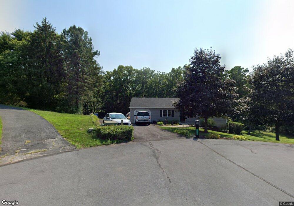
185 Kensington Dr Unit 29 Littlestown, PA 17340
Estimated Value: $266,000 - $294,000
3
Beds
1
Bath
1,092
Sq Ft
$257/Sq Ft
Est. Value
About This Home
This home is located at 185 Kensington Dr Unit 29, Littlestown, PA 17340 and is currently estimated at $280,102, approximately $256 per square foot. 185 Kensington Dr Unit 29 is a home located in Adams County with nearby schools including Rolling Acres El School, Maple Avenue Middle School, and Littlestown Senior High School.
Ownership History
Date
Name
Owned For
Owner Type
Purchase Details
Closed on
Jul 29, 1994
Bought by
Purnell Michael A and Purnell Janis B
Current Estimated Value
Create a Home Valuation Report for This Property
The Home Valuation Report is an in-depth analysis detailing your home's value as well as a comparison with similar homes in the area
Home Values in the Area
Average Home Value in this Area
Purchase History
| Date | Buyer | Sale Price | Title Company |
|---|---|---|---|
| Purnell Michael A | $105,900 | -- |
Source: Public Records
Tax History Compared to Growth
Tax History
| Year | Tax Paid | Tax Assessment Tax Assessment Total Assessment is a certain percentage of the fair market value that is determined by local assessors to be the total taxable value of land and additions on the property. | Land | Improvement |
|---|---|---|---|---|
| 2025 | $3,371 | $178,100 | $52,700 | $125,400 |
| 2024 | $3,240 | $178,100 | $52,700 | $125,400 |
| 2023 | $3,159 | $178,100 | $52,700 | $125,400 |
| 2022 | $3,136 | $178,100 | $52,700 | $125,400 |
| 2021 | $3,024 | $178,100 | $52,700 | $125,400 |
| 2020 | $2,980 | $178,100 | $52,700 | $125,400 |
| 2019 | $2,917 | $178,100 | $52,700 | $125,400 |
| 2018 | $2,830 | $178,100 | $52,700 | $125,400 |
| 2017 | $2,741 | $178,100 | $52,700 | $125,400 |
| 2016 | -- | $178,100 | $52,700 | $125,400 |
| 2015 | -- | $178,100 | $52,700 | $125,400 |
| 2014 | -- | $178,100 | $52,700 | $125,400 |
Source: Public Records
Map
Nearby Homes
- 161 Stoners Cir
- 58 Windsor Ct
- 48 Windsor Ct
- 52 Stayman Way Unit 81
- 58 N Gala Unit 397
- 135 Apple Grove Ln Unit 438
- 440 N Queen St
- 20 Locust Dr
- 140 Apple Grove Ln Unit 425
- 20c Locust Dr
- 0 Locust Dr Unit PAAD2015910
- 22 Rita Marie Ave
- 1024 Frederick Pike Unit 6
- 129 W King St
- 162 Newark St
- 117 Charles St
- 115 Charles St
- 61 E King St
- 15 Yorktowne Ct Unit 97
- 211 E King St
- 197 Kensington Dr
- 175 Kensington Dr Unit 30
- 178 Kensington Dr Unit 28
- 157 Kensington Dr
- 162 Kensington Dr Unit 27
- 620 Saint Johns Rd
- 147 Stoners Cir
- 145 Stoners Cir Unit 21A
- 143 Stoners Cir
- 141 Stoners Cir
- 149 Stoners Cir
- 139 Stoners Cir
- 137 Stoners Cir
- 153 Stoners Cir
- 135 Stoners Cir
- 33 Digges Ct
- 133 Stoners Cir
- 156 Stoners Cir Unit 24A
- 155 Stoners Cir
- 31 Digges Ct