Estimated Value: $172,489 - $234,000
3
Beds
2
Baths
1,820
Sq Ft
$111/Sq Ft
Est. Value
About This Home
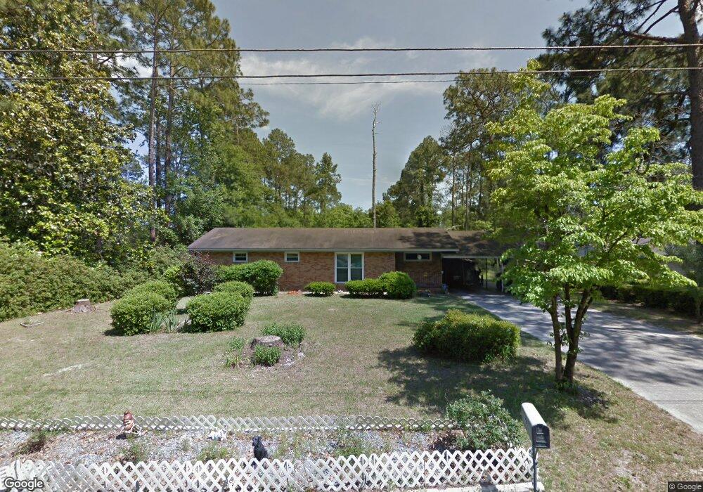
This home is located at 185 S 9th St, Jesup, GA 31545 and is currently estimated at $202,372, approximately $111 per square foot. 185 S 9th St is a home located in Wayne County with nearby schools including Bacon Elementary School, Martha Puckett Middle School, and Wayne County High School.
Ownership History
Date
Name
Owned For
Owner Type
Purchase Details
Closed on
Jun 15, 2007
Sold by
Stevens Willa H
Bought by
Spangler Eugene and Ross Wilma R
Current Estimated Value
Home Financials for this Owner
Home Financials are based on the most recent Mortgage that was taken out on this home.
Original Mortgage
$92,000
Outstanding Balance
$56,203
Interest Rate
6.16%
Mortgage Type
New Conventional
Estimated Equity
$146,169
Purchase Details
Closed on
Aug 1, 1958
Bought by
Stevens Willa H
Create a Home Valuation Report for This Property
The Home Valuation Report is an in-depth analysis detailing your home's value as well as a comparison with similar homes in the area
Home Values in the Area
Average Home Value in this Area
Purchase History
| Date | Buyer | Sale Price | Title Company |
|---|---|---|---|
| Spangler Eugene | $92,000 | -- | |
| Stevens Willa H | -- | -- |
Source: Public Records
Mortgage History
| Date | Status | Borrower | Loan Amount |
|---|---|---|---|
| Open | Spangler Eugene | $92,000 |
Source: Public Records
Tax History Compared to Growth
Tax History
| Year | Tax Paid | Tax Assessment Tax Assessment Total Assessment is a certain percentage of the fair market value that is determined by local assessors to be the total taxable value of land and additions on the property. | Land | Improvement |
|---|---|---|---|---|
| 2024 | $1,502 | $49,101 | $2,610 | $46,491 |
| 2023 | $1,353 | $38,238 | $2,594 | $35,644 |
| 2022 | $1,204 | $38,238 | $2,594 | $35,644 |
| 2021 | $1,289 | $38,238 | $2,594 | $35,644 |
| 2020 | $1,160 | $38,238 | $2,594 | $35,644 |
| 2019 | $1,194 | $38,238 | $2,594 | $35,644 |
| 2018 | $1,194 | $38,238 | $2,594 | $35,644 |
| 2017 | $1,028 | $38,238 | $2,594 | $35,644 |
| 2016 | $995 | $38,238 | $2,594 | $35,644 |
| 2014 | $997 | $38,238 | $2,594 | $35,644 |
| 2013 | -- | $38,238 | $2,594 | $35,644 |
Source: Public Records
Map
Nearby Homes