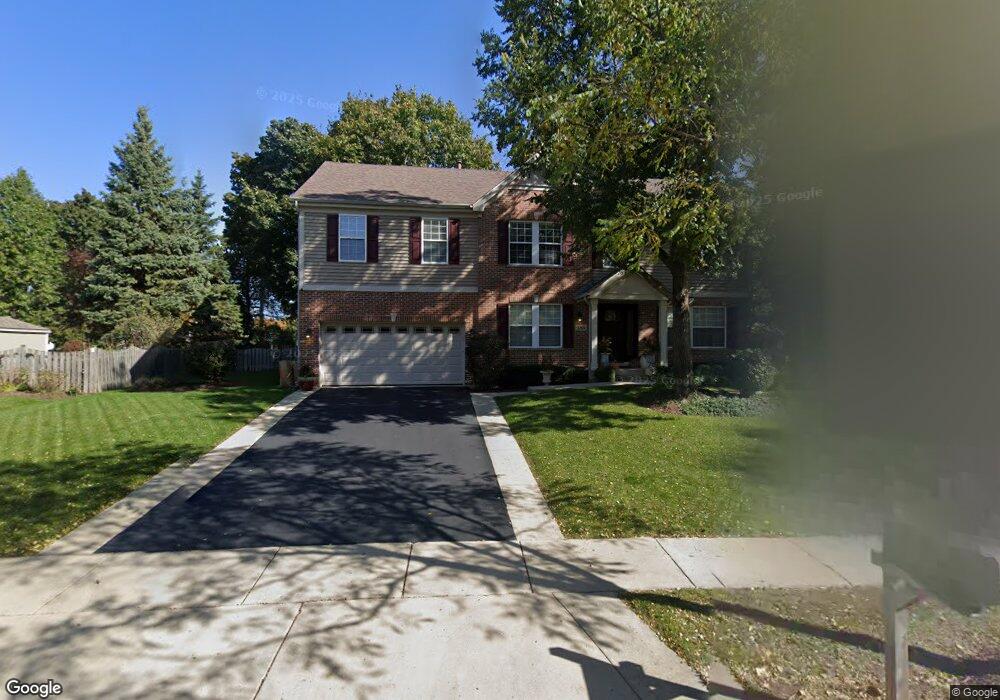
185 S Oakleaf Rd Algonquin, IL 60102
Estimated Value: $447,573 - $555,000
4
Beds
3
Baths
3,190
Sq Ft
$158/Sq Ft
Est. Value
About This Home
This home is located at 185 S Oakleaf Rd, Algonquin, IL 60102 and is currently estimated at $503,643, approximately $157 per square foot. 185 S Oakleaf Rd is a home located in McHenry County with nearby schools including Westfield Community School, Lincoln Prairie Elementary School, and Harry D Jacobs High School.
Ownership History
Date
Name
Owned For
Owner Type
Purchase Details
Closed on
May 24, 2024
Sold by
Demaira Michael J and Demaira Deborah A
Bought by
Michael J Demaira And Deborah A Demaira Trust and Demaira
Current Estimated Value
Purchase Details
Closed on
Aug 10, 2005
Sold by
Jablonski Scott P and Jablonski Kimberly S
Bought by
Demaira Michael J and Demaira Deborah A
Home Financials for this Owner
Home Financials are based on the most recent Mortgage that was taken out on this home.
Original Mortgage
$322,000
Interest Rate
5.66%
Mortgage Type
Fannie Mae Freddie Mac
Purchase Details
Closed on
Feb 10, 1998
Sold by
Kennedy Group Ltd Partnership
Bought by
Jablonski Scott P and Jablonski Kimberly S
Home Financials for this Owner
Home Financials are based on the most recent Mortgage that was taken out on this home.
Original Mortgage
$200,000
Interest Rate
6.99%
Create a Home Valuation Report for This Property
The Home Valuation Report is an in-depth analysis detailing your home's value as well as a comparison with similar homes in the area
Purchase History
We collect this data history from publicly available records. To have your information removed, we recommend requesting removal directly through your county’s website.
| Date | Buyer | Sale Price | Title Company |
|---|---|---|---|
| Michael J Demaira And Deborah A Demaira Trust | -- | None Listed On Document | |
| Demaira Michael J | $410,000 | Ticor Title Insurance Compan | |
| Jablonski Scott P | $248,500 | First American Title |
Source: Public Records
Mortgage History
We collect this data history from publicly available records. To have your information removed, we recommend requesting removal directly through your county’s website.
| Date | Status | Borrower | Loan Amount |
|---|---|---|---|
| Previous Owner | Demaira Michael J | $322,000 | |
| Previous Owner | Jablonski Scott P | $200,000 |
Source: Public Records
Tax History
| Year | Tax Paid | Tax Assessment Tax Assessment Total Assessment is a certain percentage of the fair market value that is determined by local assessors to be the total taxable value of land and additions on the property. | Land | Improvement |
|---|---|---|---|---|
| 2024 | $10,214 | $138,566 | $28,694 | $109,872 |
| 2023 | $9,705 | $123,930 | $25,663 | $98,267 |
| 2022 | $10,459 | $127,959 | $28,636 | $99,323 |
| 2021 | $10,045 | $119,209 | $26,678 | $92,531 |
| 2020 | $9,786 | $114,989 | $25,734 | $89,255 |
| 2019 | $10,336 | $118,564 | $24,631 | $93,933 |
| 2018 | $10,534 | $116,519 | $24,206 | $92,313 |
| 2017 | $10,333 | $109,769 | $22,804 | $86,965 |
| 2016 | $10,195 | $102,953 | $21,388 | $81,565 |
| 2013 | -- | $86,895 | $19,952 | $66,943 |
Source: Public Records
Map
Nearby Homes
- 295 Winchester Dr
- 1600 Huntington Dr N
- 113 Pheasant Trail
- 275 Farmhill Dr
- 101 Oakleaf Rd
- 621 Kirkland Dr
- 1 Grandview Ct Unit 8
- 1431 Essex St
- 1410 Essex St
- 100 Village Creek Dr Unit 17A
- 106 Village Creek Dr Unit 17D
- LOT 3 Blackhawk Dr
- 425 Somerset Ct
- 731 Roaring Brook Ln
- 750 Majestic Dr
- 761 Majestic Dr
- 234 Indian Trail
- 602 Delaware Dr Unit 10
- 909 Roger St
- 2704 Bay View Cir
- 195 S Oakleaf Rd
- 175 S Oakleaf Rd
- 170 Lake Dr S
- 160 Lake Dr S
- 180 Lake Dr S
- 160 S Oakleaf Rd
- 205 S Oakleaf Rd
- 165 S Oakleaf Rd
- 150 Lake Dr S
- 190 Lake Dr S
- 170 S Oakleaf Rd
- 150 S Oakleaf Rd
- 140 Lake Dr S
- 215 S Oakleaf Rd
- 165 Lake Dr S
- 175 Lake Dr S
- 155 S Oakleaf Rd
- 5 Portsmith Ct
- 180 S Oakleaf Rd
- 155 Lake Dr S
Your Personal Tour Guide
Ask me questions while you tour the home.