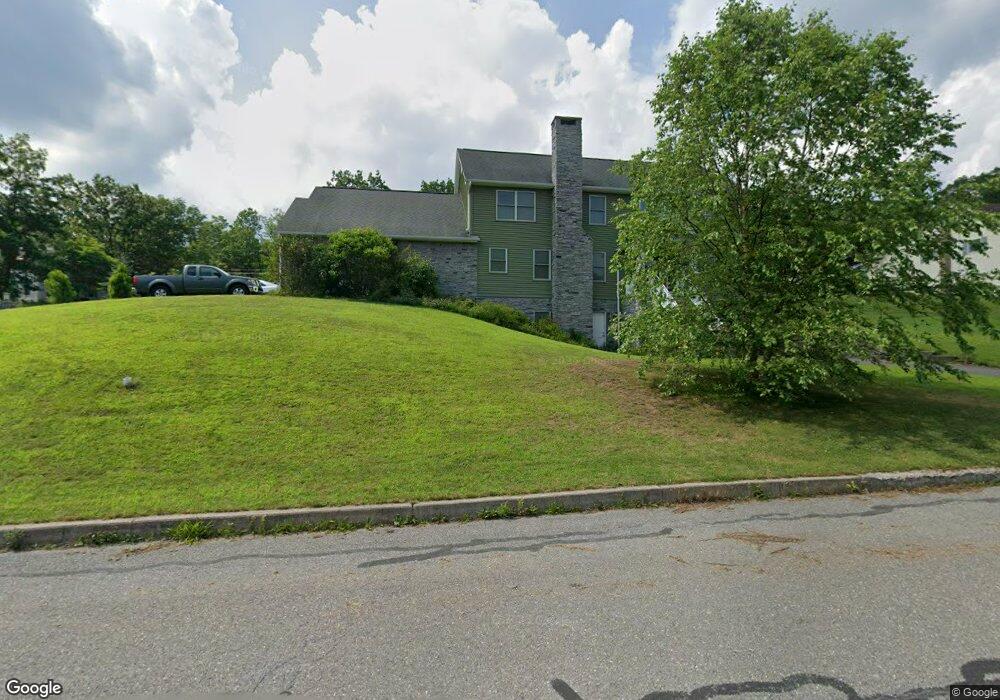
185 W Diaz Ave Nesquehoning, PA 18240
Estimated Value: $295,000 - $608,002
3
Beds
5
Baths
3,330
Sq Ft
$127/Sq Ft
Est. Value
About This Home
This home is located at 185 W Diaz Ave, Nesquehoning, PA 18240 and is currently estimated at $424,251, approximately $127 per square foot. 185 W Diaz Ave is a home with nearby schools including Panther Valley Elementary School, Panther Valley Intermediate School, and Panther Valley Junior/Senior High School.
Ownership History
Date
Name
Owned For
Owner Type
Purchase Details
Closed on
Sep 29, 2025
Sold by
Hawk David A and Hawk Melissa E
Bought by
Hawk David A and Hawk Melissa E
Current Estimated Value
Purchase Details
Closed on
May 25, 2021
Sold by
Hawk David A and Hawk Melissa E
Bought by
Hawk Dadvid A and Hawk Melissa E
Home Financials for this Owner
Home Financials are based on the most recent Mortgage that was taken out on this home.
Original Mortgage
$356,000
Interest Rate
2.9%
Mortgage Type
Commercial
Create a Home Valuation Report for This Property
The Home Valuation Report is an in-depth analysis detailing your home's value as well as a comparison with similar homes in the area
Home Values in the Area
Average Home Value in this Area
Purchase History
| Date | Buyer | Sale Price | Title Company |
|---|---|---|---|
| Hawk David A | -- | None Listed On Document | |
| Hawk Dadvid A | -- | Bankers Settlement |
Source: Public Records
Mortgage History
| Date | Status | Borrower | Loan Amount |
|---|---|---|---|
| Previous Owner | Hawk Dadvid A | $356,000 |
Source: Public Records
Tax History Compared to Growth
Tax History
| Year | Tax Paid | Tax Assessment Tax Assessment Total Assessment is a certain percentage of the fair market value that is determined by local assessors to be the total taxable value of land and additions on the property. | Land | Improvement |
|---|---|---|---|---|
| 2025 | $14,509 | $153,550 | $14,650 | $138,900 |
| 2024 | $15,102 | $153,550 | $14,650 | $138,900 |
| 2023 | $14,796 | $153,550 | $14,650 | $138,900 |
| 2022 | $14,893 | $153,550 | $14,650 | $138,900 |
| 2021 | $14,893 | $153,550 | $14,650 | $138,900 |
| 2020 | $14,662 | $153,550 | $14,650 | $138,900 |
| 2019 | $13,818 | $153,550 | $14,650 | $138,900 |
| 2018 | $13,664 | $153,550 | $14,650 | $138,900 |
| 2017 | $13,664 | $153,550 | $14,650 | $138,900 |
| 2016 | -- | $153,550 | $14,650 | $138,900 |
| 2015 | -- | $153,550 | $14,650 | $138,900 |
| 2014 | -- | $153,550 | $14,650 | $138,900 |
Source: Public Records
Map
Nearby Homes
- 58 W Columbus Ave
- 24 W Garibaldi Ave
- 61 Rhume St
- 34 Coal St
- 105 E Columbus Ave
- 134 W Railroad St Unit 136
- 2 W Catawissa St
- 117 E Garibaldi Ave
- 153 W High St
- 1 W High St
- 68 E Railroad St
- 0 11th Ave Unit PM-131093
- 419 E White Bear Dr
- 129 Lentz Trail
- 16 Andrewsville St
- 333 E Hazard St
- A591 Apple Lane & Stony Mountain
- 138 E Fell St
- 237 Stock St
- 421 E Patterson St
- 2 Little Flower Ave
- 2 Little Flower Ave
- 116 W Diaz Ave
- 114 W Diaz Ave
- 112 W Diaz Ave
- 10 Little Flower Ave
- 15 Little Flower Ave
- 11 Little Flower Ave
- 17 Little Flower Ave
- 1 Little Flower Ave
- 110 W Diaz Ave
- 19 Little Flower Ave
- 108 W Diaz Ave
- 21 Little Flower Ave
- 229 W Marconi Ave
- 235 W Marconi Ave Unit 237
- 106 W Diaz Ave
- 31 Little Flower Ave
- 175 W Diaz Ave
- 171 W Marconi Ave