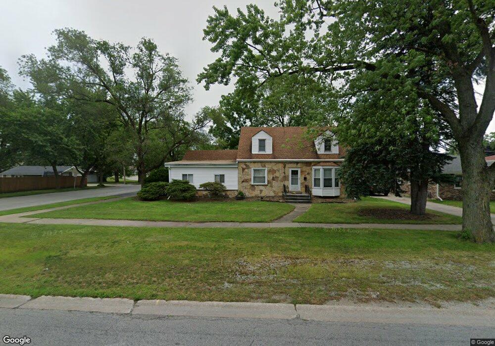
18503 Burnham Ave Lansing, IL 60438
Estimated Value: $216,000 - $244,000
4
Beds
3
Baths
1,475
Sq Ft
$155/Sq Ft
Est. Value
About This Home
This home is located at 18503 Burnham Ave, Lansing, IL 60438 and is currently estimated at $229,221, approximately $155 per square foot. 18503 Burnham Ave is a home located in Cook County with nearby schools including Coolidge Elementary School, Memorial Jr High School, and Thornton Fractnl So High School.
Ownership History
Date
Name
Owned For
Owner Type
Purchase Details
Closed on
Dec 22, 1998
Sold by
Janet Decavitch Thomas P and Janet Devavitch
Bought by
Medendorp Terri L
Current Estimated Value
Home Financials for this Owner
Home Financials are based on the most recent Mortgage that was taken out on this home.
Original Mortgage
$75,000
Interest Rate
6.79%
Mortgage Type
Purchase Money Mortgage
Create a Home Valuation Report for This Property
The Home Valuation Report is an in-depth analysis detailing your home's value as well as a comparison with similar homes in the area
Home Values in the Area
Average Home Value in this Area
Purchase History
| Date | Buyer | Sale Price | Title Company |
|---|---|---|---|
| Medendorp Terri L | -- | -- |
Source: Public Records
Mortgage History
| Date | Status | Borrower | Loan Amount |
|---|---|---|---|
| Closed | Medendorp Terri L | $75,000 |
Source: Public Records
Tax History
| Year | Tax Paid | Tax Assessment Tax Assessment Total Assessment is a certain percentage of the fair market value that is determined by local assessors to be the total taxable value of land and additions on the property. | Land | Improvement |
|---|---|---|---|---|
| 2025 | $1,716 | $4,211 | $1,719 | $2,492 |
| 2024 | $1,716 | $4,211 | $1,719 | $2,492 |
| 2023 | $1,357 | $4,488 | $1,719 | $2,769 |
| 2022 | $1,357 | $2,772 | $1,484 | $1,288 |
| 2021 | $1,331 | $2,772 | $1,484 | $1,288 |
| 2020 | $1,262 | $2,772 | $1,484 | $1,288 |
| 2019 | $1,570 | $3,443 | $1,250 | $2,193 |
| 2018 | $1,540 | $3,443 | $1,250 | $2,193 |
| 2017 | $1,562 | $3,443 | $1,250 | $2,193 |
| 2016 | $1,299 | $2,876 | $1,171 | $1,705 |
| 2015 | $1,195 | $2,876 | $1,171 | $1,705 |
| 2014 | $1,184 | $2,876 | $1,171 | $1,705 |
| 2013 | $1,297 | $3,407 | $1,171 | $2,236 |
Source: Public Records
Map
Nearby Homes
- 3250 186th St
- 3310 186th St
- 18315 Burnham Ave Unit 204
- 3316 Ann St
- 3225 Otto St
- 3359 Ann St
- 18263 Greenbay Ave
- 18275 Ada St
- 18309 Grant St
- 18514 Ridgewood Ave
- 18644 William St
- 18747 Sherman St
- 18634 Bernadine St
- 18655 Oakwood Ave
- 18241 Ridgewood Ave
- 18504 Wentworth Ave
- 18855 Burnham Ave Unit 234
- 18864 Greenbay Ave
- 2918 188th Place
- 18405 Wentworth Ave Unit 1D
- 18503 Burnham Ave
- 18503 Burnham Ave
- 18511 Burnham Ave
- 18515 Burnham Ave
- 18515 Burnham Ave
- 18510 Walter St
- 18519 Burnham Ave
- 18441 Burnham Ave
- 18441 Burnham Ave
- 18441 Burnham Ave
- 18514 Walter St
- 18433 Burnham Ave
- 18433 Burnham Ave
- 18434 Walter St
- 18518 Walter St
- 3222 S Schultz Dr
- 18525 Burnham Ave
- 18525 Burnham Ave
- 18525 Burnham Ave
- 18522 Walter St
Your Personal Tour Guide
Ask me questions while you tour the home.