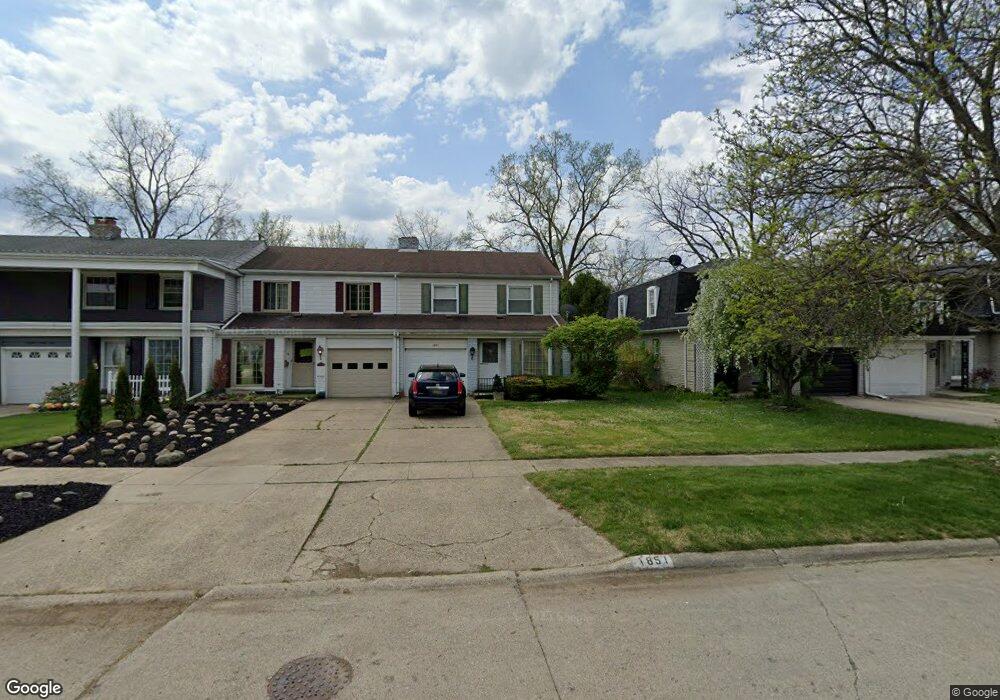
1851 Laurel Oak Dr Flint, MI 48507
Westgate NeighborhoodEstimated Value: $94,014 - $126,000
3
Beds
2
Baths
1,741
Sq Ft
$63/Sq Ft
Est. Value
About This Home
This home is located at 1851 Laurel Oak Dr, Flint, MI 48507 and is currently estimated at $110,254, approximately $63 per square foot. 1851 Laurel Oak Dr is a home located in Genesee County with nearby schools including Neithercut Elementary School, Flint Southwestern Classical Academy, and International Academy of Flint (K-12).
Ownership History
Date
Name
Owned For
Owner Type
Purchase Details
Closed on
Apr 19, 2023
Sold by
Fair Virginia B
Bought by
Moreau Property Group Llc
Current Estimated Value
Purchase Details
Closed on
Apr 14, 2023
Sold by
Fair Vicki L
Bought by
Fair Virginia B and Fair Thomas W
Purchase Details
Closed on
Jan 1, 2004
Sold by
Gloeden Vicki L
Bought by
Fair Thomas W and Fair Virginia B
Home Financials for this Owner
Home Financials are based on the most recent Mortgage that was taken out on this home.
Original Mortgage
$85,000
Interest Rate
6.25%
Mortgage Type
Seller Take Back
Purchase Details
Closed on
Oct 19, 2001
Sold by
Carlsn Michael D
Bought by
Carlson Vicki L and Fair Vicki L
Purchase Details
Closed on
Jul 19, 2000
Sold by
Corrado Leona N
Bought by
Carlson Michael D and Fair Vicki L
Create a Home Valuation Report for This Property
The Home Valuation Report is an in-depth analysis detailing your home's value as well as a comparison with similar homes in the area
Home Values in the Area
Average Home Value in this Area
Purchase History
| Date | Buyer | Sale Price | Title Company |
|---|---|---|---|
| Moreau Property Group Llc | -- | Liberty Title | |
| Fair Virginia B | -- | Liberty Title | |
| Fair Thomas W | $108,000 | First American Title Ins Co | |
| Carlson Vicki L | -- | -- | |
| Carlson Michael D | $72,000 | Guaranty Title Company |
Source: Public Records
Mortgage History
| Date | Status | Borrower | Loan Amount |
|---|---|---|---|
| Previous Owner | Fair Thomas W | $85,000 |
Source: Public Records
Tax History
| Year | Tax Paid | Tax Assessment Tax Assessment Total Assessment is a certain percentage of the fair market value that is determined by local assessors to be the total taxable value of land and additions on the property. | Land | Improvement |
|---|---|---|---|---|
| 2025 | $3,482 | $35,000 | $0 | $0 |
| 2024 | $3,173 | $45,000 | $0 | $0 |
| 2023 | $1,323 | $38,400 | $0 | $0 |
| 2022 | $0 | $29,400 | $0 | $0 |
| 2021 | $1,345 | $23,900 | $0 | $0 |
| 2020 | $1,229 | $21,600 | $0 | $0 |
| 2019 | $1,196 | $14,400 | $0 | $0 |
| 2018 | $1,247 | $14,700 | $0 | $0 |
| 2017 | $1,282 | $0 | $0 | $0 |
| 2016 | $1,414 | $0 | $0 | $0 |
| 2015 | -- | $0 | $0 | $0 |
| 2014 | -- | $0 | $0 | $0 |
| 2012 | -- | $22,200 | $0 | $0 |
Source: Public Records
Map
Nearby Homes
- 1845 Laurel Oak Dr
- 1939 Laurel Oak Dr
- 1902 Rockcreek Ln
- 1933 Greenbriar Ln
- Lot 57 Walnut Creek Dr
- 4202 Park Forest Dr
- 4101 Greenbrook Ln
- 1446 Stephens Ave
- 1814 Penbrook Ln
- 4502 Huckleberry Ln
- 4302 Huckleberry Ln
- 3312 Renault Dr
- 1826 Greenbrook Ln
- 1627 Blackberry Ln
- 1836 Willowbrook Cir
- 1247 Catalina Dr
- 1741 Carmanbrook Pkwy
- 3485 Hammerberg Rd
- 1814 Carmanbrook Pkwy
- 1508 W Bristol Rd
- 1849 Laurel Oak Dr
- 1847 Laurel Oak Dr
- 1855 Laurel Oak Dr
- 1857 Laurel Oak Dr
- 1859 Laurel Oak Dr
- 1843 Laurel Oak Dr
- 1907 Laurel Oak Dr
- 1901 Laurel Oak Dr
- 1841 Laurel Oak Dr
- 1903 Laurel Oak Dr
- 1837 Laurel Oak Dr
- 1905 Laurel Oak Dr
- 1835 Laurel Oak Dr
- 1852 Laurel Oak Dr
- 1833 Laurel Oak Dr
- 1846 Laurel Oak Dr
- 1858 Laurel Oak Dr
- 1908 Laurel Oak Dr
- 1831 Laurel Oak Dr
- 1909 Laurel Oak Dr
Your Personal Tour Guide
Ask me questions while you tour the home.