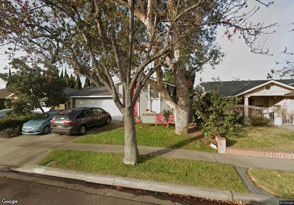
18515 Kamstra Ave Cerritos, CA 90703
Estimated Value: $1,021,206 - $1,225,000
3
Beds
2
Baths
1,474
Sq Ft
$771/Sq Ft
Est. Value
About This Home
This home is located at 18515 Kamstra Ave, Cerritos, CA 90703 and is currently estimated at $1,135,802, approximately $770 per square foot. 18515 Kamstra Ave is a home located in Los Angeles County with nearby schools including Frank C. Leal Elementary School, Tetzlaff (Martin B.) Middle School, and Cerritos High School.
Ownership History
Date
Name
Owned For
Owner Type
Purchase Details
Closed on
Nov 10, 2016
Sold by
Rodriguez Jorge
Bought by
Rodriguez Jorge and Rodriguez Silvia T
Current Estimated Value
Home Financials for this Owner
Home Financials are based on the most recent Mortgage that was taken out on this home.
Original Mortgage
$417,000
Interest Rate
3.54%
Mortgage Type
New Conventional
Purchase Details
Closed on
Apr 19, 2014
Sold by
Rodriguez Jorge
Bought by
The Jorge Rodriguez & Silvia T Rodriguez
Create a Home Valuation Report for This Property
The Home Valuation Report is an in-depth analysis detailing your home's value as well as a comparison with similar homes in the area
Home Values in the Area
Average Home Value in this Area
Purchase History
| Date | Buyer | Sale Price | Title Company |
|---|---|---|---|
| Rodriguez Jorge | -- | Stewart Title Company | |
| Rodriguez Jorge | -- | Stewart Title Company | |
| The Jorge Rodriguez & Silvia T Rodriguez | -- | None Available |
Source: Public Records
Mortgage History
| Date | Status | Borrower | Loan Amount |
|---|---|---|---|
| Closed | Rodriguez Jorge | $417,000 |
Source: Public Records
Tax History Compared to Growth
Tax History
| Year | Tax Paid | Tax Assessment Tax Assessment Total Assessment is a certain percentage of the fair market value that is determined by local assessors to be the total taxable value of land and additions on the property. | Land | Improvement |
|---|---|---|---|---|
| 2025 | $1,664 | $105,695 | $31,212 | $74,483 |
| 2024 | $1,664 | $103,623 | $30,600 | $73,023 |
| 2023 | $1,620 | $101,592 | $30,000 | $71,592 |
| 2022 | $1,593 | $99,601 | $29,412 | $70,189 |
| 2021 | $1,553 | $97,649 | $28,836 | $68,813 |
| 2019 | $1,519 | $94,755 | $27,982 | $66,773 |
| 2018 | $1,383 | $92,898 | $27,434 | $65,464 |
| 2016 | $1,312 | $89,293 | $26,370 | $62,923 |
| 2015 | $1,296 | $87,952 | $25,974 | $61,978 |
| 2014 | $1,282 | $86,230 | $25,466 | $60,764 |
Source: Public Records
Map
Nearby Homes
- 13044 Hedda Ln
- 18006 Point Conception Place
- 19008 Jeffrey Ave
- 13210 Sutton St
- 12360 Hedda Dr
- 12711 Castleford Ln
- 19335 Derbyshire Ln
- 13010 Artesia Blvd
- 12525 Semora St
- 0 Parcel: 7016-014-017 Ave Unit PW25183248
- 12361 Caravel Place
- 19118 Martha Ave
- 18517 Betty Way
- 12684 Palm St
- 12967 Moorshire Dr
- 12251 Carver Ln
- 18430 Horst Ave
- 19657 Sequoia Ave
- 18035 Horst Ave
- 17721 Norwalk Blvd Unit 47
- 18521 Kamstra Ave
- 18511 Kamstra Ave
- 18525 Kamstra Ave
- 18505 Kamstra Ave
- 12854 Arabella St
- 12843 Heritage Place
- 12845 Heritage Place
- 18603 Kamstra Ave
- 12850 Arabella St
- 18512 Kamstra Ave
- 18516 Kamstra Ave
- 18506 Kamstra Ave
- 18522 Kamstra Ave
- 12837 Heritage Place
- 18502 Kamstra Ave
- 18607 Kamstra Ave
- 18600 Kamstra Ave
- 12844 Arabella St
- 12842 Heritage Place
- 18421 Kamstra Ave