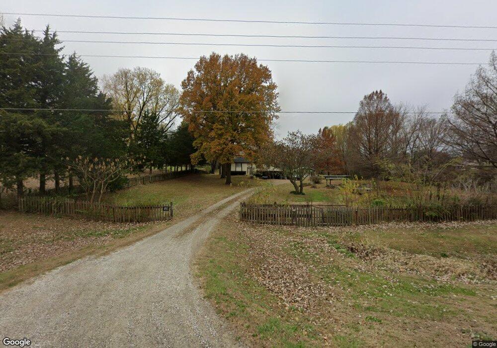
18527 206th St Tonganoxie, KS 66086
Estimated Value: $334,000 - $370,352
3
Beds
2
Baths
1,428
Sq Ft
$247/Sq Ft
Est. Value
About This Home
This home is located at 18527 206th St, Tonganoxie, KS 66086 and is currently estimated at $353,088, approximately $247 per square foot. 18527 206th St is a home located in Leavenworth County with nearby schools including Tonganoxie Elementary School, Tonganoxie Middle School, and Tonganoxie High School.
Ownership History
Date
Name
Owned For
Owner Type
Purchase Details
Closed on
Mar 30, 2023
Sold by
Wagner Laurence E
Bought by
Moreno Michael and Moreno Valerie
Current Estimated Value
Home Financials for this Owner
Home Financials are based on the most recent Mortgage that was taken out on this home.
Original Mortgage
$215,000
Outstanding Balance
$208,914
Interest Rate
6.5%
Mortgage Type
New Conventional
Estimated Equity
$144,174
Create a Home Valuation Report for This Property
The Home Valuation Report is an in-depth analysis detailing your home's value as well as a comparison with similar homes in the area
Home Values in the Area
Average Home Value in this Area
Purchase History
| Date | Buyer | Sale Price | Title Company |
|---|---|---|---|
| Moreno Michael | -- | Security 1St Title |
Source: Public Records
Mortgage History
| Date | Status | Borrower | Loan Amount |
|---|---|---|---|
| Open | Moreno Michael | $215,000 |
Source: Public Records
Tax History Compared to Growth
Tax History
| Year | Tax Paid | Tax Assessment Tax Assessment Total Assessment is a certain percentage of the fair market value that is determined by local assessors to be the total taxable value of land and additions on the property. | Land | Improvement |
|---|---|---|---|---|
| 2025 | $4,107 | $36,889 | $10,109 | $26,780 |
| 2024 | $3,997 | $36,888 | $9,094 | $27,794 |
| 2023 | $3,997 | $35,815 | $8,953 | $26,862 |
| 2022 | $3,663 | $32,051 | $7,167 | $24,884 |
| 2021 | $3,341 | $28,739 | $6,592 | $22,147 |
| 2020 | $3,101 | $26,588 | $6,257 | $20,331 |
| 2019 | $2,919 | $25,472 | $6,257 | $19,215 |
| 2018 | $2,626 | $22,939 | $5,107 | $17,832 |
| 2017 | $2,441 | $21,183 | $4,647 | $16,536 |
| 2016 | $2,289 | $19,834 | $4,384 | $15,450 |
| 2015 | $2,185 | $19,017 | $4,384 | $14,633 |
| 2014 | $2,076 | $18,462 | $4,384 | $14,078 |
Source: Public Records
Map
Nearby Homes
- RC Greenfield Plan at Stone Creek
- RC Keswick Plan at Stone Creek
- RC Mitchell Plan at Stone Creek
- RC Baltimore Plan at Stone Creek
- RC Cooper Plan at Stone Creek
- RC Armstrong Plan at Stone Creek
- RC Bridgeport Plan at Stone Creek
- RC Beaumont Plan at Stone Creek
- RC Pickett Plan at Stone Creek
- RC Somerville Plan at Stone Creek
- RC Cypress II Plan at Stone Creek
- 2134 Woodfield Dr
- 1950 Jackson Dr
- 1940 E Finch Dr
- 2102 Brook Ridge Cir
- 2133 Brook Ridge Cir
- 290 Rawlings Dr
- 1870 Fall Creek Dr
- 2470 Woodfield Dr
- 440 Rock Creek Dr
- 18501 206th St
- 18561 206th St
- 18477 206th St
- 18500 206th St
- 18600 206th St
- 18617 206th St
- 20626 West Dr
- 18591 206th St
- 18449 206th St
- 18629 206th St
- 20726 West Dr
- 20612 Sandusky Rd
- 18632 206th St
- 20749 West Dr
- 20748 Sandusky Rd
- 18416 206th St
- 20724 Sandusky Rd
- 18648 207th St
- 18675 206th St
- 18611 207th St