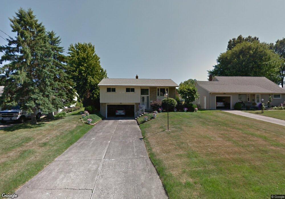
1853 Basil Ave Youngstown, OH 44514
Estimated Value: $174,000 - $202,000
3
Beds
2
Baths
1,904
Sq Ft
$97/Sq Ft
Est. Value
About This Home
This home is located at 1853 Basil Ave, Youngstown, OH 44514 and is currently estimated at $184,870, approximately $97 per square foot. 1853 Basil Ave is a home located in Mahoning County with nearby schools including Paul C. Bunn Elementary School, Chaney High School, and The Montessori School of the Mahoning Valley.
Ownership History
Date
Name
Owned For
Owner Type
Purchase Details
Closed on
Jun 29, 2017
Sold by
Peftrino Mario and Peftrino Elisena
Bought by
White Matthew A
Current Estimated Value
Home Financials for this Owner
Home Financials are based on the most recent Mortgage that was taken out on this home.
Original Mortgage
$96,715
Outstanding Balance
$79,487
Interest Rate
3.94%
Mortgage Type
FHA
Estimated Equity
$105,383
Purchase Details
Closed on
Sep 26, 1967
Bought by
Petrino Mario and Petrino Elisena
Create a Home Valuation Report for This Property
The Home Valuation Report is an in-depth analysis detailing your home's value as well as a comparison with similar homes in the area
Home Values in the Area
Average Home Value in this Area
Purchase History
| Date | Buyer | Sale Price | Title Company |
|---|---|---|---|
| White Matthew A | $98,500 | None Available | |
| Petrino Mario | -- | -- |
Source: Public Records
Mortgage History
| Date | Status | Borrower | Loan Amount |
|---|---|---|---|
| Open | White Matthew A | $96,715 |
Source: Public Records
Tax History
| Year | Tax Paid | Tax Assessment Tax Assessment Total Assessment is a certain percentage of the fair market value that is determined by local assessors to be the total taxable value of land and additions on the property. | Land | Improvement |
|---|---|---|---|---|
| 2025 | $2,264 | $45,630 | $5,590 | $40,040 |
| 2024 | $2,553 | $45,630 | $5,590 | $40,040 |
| 2023 | $2,536 | $45,630 | $5,590 | $40,040 |
| 2022 | $2,112 | $28,660 | $5,430 | $23,230 |
| 2021 | $2,112 | $28,660 | $5,430 | $23,230 |
| 2020 | $2,122 | $28,660 | $5,430 | $23,230 |
| 2019 | $2,086 | $24,700 | $4,680 | $20,020 |
| 2018 | $1,317 | $24,700 | $4,680 | $20,020 |
| 2017 | $1,297 | $24,700 | $4,680 | $20,020 |
| 2016 | $1,331 | $26,140 | $5,720 | $20,420 |
| 2015 | $1,307 | $26,140 | $5,720 | $20,420 |
| 2014 | $1,299 | $26,140 | $5,720 | $20,420 |
| 2013 | $1,283 | $26,140 | $5,720 | $20,420 |
Source: Public Records
Map
Nearby Homes
- 1870 Basil Ave
- 0 Woodlawn Ave
- 1750 Halbert Dr
- 1737 Halbert Dr
- 5425 Sheridan Rd
- 0 Lemoyne Ave
- 1933 Brandon Ave
- 0 Oles Ave
- 1926 Brandon Ave
- 5007 Sheridan Rd
- 1928 Palo Verde Dr
- 1913 Country Club Ave
- 1654 Thalia Ave
- 0 Mathews Rd Unit 5149232
- 0 Mathews Rd Unit 5143059
- 1514 Thalia Ave
- 5710 Youngstown Poland Rd
- 587 Edison St
- 1634 Meadowbrook Ave
- 611 W Wilson St
- 1859 Basil Ave
- 1847 Basil Ave
- 1841 Basil Ave
- 1865 Basil Ave
- 1860 Halbert Dr
- 1854 Halbert Dr
- 1868 Halbert Dr
- 5322 Linger Place
- 1835 Basil Ave
- 1871 Basil Ave
- 1846 Halbert Dr
- 1846 Basil Ave
- 5330 Linger Place
- 1852 Basil Ave
- 1840 Basil Ave
- 1858 Basil Ave
- 1838 Halbert Dr
- 1829 Basil Ave
- 5334 Linger Place
- 1834 Basil Ave
Your Personal Tour Guide
Ask me questions while you tour the home.