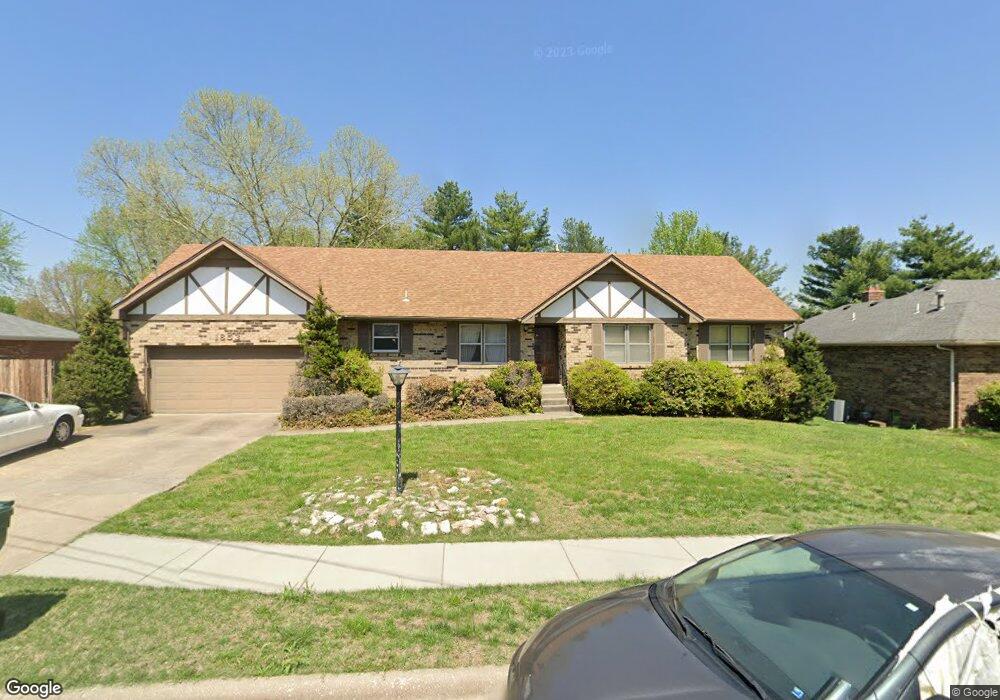
1853 E Wheatridge Dr Springfield, MO 65803
Estimated Value: $318,000 - $383,000
5
Beds
3
Baths
2,734
Sq Ft
$123/Sq Ft
Est. Value
About This Home
This home is located at 1853 E Wheatridge Dr, Springfield, MO 65803 and is currently estimated at $336,695, approximately $123 per square foot. 1853 E Wheatridge Dr is a home located in Greene County with nearby schools including Pleasant View K-8 School, Hillcrest High School, and Dayspring Christian School.
Ownership History
Date
Name
Owned For
Owner Type
Purchase Details
Closed on
Oct 23, 2020
Sold by
Bohanon Joseph T and Bohanon Margaret C
Bought by
Bohanon Joseph
Current Estimated Value
Home Financials for this Owner
Home Financials are based on the most recent Mortgage that was taken out on this home.
Original Mortgage
$144,000
Interest Rate
2.8%
Mortgage Type
New Conventional
Create a Home Valuation Report for This Property
The Home Valuation Report is an in-depth analysis detailing your home's value as well as a comparison with similar homes in the area
Purchase History
| Date | Buyer | Sale Price | Title Company |
|---|---|---|---|
| Bohanon Joseph | -- | None Available |
Source: Public Records
Mortgage History
| Date | Status | Borrower | Loan Amount |
|---|---|---|---|
| Closed | Bohanon Joseph | $144,000 |
Source: Public Records
Tax History
| Year | Tax Paid | Tax Assessment Tax Assessment Total Assessment is a certain percentage of the fair market value that is determined by local assessors to be the total taxable value of land and additions on the property. | Land | Improvement |
|---|---|---|---|---|
| 2025 | $1,972 | $36,460 | $8,320 | $28,140 |
| 2024 | $1,844 | $31,860 | $4,180 | $27,680 |
| 2023 | $1,835 | $31,860 | $4,180 | $27,680 |
| 2022 | $1,774 | $30,190 | $4,180 | $26,010 |
| 2021 | $1,697 | $30,190 | $4,180 | $26,010 |
| 2020 | $1,626 | $27,460 | $4,180 | $23,280 |
| 2019 | $1,580 | $27,460 | $4,180 | $23,280 |
| 2018 | $1,335 | $23,090 | $3,230 | $19,860 |
| 2017 | $1,323 | $23,090 | $3,230 | $19,860 |
| 2016 | $1,321 | $23,090 | $3,230 | $19,860 |
| 2015 | $1,311 | $23,090 | $3,230 | $19,860 |
| 2014 | $1,310 | $23,090 | $3,230 | $19,860 |
Source: Public Records
Map
Nearby Homes
- 3630 Snowmass Cir
- 3753 N Pickwick Ave
- 3749 N Pickwick Ave
- 3424 N Darwin Ave
- 2393 E Valley Water Mill Rd
- 1338 E Burntwood St
- 1917 E Smith St
- 1809 E Smith St
- 1270 E Ogorman Ct
- 3957 N Springlawn Ave
- 4541b N Lanier Ln
- 4541 N Lanier Ln
- 1310 E Bonaire Ct
- Tract C N Farm Road 173
- 3861 Slavens Ave
- 1502 E McClernon St
- 1339 E McClernon St
- 3156 N National Ave
- 3107 N Neergard Ave
- 748 E Bluff Dr
- 1901 E Wheatridge Dr
- 1849 E Wheatridge Dr
- 1854 E Burntwood St
- 1900 E Burntwood St
- 1904 E Burntwood St
- 1839 E Wheatridge Dr
- 1905 E Wheatridge Dr
- 1848 E Burntwood St
- 1854 E Wheatridge Dr
- 1850 E Wheatridge Dr
- 1840 E Burntwood St
- 1900 E Wheatridge Dr
- 1840 E Wheatridge Dr
- 1907 E Wheatridge Dr
- 1831 E Wheatridge Dr
- 1904 E Wheatridge Dr
- 1832 E Burntwood St
- 1832 E Wheatridge Dr
- 1857 E Burntwood St
- 3951 N Bannister Ave
Your Personal Tour Guide
Ask me questions while you tour the home.