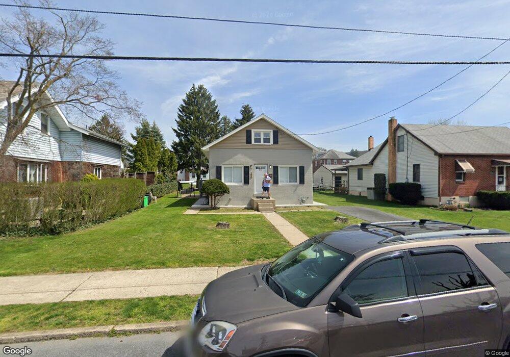
1853 S 2nd St Unit 1857 Allentown, PA 18103
Southside NeighborhoodEstimated Value: $212,000 - $271,500
4
Beds
1
Bath
1,170
Sq Ft
$210/Sq Ft
Est. Value
About This Home
This home is located at 1853 S 2nd St Unit 1857, Allentown, PA 18103 and is currently estimated at $246,125, approximately $210 per square foot. 1853 S 2nd St Unit 1857 is a home located in Lehigh County with nearby schools including Hiram W Dodd Elementary School, South Mountain Middle School, and Louis E. Dieruff High School.
Ownership History
Date
Name
Owned For
Owner Type
Purchase Details
Closed on
Jun 23, 2017
Sold by
Marushak Derek R
Bought by
Negron Joel E Luna and Espinell Laurimar Ortega
Current Estimated Value
Home Financials for this Owner
Home Financials are based on the most recent Mortgage that was taken out on this home.
Original Mortgage
$117,826
Outstanding Balance
$98,087
Interest Rate
4.05%
Mortgage Type
FHA
Estimated Equity
$148,038
Purchase Details
Closed on
Jun 29, 2011
Sold by
Marushak Jean
Bought by
Marushak Derek R
Home Financials for this Owner
Home Financials are based on the most recent Mortgage that was taken out on this home.
Original Mortgage
$57,680
Interest Rate
4.62%
Mortgage Type
New Conventional
Purchase Details
Closed on
Aug 2, 1979
Bought by
Marushak Jean
Create a Home Valuation Report for This Property
The Home Valuation Report is an in-depth analysis detailing your home's value as well as a comparison with similar homes in the area
Home Values in the Area
Average Home Value in this Area
Purchase History
| Date | Buyer | Sale Price | Title Company |
|---|---|---|---|
| Negron Joel E Luna | $120,000 | None Available | |
| Marushak Derek R | $72,100 | -- | |
| Marushak Jean | -- | -- |
Source: Public Records
Mortgage History
| Date | Status | Borrower | Loan Amount |
|---|---|---|---|
| Open | Negron Joel E Luna | $117,826 | |
| Previous Owner | Marushak Derek R | $57,680 |
Source: Public Records
Tax History Compared to Growth
Tax History
| Year | Tax Paid | Tax Assessment Tax Assessment Total Assessment is a certain percentage of the fair market value that is determined by local assessors to be the total taxable value of land and additions on the property. | Land | Improvement |
|---|---|---|---|---|
| 2025 | $3,900 | $111,100 | $24,600 | $86,500 |
| 2024 | $3,900 | $111,100 | $24,600 | $86,500 |
| 2023 | $3,900 | $111,100 | $24,600 | $86,500 |
| 2022 | $3,773 | $111,100 | $86,500 | $24,600 |
| 2021 | $3,704 | $111,100 | $24,600 | $86,500 |
| 2020 | $3,614 | $111,100 | $24,600 | $86,500 |
| 2019 | $3,560 | $111,100 | $24,600 | $86,500 |
| 2018 | $3,282 | $111,100 | $24,600 | $86,500 |
| 2017 | $2,651 | $91,700 | $20,700 | $71,000 |
| 2016 | -- | $91,700 | $20,700 | $71,000 |
| 2015 | -- | $91,700 | $20,700 | $71,000 |
| 2014 | -- | $91,700 | $20,700 | $71,000 |
Source: Public Records
Map
Nearby Homes
- 1852 S 2nd St
- 148 W Brookdale St
- 203 W Brookdale St
- 102 W Brookdale St
- 135 W Wabash St
- 1865 Chapel Ave
- 206 208 W Emaus Ave
- 1831 S Church St
- 2429 S Front St
- 2421 S Wood St
- 127 E Lynnwood St
- 121 Woodcrest Cir
- 2441 S 4th St
- 2347 S Law St Unit 2349
- 566 W Emaus Ave
- 566 588 W Emaus Ave
- 2416 S Alice St Unit 2418
- 320 E Paoli St
- 316 W Mountain Rd
- 2401 S Church St
- 1855 S 2nd St
- 1849 S 2nd St Unit 1851
- 1859 S 2nd St Unit 1861
- 1845 S 2nd St Unit 1847
- 1845 S 2nd St
- 1863 S 2nd St Unit 1867
- 1856 S Wood St Unit 1858
- 1852 S Wood St Unit 1854
- 1862 S Wood St
- 1869 S 2nd St Unit 1871
- 1864 S Wood St
- 1848 S Wood St Unit 1850
- 1866 S Wood St
- 1856 S 2nd St Unit 1858
- 1850 S 2nd St Unit 1854
- 1860 S 2nd St Unit 1866
- 1868 S Wood St
- 1873 S 2nd St Unit 1875
- 1844 S 2nd St Unit 1848
- 146 W Brookdale St Unit 148