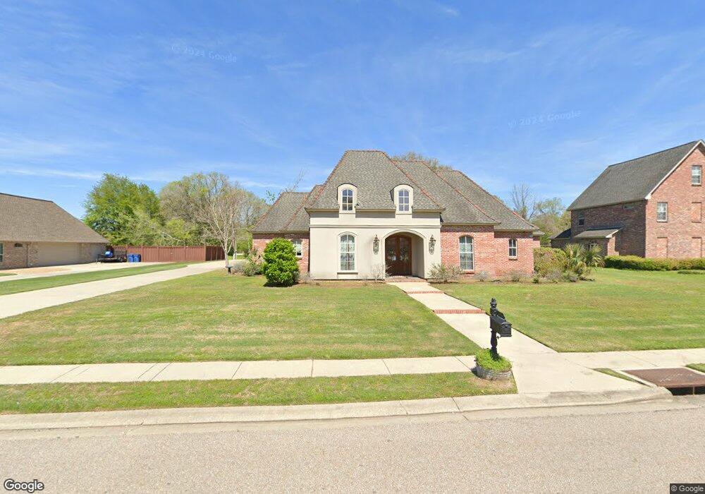
1854 Safford Blvd Port Allen, LA 70767
West Baton Rouge Parish NeighborhoodEstimated Value: $455,000 - $557,000
4
Beds
3
Baths
2,933
Sq Ft
$179/Sq Ft
Est. Value
About This Home
This home is located at 1854 Safford Blvd, Port Allen, LA 70767 and is currently estimated at $523,828, approximately $178 per square foot. 1854 Safford Blvd is a home located in West Baton Rouge Parish with nearby schools including Brusly Elementary School, Lukeville Upper Elementary School, and Brusly Middle School.
Ownership History
Date
Name
Owned For
Owner Type
Purchase Details
Closed on
Feb 28, 2012
Sold by
Landry Michael Anthony and Landry Bethany Barnes
Bought by
Berthelot Coody Brian Lee and Berthelot Coody Dana
Current Estimated Value
Home Financials for this Owner
Home Financials are based on the most recent Mortgage that was taken out on this home.
Original Mortgage
$266,000
Outstanding Balance
$183,072
Interest Rate
3.91%
Mortgage Type
New Conventional
Estimated Equity
$340,756
Create a Home Valuation Report for This Property
The Home Valuation Report is an in-depth analysis detailing your home's value as well as a comparison with similar homes in the area
Home Values in the Area
Average Home Value in this Area
Purchase History
| Date | Buyer | Sale Price | Title Company |
|---|---|---|---|
| Berthelot Coody Brian Lee | $372,000 | Stewart Title Guaranty Co |
Source: Public Records
Mortgage History
| Date | Status | Borrower | Loan Amount |
|---|---|---|---|
| Open | Berthelot Coody Brian Lee | $266,000 |
Source: Public Records
Tax History Compared to Growth
Tax History
| Year | Tax Paid | Tax Assessment Tax Assessment Total Assessment is a certain percentage of the fair market value that is determined by local assessors to be the total taxable value of land and additions on the property. | Land | Improvement |
|---|---|---|---|---|
| 2024 | $3,651 | $45,190 | $9,000 | $36,190 |
| 2023 | $3,415 | $40,390 | $8,500 | $31,890 |
| 2022 | $4,236 | $40,390 | $8,500 | $31,890 |
| 2021 | $4,332 | $40,390 | $8,500 | $31,890 |
| 2020 | $3,937 | $36,350 | $7,650 | $28,700 |
| 2019 | $4,379 | $38,810 | $5,470 | $33,340 |
| 2018 | $4,458 | $38,810 | $5,470 | $33,340 |
| 2017 | $4,117 | $38,810 | $5,470 | $33,340 |
| 2015 | $3,289 | $38,300 | $4,960 | $33,340 |
| 2014 | $3,236 | $38,300 | $4,960 | $33,340 |
| 2013 | $2,837 | $33,580 | $4,960 | $28,620 |
Source: Public Records
Map
Nearby Homes
- 4747 Evergreen Dr
- 2218 Silverstone Ave
- 1959 Fairview Ave
- 2217 Silverstone Ave
- 2742 Emily Dr
- 1394 Rue Riviere
- 1152 Freeman Ln
- 2488 Oak Alley Dr
- 4000 Lake Beau Pre Blvd Unit 110
- 526 Gwin St
- 6455 Louisiana 1
- 6312 Louisiana 1
- 3926 Northshore Ave
- 5565 Ducros Dr
- 540 Bourgeois St
- 3839 Southpass Ave
- 5024 Myrtle Trail Dr
- 3822 Southpass Ave
- 5129 Amberlyn Dr
- 3531 Riverway Dr
- 1836 Safford Blvd
- 1880 Safford Blvd
- 1869 Safford Blvd
- 1845 Safford Blvd
- 1916 Safford Blvd
- 4760 S River Rd
- 4734 S River Rd
- 1921 Safford Blvd
- 4810 S River Rd
- 1815 Auguste St
- 4809 Lafitte Ct
- 1944 Safford Blvd
- 4744 S River Rd
- 1825 Auguste St
- 4830 S River Rd
- 1957 Safford Blvd
- 4814 Lafitte Ct
- 4835 Lafitte Ct
- 1968 Safford Blvd
- 4655 Missouri Dr