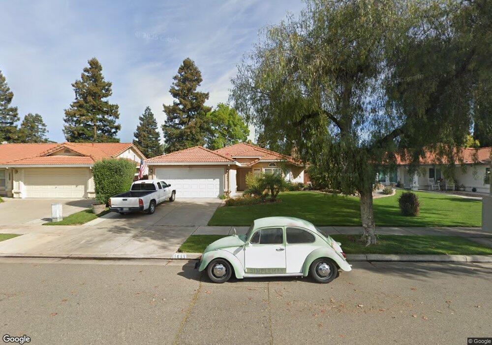
1855 Brookside Dr Merced, CA 95348
Estimated Value: $359,000 - $374,000
3
Beds
2
Baths
1,390
Sq Ft
$264/Sq Ft
Est. Value
About This Home
This home is located at 1855 Brookside Dr, Merced, CA 95348 and is currently estimated at $367,432, approximately $264 per square foot. 1855 Brookside Dr is a home located in Merced County with nearby schools including Luther Burbank Elementary School, Tenaya Middle School, and Merced High School.
Ownership History
Date
Name
Owned For
Owner Type
Purchase Details
Closed on
Aug 30, 2017
Sold by
Decker Tracy Renee and Decker Jeremiah J
Bought by
Decker Tracy Renee and Decker Jeremiah J
Current Estimated Value
Home Financials for this Owner
Home Financials are based on the most recent Mortgage that was taken out on this home.
Original Mortgage
$81,760
Outstanding Balance
$19,006
Interest Rate
3.92%
Mortgage Type
New Conventional
Estimated Equity
$348,426
Purchase Details
Closed on
Oct 16, 2002
Sold by
Grace Jason and Grace Christina
Bought by
Walton Tracy
Home Financials for this Owner
Home Financials are based on the most recent Mortgage that was taken out on this home.
Original Mortgage
$134,000
Interest Rate
6.12%
Purchase Details
Closed on
Jul 23, 1998
Sold by
Willis Thomas J
Bought by
Grace Jason and Grace Christina
Create a Home Valuation Report for This Property
The Home Valuation Report is an in-depth analysis detailing your home's value as well as a comparison with similar homes in the area
Purchase History
| Date | Buyer | Sale Price | Title Company |
|---|---|---|---|
| Decker Tracy Renee | -- | First American Title Insuran | |
| Walton Tracy | $190,000 | Fidelity Title Company | |
| Grace Jason | -- | Chicago Title Co |
Source: Public Records
Mortgage History
| Date | Status | Borrower | Loan Amount |
|---|---|---|---|
| Open | Decker Tracy Renee | $81,760 | |
| Previous Owner | Walton Tracy | $134,000 |
Source: Public Records
Tax History
| Year | Tax Paid | Tax Assessment Tax Assessment Total Assessment is a certain percentage of the fair market value that is determined by local assessors to be the total taxable value of land and additions on the property. | Land | Improvement |
|---|---|---|---|---|
| 2025 | $2,896 | $275,017 | $50,681 | $224,336 |
| 2024 | $2,896 | $269,626 | $49,688 | $219,938 |
| 2023 | $2,855 | $264,340 | $48,714 | $215,626 |
| 2022 | $2,886 | $259,158 | $47,759 | $211,399 |
| 2021 | $2,869 | $254,077 | $46,823 | $207,254 |
| 2020 | $2,736 | $244,000 | $80,000 | $164,000 |
| 2019 | $2,590 | $229,500 | $65,000 | $164,500 |
| 2018 | $2,310 | $220,000 | $55,000 | $165,000 |
| 2017 | $2,366 | $214,000 | $45,000 | $169,000 |
| 2016 | $2,241 | $202,000 | $45,000 | $157,000 |
| 2015 | $1,775 | $161,000 | $45,000 | $116,000 |
| 2014 | $1,490 | $136,000 | $30,000 | $106,000 |
Source: Public Records
Map
Nearby Homes
- 1541 W North Bear Creek Dr
- 2500 N State Highway 59 Unit 36
- 2500 N State Highway 59 Unit 278
- 2500 N State Highway 59 Unit 239
- 2500 N State Highway 59 Unit 18
- 2500 N State Highway 59
- 1648 W North Bear Creek Dr
- 1963 Shadowbrook Dr
- 1973 Shadowbrook Dr
- 1441 W 20th St
- 1646 W North Bear Creek Dr
- 1656 W North Bear Creek Dr Unit 9
- 1664 W North Bear Creek Dr Unit 5
- 1438 W 19th St
- 1482 Autry Way
- 1463 W 25th St
- 2790 N State Highway 59
- 1145 W 22nd St
- 1274 Devonwood Dr
- 1127 W 23rd St
- 1843 Brookside Dr
- 1867 Brookside Dr
- 1856 Springfield Ct
- 1831 Brookside Dr
- 1879 Brookside Dr
- 1880 Springfield Ct
- 1854 Brookside Dr
- 1866 Brookside Dr
- 1840 Brookside Dr
- 1819 Brookside Dr
- 1891 Brookside Dr
- 1832 Springfield Ct
- 1878 Brookside Dr
- 1830 Brookside Dr
- 1892 Springfield Ct
- 1807 Brookside Dr
- 1890 Brookside Dr
- 1820 Brookside Dr
- 1857 Springfield Ct
- 1845 Springfield Ct
Your Personal Tour Guide
Ask me questions while you tour the home.