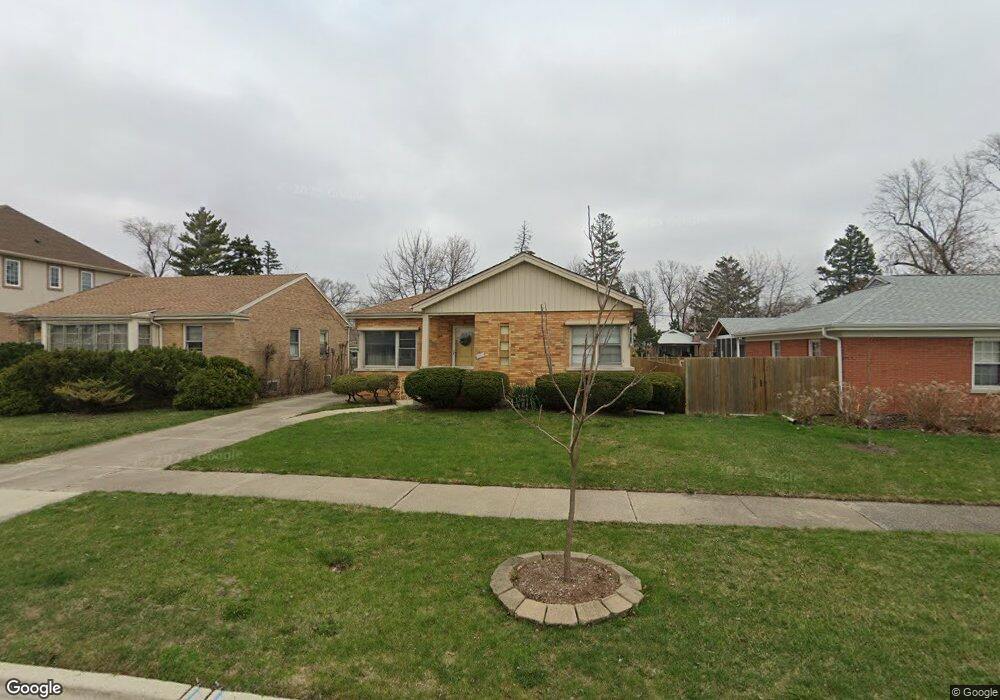
1855 Manchester Ave Westchester, IL 60154
Estimated Value: $320,000 - $374,000
3
Beds
1
Bath
1,261
Sq Ft
$277/Sq Ft
Est. Value
About This Home
This home is located at 1855 Manchester Ave, Westchester, IL 60154 and is currently estimated at $348,961, approximately $276 per square foot. 1855 Manchester Ave is a home located in Cook County with nearby schools including Westchester Primary School, Westchester Intermediate School, and Westchester Middle School.
Ownership History
Date
Name
Owned For
Owner Type
Purchase Details
Closed on
Jun 30, 1997
Sold by
Ahn Peter J and Ahn Eunho C
Bought by
Jovicevic Milan and Jovicevic Terri A
Current Estimated Value
Home Financials for this Owner
Home Financials are based on the most recent Mortgage that was taken out on this home.
Original Mortgage
$132,600
Outstanding Balance
$19,848
Interest Rate
8%
Mortgage Type
VA
Estimated Equity
$329,113
Purchase Details
Closed on
Mar 30, 1995
Sold by
Pinnacle Bank
Bought by
Ann Peter J and Ahn Hun No C
Home Financials for this Owner
Home Financials are based on the most recent Mortgage that was taken out on this home.
Original Mortgage
$86,100
Interest Rate
7.87%
Create a Home Valuation Report for This Property
The Home Valuation Report is an in-depth analysis detailing your home's value as well as a comparison with similar homes in the area
Home Values in the Area
Average Home Value in this Area
Purchase History
| Date | Buyer | Sale Price | Title Company |
|---|---|---|---|
| Jovicevic Milan | $130,000 | -- | |
| Ann Peter J | $3,000 | Dukane Title Ins |
Source: Public Records
Mortgage History
| Date | Status | Borrower | Loan Amount |
|---|---|---|---|
| Open | Jovicevic Milan | $132,600 | |
| Previous Owner | Ann Peter J | $86,100 |
Source: Public Records
Tax History Compared to Growth
Tax History
| Year | Tax Paid | Tax Assessment Tax Assessment Total Assessment is a certain percentage of the fair market value that is determined by local assessors to be the total taxable value of land and additions on the property. | Land | Improvement |
|---|---|---|---|---|
| 2024 | $6,181 | $26,869 | $4,655 | $22,214 |
| 2023 | $5,203 | $26,869 | $4,655 | $22,214 |
| 2022 | $5,203 | $20,473 | $3,990 | $16,483 |
| 2021 | $5,062 | $20,473 | $3,990 | $16,483 |
| 2020 | $5,012 | $20,473 | $3,990 | $16,483 |
| 2019 | $5,131 | $21,591 | $3,657 | $17,934 |
| 2018 | $5,062 | $21,591 | $3,657 | $17,934 |
| 2017 | $4,981 | $21,591 | $3,657 | $17,934 |
| 2016 | $4,552 | $18,106 | $3,325 | $14,781 |
| 2015 | $4,458 | $18,106 | $3,325 | $14,781 |
| 2014 | $4,370 | $18,106 | $3,325 | $14,781 |
| 2013 | $3,589 | $16,906 | $3,325 | $13,581 |
Source: Public Records
Map
Nearby Homes
- 1840 Gardner Rd
- 1900 Manchester Ave
- 1623 Manchester Ave
- 1907 Suffolk Ave
- 1601 Bristol Ave
- 1500 Bristol Ave
- 1932 Newcastle Ave
- 1433 Bristol Ave
- 2128 Hull Ave
- 10072 Drury Ln
- 2320 S 22nd Ave
- 2237 S 22nd Ave
- 1542 Homestead Rd
- 1119 Newcastle Ave
- 2510 S 17th Ave
- 1245 S Mannheim Rd Unit 2
- 1247 S Mannheim Rd Unit 3
- 923 Manchester Ave
- 920 Suffolk Ave
- 1016 Hull Ave
- 1849 Manchester Ave
- 1859 Manchester Ave
- 1843 Manchester Ave
- 1854 Bristol Ave
- 1850 Bristol Ave
- 1858 Bristol Ave
- 1837 Manchester Ave
- 1842 Bristol Ave
- 1901 Manchester Ave
- 1831 Manchester Ave
- 1836 Bristol Ave
- 1848 Manchester Ave
- 1858 Manchester Ave
- 1842 Manchester Ave
- 1900 Bristol Ave
- 1830 Bristol Ave
- 1907 Manchester Ave
- 1836 Manchester Ave
- 1825 Manchester Ave
- 1906 Bristol Ave