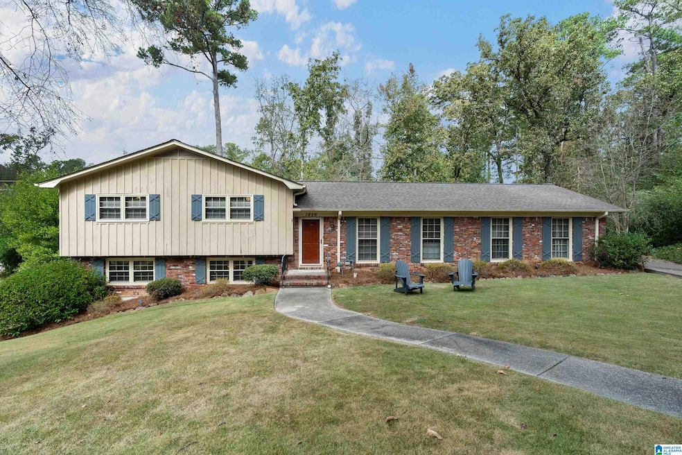
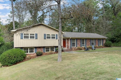
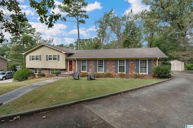
1856 Burning Tree Cir Birmingham, AL 35226
Estimated payment $2,226/month
Highlights
- Deck
- Attic
- Fenced Yard
- Shades Valley High School Rated A-
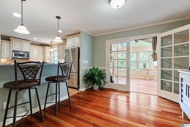
- Stone Countertops
- Attached Garage
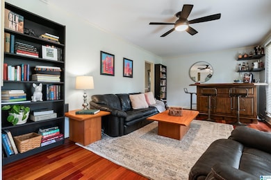
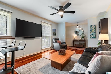
About This Home
Enjoy the best of both worlds with this charming 3-bedroom, 2-bath home—currently zoned county for low taxes, yet eligible for annexation into the city of Hoover. Once inside, you’ll find a large family room centered around a cozy fireplace, perfect for gatherings and relaxation. The huge sunroom is a showstopper, offering panoramic views of the expansive backyard. With plenty of room to entertain, garden, or simply enjoy the outdoors, this property offers comfort, space, and flexibility in a highly desirable location. Schedule your showing today!
Home Details
Home Type
- Single Family
Est. Annual Taxes
- $1,442
Year Built
- Built in 1966
Lot Details
- 0.48 Acre Lot
- Fenced Yard
Parking
- Attached Garage
- Rear-Facing Garage
Home Design
- Split Level Home
- Brick Exterior Construction
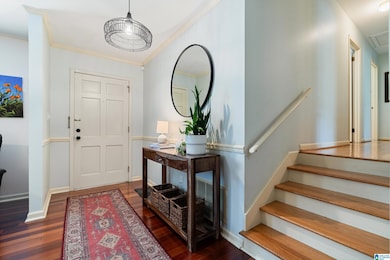
Interior Spaces
- ENERGY STAR Qualified Ceiling Fan
- Recessed Lighting
- Brick Fireplace
- Window Treatments
- Family Room with Fireplace
- Laundry in Basement
- Stone Countertops
- Attic
Bedrooms and Bathrooms
- 3 Bedrooms
- 2 Full Bathrooms
Laundry
- Laundry Room
- Washer and Electric Dryer Hookup
Schools
- Grantswood Elementary School
- Irondale Middle School
- Shades Valley High School
Additional Features
- Deck
- Gas Water Heater
Community Details
- $40 Other Monthly Fees
Map
Home Values in the Area
Average Home Value in this Area
Tax History
| Year | Tax Paid | Tax Assessment Tax Assessment Total Assessment is a certain percentage of the fair market value that is determined by local assessors to be the total taxable value of land and additions on the property. | Land | Improvement |
|---|---|---|---|---|
| 2024 | $1,442 | $31,820 | -- | -- |
| 2022 | $1,326 | $31,030 | $12,400 | $18,630 |
| 2021 | $1,161 | $27,230 | $12,400 | $14,830 |
| 2020 | $1,088 | $25,570 | $12,400 | $13,170 |
| 2019 | $1,031 | $24,260 | $0 | $0 |
| 2018 | $1,036 | $21,740 | $0 | $0 |
| 2017 | $979 | $20,600 | $0 | $0 |
| 2016 | $908 | $19,180 | $0 | $0 |
| 2015 | $908 | $19,180 | $0 | $0 |
| 2014 | $902 | $18,960 | $0 | $0 |
| 2013 | $902 | $18,960 | $0 | $0 |
Property History
| Date | Event | Price | List to Sale | Price per Sq Ft |
|---|---|---|---|---|
| 11/04/2025 11/04/25 | Pending | -- | -- | -- |
| 10/30/2025 10/30/25 | For Sale | $399,900 | -- | $167 / Sq Ft |
Purchase History
| Date | Type | Sale Price | Title Company |
|---|---|---|---|
| Warranty Deed | $350,000 | -- | |
| Warranty Deed | $500 | -- | |
| Warranty Deed | $500 | -- |
Mortgage History
| Date | Status | Loan Amount | Loan Type |
|---|---|---|---|
| Open | $200,000 | New Conventional |
Source: Greater Alabama MLS
MLS Number: 21435206
APN: 39-00-11-4-002-018.000
Disclaimer: Certain information contained herein is derived from information provided by parties other than Homes.com. All information provided is deemed reliable, but is not guaranteed to be accurate and should be independently verified.
![]() IDX information is provided exclusively for personal, non-commercial use, and may not be used for any purpose other than to identify prospective properties consumers may be interested in purchasing. Information is deemed reliable but not guaranteed.
IDX information is provided exclusively for personal, non-commercial use, and may not be used for any purpose other than to identify prospective properties consumers may be interested in purchasing. Information is deemed reliable but not guaranteed.
- 3240 Mockingbird Ln
- 3236 Mockingbird Ln
- 3204 Huntington Ct
- 1731 Hummingbird Ln
- 3413 Crayrich Dr
- 1867 Valgreen Ln Unit 8
- 1867 Valgreen Ln
- 1840 Valgreen Ln
- 0 Mayflower Dr Unit 23 & 24 21430806
- 1916 Mayflower Dr
- 1847 Wisterwood Dr Unit 4, 5, 6
- 1641 Kestwick Dr
- 1608 Kestwick Dr
- 1900 Charlotte Dr Unit 23 & 24
- 1924 Charlotte Dr Unit 19A
- 2503 Grand Point Cir
- 301 Laredo Dr
- 3420 Primm Ln Unit 1
- 3475 Tamassee Ln
- 3405 Wellford Cir
