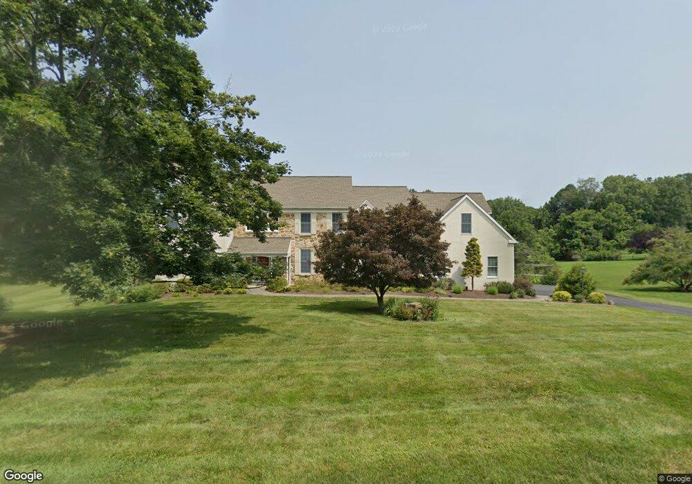
1856 Huntsman Ln West Chester, PA 19382
East Marlborough Township NeighborhoodEstimated Value: $1,166,992 - $1,522,000
5
Beds
5
Baths
4,285
Sq Ft
$307/Sq Ft
Est. Value
About This Home
This home is located at 1856 Huntsman Ln, West Chester, PA 19382 and is currently estimated at $1,315,998, approximately $307 per square foot. 1856 Huntsman Ln is a home located in Chester County with nearby schools including Pocopson Elementary School, Charles F. Patton Middle School, and Unionville High School.
Ownership History
Date
Name
Owned For
Owner Type
Purchase Details
Closed on
Oct 9, 1998
Sold by
Morris Harry J and Morris Joanne L
Bought by
Hunting Raymond D and Hunting Stacey H
Current Estimated Value
Home Financials for this Owner
Home Financials are based on the most recent Mortgage that was taken out on this home.
Original Mortgage
$365,000
Outstanding Balance
$79,224
Interest Rate
6.8%
Estimated Equity
$1,236,774
Purchase Details
Closed on
Jul 31, 1996
Sold by
Dimario Carmen and Dimario Anna M
Bought by
Morris Harry J and Morris Joanne L
Home Financials for this Owner
Home Financials are based on the most recent Mortgage that was taken out on this home.
Original Mortgage
$350,000
Interest Rate
8.24%
Create a Home Valuation Report for This Property
The Home Valuation Report is an in-depth analysis detailing your home's value as well as a comparison with similar homes in the area
Home Values in the Area
Average Home Value in this Area
Purchase History
| Date | Buyer | Sale Price | Title Company |
|---|---|---|---|
| Hunting Raymond D | $525,000 | -- | |
| Morris Harry J | $392,000 | -- |
Source: Public Records
Mortgage History
| Date | Status | Borrower | Loan Amount |
|---|---|---|---|
| Open | Hunting Raymond D | $365,000 | |
| Previous Owner | Morris Harry J | $350,000 |
Source: Public Records
Tax History Compared to Growth
Tax History
| Year | Tax Paid | Tax Assessment Tax Assessment Total Assessment is a certain percentage of the fair market value that is determined by local assessors to be the total taxable value of land and additions on the property. | Land | Improvement |
|---|---|---|---|---|
| 2025 | $2,508 | $372,460 | $82,680 | $289,780 |
| 2024 | $2,508 | $372,460 | $82,680 | $289,780 |
| 2023 | $2,508 | $372,460 | $82,680 | $289,780 |
| 2022 | $2,086 | $372,460 | $82,680 | $289,780 |
| 2021 | $2,508 | $372,460 | $82,680 | $289,780 |
| 2020 | $2,018 | $372,460 | $82,680 | $289,780 |
| 2019 | $2,440 | $372,460 | $82,680 | $289,780 |
| 2018 | $2,440 | $372,460 | $82,680 | $289,780 |
| 2017 | $2,440 | $372,460 | $82,680 | $289,780 |
| 2016 | $1,544 | $372,460 | $82,680 | $289,780 |
| 2015 | $1,544 | $372,460 | $82,680 | $289,780 |
| 2014 | $1,544 | $356,950 | $82,680 | $274,270 |
Source: Public Records
Map
Nearby Homes
- 765 Folly Hill Rd
- 2039-2035 Lenape Unionville Rd
- 0 Haines Mill Rd
- 741 Haines Mill Rd
- 323 E Street Rd
- 327 E Street Rd
- 1936 Lenape Rd
- 454 Larkspur Dr
- 505 Wisteria Dr
- 1740 Lenape Rd
- 213 Katsura Dr
- 217 Kirkbrae Rd
- 347 Astilbe Dr
- 113 Lantana Dr
- 962 E Baltimore Pike
- 1053 Unionville Wawaset Rd
- 24 W Jonathan Ct
- 736 Cascade Way
- 907 Unionville Wawaset Rd
- 280 Cherry Ln Unit 34
- 1854 Huntsman Ln
- 1859 Huntsman Ln
- 757 Folly Hill Rd
- 1852 Huntsman Ln
- 753 Folly Hill Rd
- 109 Gideon Dr
- 111 Gideon Dr
- 1857 Huntsman Ln
- 1855 Huntsman Ln
- 767 Folly Hill Rd
- 113 Gideon Dr
- 789 Folly Hill Rd
- 1850 Huntsman Ln
- 1853 Huntsman Ln
- 107 Gideon Dr
- 115 Gideon Dr
- 1848 Huntsman Ln
- 106 Gideon Dr
- 800 Folly Hill Rd
- 755 Folly Hill Rd