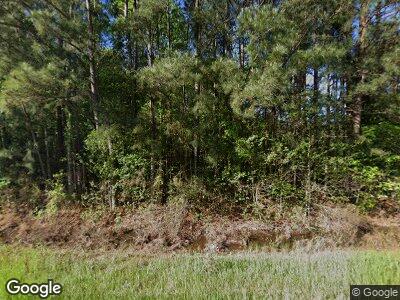
1856 Pershing Hwy SMacKover, AR 71762
Estimated Value: $247,000 - $377,886
--
Bed
3
Baths
2,448
Sq Ft
$129/Sq Ft
Est. Value
About This Home
This home is located at 1856 Pershing Hwy, SMacKover, AR 71762 and is currently estimated at $314,722, approximately $128 per square foot. 1856 Pershing Hwy is a home located in Union County with nearby schools including Smackover Elementary School, Norphlet Middle School, and Smackover High School.
Ownership History
Date
Name
Owned For
Owner Type
Purchase Details
Closed on
Oct 16, 2018
Sold by
Hatch Wayne and Hatch Teresa
Bought by
Miller James Bradley and Miller Hanna
Current Estimated Value
Purchase Details
Closed on
Sep 17, 2013
Sold by
Huitt Nancy J and Huitt Steve M
Bought by
Huitt Angela
Purchase Details
Closed on
Oct 14, 2009
Sold by
Overturf Beverly
Bought by
Walthall Jon D and Walthall Teresa L
Purchase Details
Closed on
Jan 8, 2007
Sold by
Cureton Lew E and Cureton Terri L
Bought by
Matthews Tamela and Matthews Neville
Home Financials for this Owner
Home Financials are based on the most recent Mortgage that was taken out on this home.
Original Mortgage
$190,732
Interest Rate
8.95%
Mortgage Type
Adjustable Rate Mortgage/ARM
Purchase Details
Closed on
Jan 1, 1991
Bought by
Parnell Michael R
Create a Home Valuation Report for This Property
The Home Valuation Report is an in-depth analysis detailing your home's value as well as a comparison with similar homes in the area
Home Values in the Area
Average Home Value in this Area
Purchase History
| Date | Buyer | Sale Price | Title Company |
|---|---|---|---|
| Miller James Bradley | $111,500 | First National Title | |
| Huitt Angela | -- | -- | |
| Walthall Jon D | -- | None Available | |
| Matthews Tamela | $180,000 | Transcontinental Title Compa | |
| Parnell Michael R | -- | -- |
Source: Public Records
Mortgage History
| Date | Status | Borrower | Loan Amount |
|---|---|---|---|
| Open | Matthews Tamela | $34,043 | |
| Previous Owner | Matthews Tamela | $206,559 | |
| Previous Owner | Mattews Tamela | $203,507 | |
| Previous Owner | Matthews Tamela | $190,732 |
Source: Public Records
Tax History Compared to Growth
Tax History
| Year | Tax Paid | Tax Assessment Tax Assessment Total Assessment is a certain percentage of the fair market value that is determined by local assessors to be the total taxable value of land and additions on the property. | Land | Improvement |
|---|---|---|---|---|
| 2024 | $2,076 | $49,660 | $2,220 | $47,440 |
| 2023 | $1,915 | $49,660 | $2,220 | $47,440 |
| 2022 | $1,742 | $35,370 | $2,210 | $33,160 |
| 2021 | $1,730 | $35,370 | $2,210 | $33,160 |
| 2020 | $1,742 | $35,370 | $2,210 | $33,160 |
| 2019 | $1,730 | $35,370 | $2,210 | $33,160 |
| 2018 | $1,730 | $35,370 | $2,210 | $33,160 |
| 2017 | $1,640 | $34,170 | $2,170 | $32,000 |
| 2016 | $1,640 | $34,170 | $2,170 | $32,000 |
| 2014 | $1,640 | $34,170 | $2,170 | $32,000 |
Source: Public Records
Map
Nearby Homes
- 0 Poplar
- 203 W 14th St
- Lots 2-3 Poplar St
- 1000 S Broadway St
- 0 W 4th St
- 601 W Padgett
- 414 W Padgett Rd
- 202 Autumn Ln
- 152 Ouachita St
- 0 Highway 75-20 Unit 24032576
- 5303 Calion Hwy
- 4258 Calion Hwy
- 5420 Calion Hwy
- 1 Ouachita Cr 61
- 1549 N Wyatt Dr
- 510 Robin Rd
- 509 Robin Rd
- 105 Ondo Ln
- 109 Agnes Rd
- 204 Millcreek Dr
