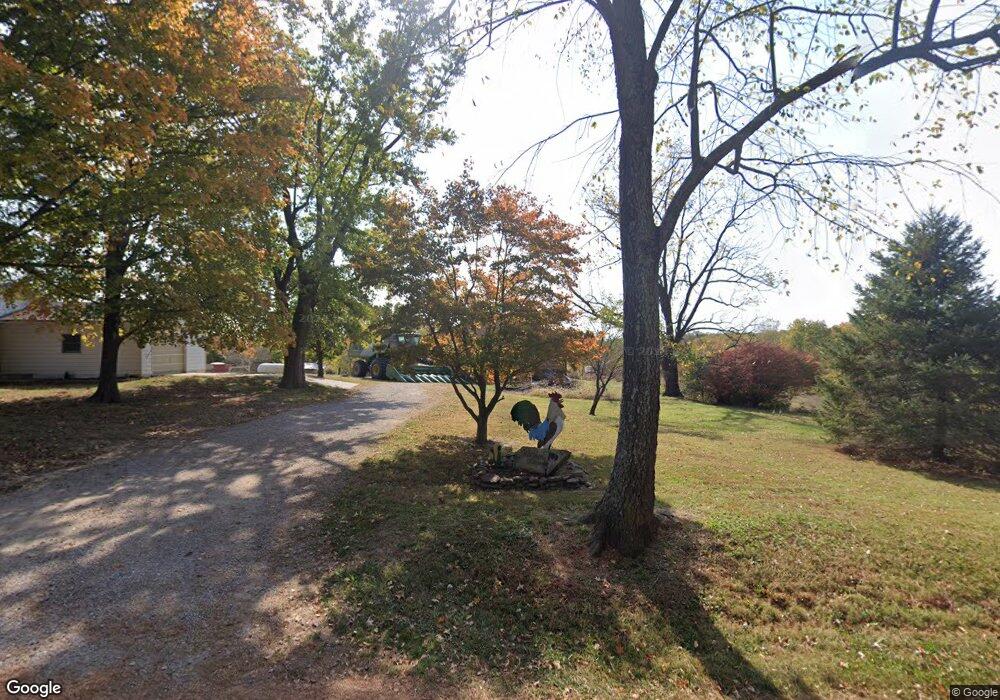
1856 Watt Hill Rd Murphysboro, IL 62966
Estimated Value: $218,000 - $410,475
--
Bed
--
Bath
1,428
Sq Ft
$220/Sq Ft
Est. Value
About This Home
This home is located at 1856 Watt Hill Rd, Murphysboro, IL 62966 and is currently estimated at $314,238, approximately $220 per square foot. 1856 Watt Hill Rd is a home with nearby schools including Murphysboro High School.
Ownership History
Date
Name
Owned For
Owner Type
Purchase Details
Closed on
Aug 26, 2014
Sold by
Buchholz Clifton L
Bought by
Worthen Craig A and Cerutti Worthen Kimberly R
Current Estimated Value
Home Financials for this Owner
Home Financials are based on the most recent Mortgage that was taken out on this home.
Original Mortgage
$208,000
Interest Rate
4.1%
Mortgage Type
Future Advance Clause Open End Mortgage
Purchase Details
Closed on
Jun 11, 2013
Sold by
Buchholz Clifton L and Roth Viola J Buchholz
Bought by
The Buchholz Family Trust
Create a Home Valuation Report for This Property
The Home Valuation Report is an in-depth analysis detailing your home's value as well as a comparison with similar homes in the area
Home Values in the Area
Average Home Value in this Area
Purchase History
| Date | Buyer | Sale Price | Title Company |
|---|---|---|---|
| Worthen Craig A | $260,000 | None Available | |
| The Buchholz Family Trust | -- | None Available |
Source: Public Records
Mortgage History
| Date | Status | Borrower | Loan Amount |
|---|---|---|---|
| Closed | Worthen Craig A | $208,000 |
Source: Public Records
Tax History Compared to Growth
Tax History
| Year | Tax Paid | Tax Assessment Tax Assessment Total Assessment is a certain percentage of the fair market value that is determined by local assessors to be the total taxable value of land and additions on the property. | Land | Improvement |
|---|---|---|---|---|
| 2024 | $4,138 | $57,603 | $15,404 | $42,199 |
| 2023 | $3,795 | $51,663 | $13,664 | $37,999 |
| 2022 | $3,445 | $46,945 | $12,114 | $34,831 |
| 2021 | $3,289 | $44,423 | $10,780 | $33,643 |
| 2020 | $3,327 | $43,805 | $9,640 | $34,165 |
| 2019 | $2,992 | $42,201 | $8,558 | $33,643 |
| 2018 | $3,274 | $41,240 | $7,597 | $33,643 |
| 2017 | $3,234 | $40,365 | $6,722 | $33,643 |
| 2016 | $3,265 | $41,261 | $5,928 | $35,333 |
| 2015 | -- | $40,538 | $5,205 | $35,333 |
| 2014 | -- | $40,032 | $4,699 | $35,333 |
| 2012 | -- | $40,270 | $4,116 | $36,154 |
Source: Public Records
Map
Nearby Homes
- 604 Shoal Creek Rd
- 2435 W Walnut St
- 2308 Alexander St
- 2381 Logan St
- 2237 Roblee Ave
- 2101 Dewey St
- 2129 Logan St
- 115 Mount Joy Rd
- 2101 Walnut St
- 2120 Logan St
- 2036 Spruce St
- 2142 Herbert St
- 1435 Hoffman Rd
- 604 S 20th St
- 506 S 20th St
- 2112 Herbert St
- 2202 Illinois Ave Unit 3 & 4
- 2202 Illinois Ave Unit 1 & 2
- 2004 Elm St
- 2130 Rains St
- 1929 Watt Hill Rd
- 1802 Watt Hill Rd
- 1745 Watt Hill Rd
- 1728 Watt Hill Rd
- 1614 Watt Hill Rd
- 1715 Watt Hill Rd
- 2269 Watt Hill Rd
- 1500 Watt Hill Rd
- 0 Watt Hill Rd
- 1475 Watt Hill Rd
- 3324 Town Creek Rd
- 1381 Watt Hill Rd
- 3173 Town Creek Rd
- 2535 Watt Hill Rd
- 2489 Watt Hill Rd
- 2469 Watt Hill Rd
- 2538 Watt Hill Rd
- 2578 Watt Hill Rd
- 3220 Town Creek Rd
- 1318 Watt Hill Rd
