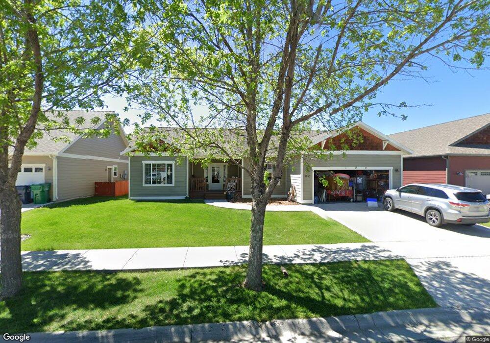
1857 Brisk Ct Bozeman, MT 59718
North Bozeman NeighborhoodEstimated Value: $630,655 - $707,000
3
Beds
2
Baths
1,591
Sq Ft
$413/Sq Ft
Est. Value
About This Home
This home is located at 1857 Brisk Ct, Bozeman, MT 59718 and is currently estimated at $656,664, approximately $412 per square foot. 1857 Brisk Ct is a home located in Gallatin County with nearby schools including Emily Dickinson School, Chief Joseph Middle School, and Gallatin High School.
Ownership History
Date
Name
Owned For
Owner Type
Purchase Details
Closed on
Oct 29, 2008
Sold by
Cascade Homes Inc
Bought by
Clarke P Ryan and Clarke Susan D
Current Estimated Value
Home Financials for this Owner
Home Financials are based on the most recent Mortgage that was taken out on this home.
Original Mortgage
$129,900
Outstanding Balance
$83,239
Interest Rate
5.77%
Mortgage Type
Purchase Money Mortgage
Estimated Equity
$573,425
Create a Home Valuation Report for This Property
The Home Valuation Report is an in-depth analysis detailing your home's value as well as a comparison with similar homes in the area
Home Values in the Area
Average Home Value in this Area
Purchase History
| Date | Buyer | Sale Price | Title Company |
|---|---|---|---|
| Clarke P Ryan | -- | American Land Title Company |
Source: Public Records
Mortgage History
| Date | Status | Borrower | Loan Amount |
|---|---|---|---|
| Open | Clarke P Ryan | $129,900 |
Source: Public Records
Tax History
| Year | Tax Paid | Tax Assessment Tax Assessment Total Assessment is a certain percentage of the fair market value that is determined by local assessors to be the total taxable value of land and additions on the property. | Land | Improvement |
|---|---|---|---|---|
| 2025 | $2,934 | $649,300 | $0 | $0 |
| 2024 | $4,103 | $616,400 | $0 | $0 |
| 2023 | $3,970 | $616,400 | $0 | $0 |
| 2022 | $3,008 | $392,300 | $0 | $0 |
| 2021 | $3,040 | $392,300 | $0 | $0 |
| 2020 | $2,943 | $344,300 | $0 | $0 |
| 2019 | $3,010 | $344,300 | $0 | $0 |
| 2018 | $2,687 | $284,700 | $0 | $0 |
| 2017 | $2,512 | $284,700 | $0 | $0 |
| 2016 | $2,389 | $253,000 | $0 | $0 |
| 2015 | $2,391 | $253,000 | $0 | $0 |
| 2014 | $2,261 | $140,768 | $0 | $0 |
Source: Public Records
Map
Nearby Homes
- 1295 Thomas Dr Unit 203
- 2232 Baxter Lane Units 1-12
- 2236 Baxter Ln Unit 5
- 2440 Tschache Ln Unit 302
- 2440 Tschache Ln Unit 204
- 1242 Thomas Dr
- 1585 N 25th Ave Unit A
- 2240 Baxter Ln Unit 6
- 2240 Baxter Ln Unit 7
- 3110 Tschache Ln
- 2770 Georgia Marie Ln
- 1109 & 1143 Thomas Dr
- 3055 Breeze Ln Unit B
- 2050 Baxter Ln
- 1640 New Holland Dr Unit A
- 3275 Breeze Ln Unit A
- 1372 Zephyr Way
- 3480 Lemhi Trail Dr
- 1140 N 27th Ave Unit 2
- 1205 New Holland Dr
- 1831 Brisk Ct
- 1871 Brisk Ct
- 1850 Buckrake Ave
- 1874 Buckrake Ave
- 1862 Buckrake Ave
- 1878 Buckrake Ave
- 1803 Brisk Ct
- 1886 Buckrake Ave
- 1826 Buckrake Ave
- 1893 Brisk Ct
- 1856 Brisk Ct
- 1828 Brisk Ct
- 1828 Brisk Ct
- 1870 Brisk Ct
- 1898 Buckrake Ave
- 1814 Buckrake Ave
- 1806 Brisk Ct
- 1890 Brisk Ct
- 1835 Leeward Ct
- 1853 Leeward Ct
Your Personal Tour Guide
Ask me questions while you tour the home.