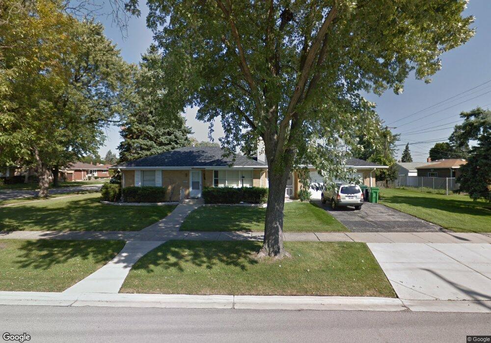
1857 Bristol Ave Westchester, IL 60154
Estimated Value: $335,000 - $368,620
3
Beds
1
Bath
1,275
Sq Ft
$280/Sq Ft
Est. Value
About This Home
This home is located at 1857 Bristol Ave, Westchester, IL 60154 and is currently estimated at $357,405, approximately $280 per square foot. 1857 Bristol Ave is a home located in Cook County with nearby schools including Westchester Primary School, Westchester Intermediate School, and Westchester Middle School.
Ownership History
Date
Name
Owned For
Owner Type
Purchase Details
Closed on
Aug 25, 2004
Sold by
Arquinas Mar G and Arquinas Silvestra S
Bought by
Rosar Building Corp
Current Estimated Value
Purchase Details
Closed on
Feb 27, 1998
Sold by
Arquinas Arnold S and Arquinas Virginia D
Bought by
Arquinas Arnold S and Arquinas Virginia D
Home Financials for this Owner
Home Financials are based on the most recent Mortgage that was taken out on this home.
Original Mortgage
$75,000
Interest Rate
7.15%
Create a Home Valuation Report for This Property
The Home Valuation Report is an in-depth analysis detailing your home's value as well as a comparison with similar homes in the area
Home Values in the Area
Average Home Value in this Area
Purchase History
| Date | Buyer | Sale Price | Title Company |
|---|---|---|---|
| Rosar Building Corp | $286,000 | Git | |
| Arquinas Arnold S | -- | Lakeshore Title Agency |
Source: Public Records
Mortgage History
| Date | Status | Borrower | Loan Amount |
|---|---|---|---|
| Previous Owner | Arquinas Arnold S | $75,000 |
Source: Public Records
Tax History Compared to Growth
Tax History
| Year | Tax Paid | Tax Assessment Tax Assessment Total Assessment is a certain percentage of the fair market value that is determined by local assessors to be the total taxable value of land and additions on the property. | Land | Improvement |
|---|---|---|---|---|
| 2024 | $7,611 | $29,000 | $7,305 | $21,695 |
| 2023 | $6,700 | $29,000 | $7,305 | $21,695 |
| 2022 | $6,700 | $21,963 | $6,262 | $15,701 |
| 2021 | $6,485 | $21,961 | $6,261 | $15,700 |
| 2020 | $6,336 | $21,961 | $6,261 | $15,700 |
| 2019 | $6,301 | $22,304 | $5,739 | $16,565 |
| 2018 | $6,219 | $22,304 | $5,739 | $16,565 |
| 2017 | $6,099 | $22,304 | $5,739 | $16,565 |
| 2016 | $5,552 | $19,038 | $5,218 | $13,820 |
| 2015 | $5,481 | $19,038 | $5,218 | $13,820 |
| 2014 | $5,354 | $19,038 | $5,218 | $13,820 |
| 2013 | $5,312 | $21,130 | $5,218 | $15,912 |
Source: Public Records
Map
Nearby Homes
- 1840 Gardner Rd
- 1900 Manchester Ave
- 1623 Manchester Ave
- 1907 Suffolk Ave
- 1601 Bristol Ave
- 1500 Bristol Ave
- 1932 Newcastle Ave
- 1433 Bristol Ave
- 2128 Hull Ave
- 2320 S 22nd Ave
- 10072 Drury Ln
- 2428 S 19th Ave
- 1542 Homestead Rd
- 2237 S 22nd Ave
- 2510 S 17th Ave
- 1119 Newcastle Ave
- 2330 S 17th Ave
- 1247 S Mannheim Rd Unit 3
- 923 Manchester Ave
- 1518 Cleveland Ave
- 1855 Bristol Ave
- 1849 Bristol Ave
- 1901 Bristol Ave
- 1858 Gardner Rd
- 1856 Gardner Rd
- 1852 Gardner Rd
- 1843 Bristol Ave
- 1846 Gardner Rd
- 1907 Bristol Ave
- 1904 Gardner Rd
- 1858 Bristol Ave
- 1854 Bristol Ave
- 1837 Bristol Ave
- 1840 Gardner Rd
- 1913 Bristol Ave
- 1850 Bristol Ave
- 1900 Bristol Ave
- 1908 Gardner Rd
- 1908 Gardner Rd
- 1836 Gardner Rd