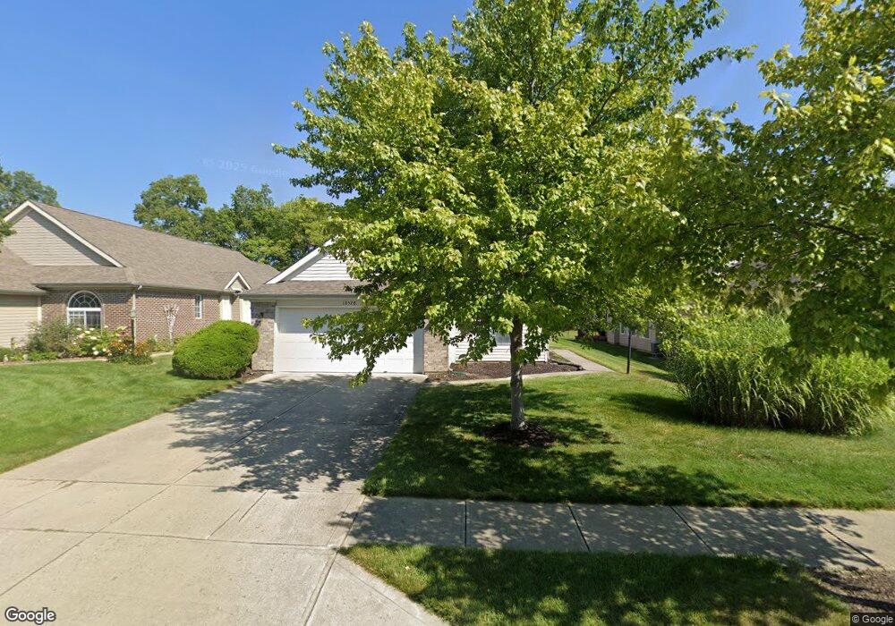
18578 Piers End Dr Noblesville, IN 46062
West Noblesville NeighborhoodEstimated Value: $312,000 - $335,000
3
Beds
2
Baths
1,696
Sq Ft
$190/Sq Ft
Est. Value
About This Home
This home is located at 18578 Piers End Dr, Noblesville, IN 46062 and is currently estimated at $321,396, approximately $189 per square foot. 18578 Piers End Dr is a home located in Hamilton County with nearby schools including Hazel Dell Elementary School, Noblesville West Middle School, and Noblesville High School.
Ownership History
Date
Name
Owned For
Owner Type
Purchase Details
Closed on
May 25, 2022
Sold by
Rams Llc
Bought by
Ao Propco 1 Llc
Current Estimated Value
Purchase Details
Closed on
May 24, 2022
Sold by
Rams Llc
Bought by
Ao Propco 1 Llc
Purchase Details
Closed on
May 5, 2022
Sold by
Rams Llc
Bought by
Ao Propco 1 Llc
Purchase Details
Closed on
Mar 3, 2022
Sold by
Bond Robert H and Bond Ann Dee
Bought by
Rams Llc
Create a Home Valuation Report for This Property
The Home Valuation Report is an in-depth analysis detailing your home's value as well as a comparison with similar homes in the area
Home Values in the Area
Average Home Value in this Area
Purchase History
| Date | Buyer | Sale Price | Title Company |
|---|---|---|---|
| Ao Propco 1 Llc | $264,905 | Bc Law Firm Pa | |
| Ao Propco 1 Llc | $264,905 | None Listed On Document | |
| Ao Propco 1 Llc | $264,906 | Bc Law Firm Pa | |
| Rams Llc | -- | None Listed On Document | |
| Rams Llc | $154,427 | None Listed On Document |
Source: Public Records
Tax History Compared to Growth
Tax History
| Year | Tax Paid | Tax Assessment Tax Assessment Total Assessment is a certain percentage of the fair market value that is determined by local assessors to be the total taxable value of land and additions on the property. | Land | Improvement |
|---|---|---|---|---|
| 2024 | $6,003 | $250,600 | $59,600 | $191,000 |
| 2023 | $6,038 | $243,400 | $59,600 | $183,800 |
| 2022 | $2,716 | $213,100 | $59,600 | $153,500 |
| 2021 | $2,254 | $178,700 | $59,600 | $119,100 |
| 2020 | $2,313 | $178,700 | $59,600 | $119,100 |
| 2019 | $1,953 | $158,500 | $34,100 | $124,400 |
| 2018 | $1,989 | $158,100 | $34,100 | $124,000 |
| 2017 | $2,105 | $139,100 | $34,100 | $105,000 |
| 2016 | $1,691 | $141,700 | $34,100 | $107,600 |
| 2014 | $1,663 | $141,800 | $35,000 | $106,800 |
| 2013 | $1,663 | $143,000 | $34,900 | $108,100 |
Source: Public Records
Map
Nearby Homes
- 18554 Piers End Dr
- 18458 Windstone Cir
- 18449 Piers End Dr
- 18760 Cromarty Cir
- 18823 Cromarty Cir
- 18434 Piers End Dr
- 18379 Piers End Dr
- 18802 Cromarty Cir
- 18808 Cromarty Cir
- 1182 Mill Run Dr
- 18487 Oriental Oak Ct
- 7448 Wythe Dr
- 3475 Westfield Rd
- 102 Pin Oak Ct
- 1119 Albemarle Cir
- 19187 Outer Bank Rd
- 18664 Tillamook Run E
- 626 Heatherwood Ct
- 18796 Tillamook Run E
- 17521 Gruner Way
- 18574 Piers End Dr
- 18582 Piers End Dr
- 18570 Piers End Dr
- 18586 Piers End Dr
- 6879 Carters Grove Dr
- 18590 Piers End Dr
- 6895 Carters Grove Dr
- 6863 Carters Grove Dr
- 6863 Carters Grove D
- 18566 Piers End Dr
- 18577 Piers End Dr
- 18581 Piers End Dr
- 18573 Piers End Dr
- 18585 Piers End Dr
- 18585 Piers End Dr Unit 56
- 6911 Carters Grove Dr
- 18569 Piers End Dr
- 6847 Carters Grove Dr
- 18594 Piers End Dr
- 18589 Piers End Dr