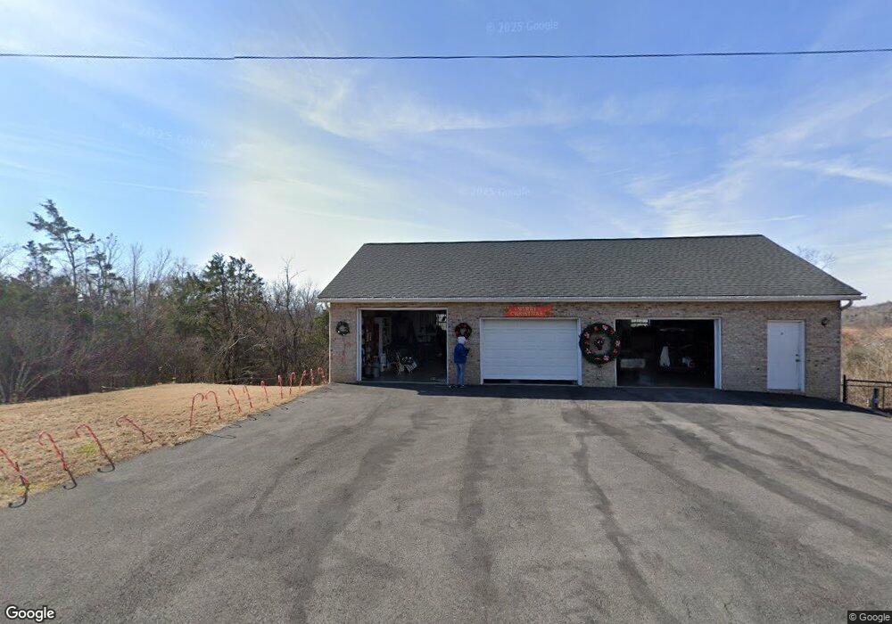
1859 Bouldercrest Dr Dandridge, TN 37725
Estimated Value: $309,000 - $494,000
--
Bed
1
Bath
1,920
Sq Ft
$224/Sq Ft
Est. Value
About This Home
This home is located at 1859 Bouldercrest Dr, Dandridge, TN 37725 and is currently estimated at $429,707, approximately $223 per square foot. 1859 Bouldercrest Dr is a home located in Jefferson County.
Ownership History
Date
Name
Owned For
Owner Type
Purchase Details
Closed on
Aug 13, 2003
Sold by
Price Mark R and Price Bobbie L
Bought by
Roberts James M
Current Estimated Value
Home Financials for this Owner
Home Financials are based on the most recent Mortgage that was taken out on this home.
Original Mortgage
$154,400
Outstanding Balance
$67,496
Interest Rate
5.52%
Estimated Equity
$362,211
Purchase Details
Closed on
Aug 2, 2001
Sold by
Ella Fugate
Bought by
Mark Price
Home Financials for this Owner
Home Financials are based on the most recent Mortgage that was taken out on this home.
Original Mortgage
$125,850
Interest Rate
7.1%
Purchase Details
Closed on
Sep 17, 1979
Bought by
Phelps Ella M Hall
Purchase Details
Closed on
Sep 24, 1975
Purchase Details
Closed on
Nov 7, 1900
Bought by
Phelps Ella M Hall
Create a Home Valuation Report for This Property
The Home Valuation Report is an in-depth analysis detailing your home's value as well as a comparison with similar homes in the area
Home Values in the Area
Average Home Value in this Area
Purchase History
| Date | Buyer | Sale Price | Title Company |
|---|---|---|---|
| Roberts James M | $193,000 | -- | |
| Mark Price | $132,500 | -- | |
| Phelps Ella M Hall | -- | -- | |
| -- | -- | -- | |
| Phelps Ella M Hall | -- | -- |
Source: Public Records
Mortgage History
| Date | Status | Borrower | Loan Amount |
|---|---|---|---|
| Open | Phelps Ella M Hall | $154,400 | |
| Previous Owner | Phelps Ella M Hall | $125,850 |
Source: Public Records
Tax History Compared to Growth
Tax History
| Year | Tax Paid | Tax Assessment Tax Assessment Total Assessment is a certain percentage of the fair market value that is determined by local assessors to be the total taxable value of land and additions on the property. | Land | Improvement |
|---|---|---|---|---|
| 2025 | $1,242 | $86,850 | $25,000 | $61,850 |
| 2023 | $1,122 | $48,775 | $0 | $0 |
| 2022 | $1,068 | $48,775 | $13,000 | $35,775 |
| 2021 | $1,068 | $48,775 | $13,000 | $35,775 |
| 2020 | $1,068 | $48,775 | $13,000 | $35,775 |
| 2019 | $1,068 | $48,775 | $13,000 | $35,775 |
| 2018 | $1,006 | $42,800 | $11,250 | $31,550 |
| 2017 | $1,006 | $42,800 | $11,250 | $31,550 |
| 2016 | $1,006 | $42,800 | $11,250 | $31,550 |
| 2015 | $1,006 | $42,800 | $11,250 | $31,550 |
| 2014 | $1,006 | $42,800 | $11,250 | $31,550 |
Source: Public Records
Map
Nearby Homes
- 1928 Bouldercrest Dr
- 1991 Lakebrook Cir
- 1988 Lakebrook Cir
- 136 Crosslake Ln
- 1045 Southwind Cir
- 417 Little Cove Dr
- 1806 Pheasant Crossing Dr
- 1018 Southwind Cir
- 1887 Lakebrook Cir
- 1710 Ferry Hill Rd
- 1614 Sams Dr
- Lots 1&2 Ferry Hill Rd
- 1635 Sams Dr
- 344 Economy Cir
- 312 Economy Cir
- 1920 Mountain Lake Dr
- 539 Morie Rd
- 428 River Bend Dr
- 323 Eagle Claw Ln
- 450 Riverbend Dr
- 1873 Bouldercrest Dr
- 1873 Boudercrest Dr
- 1847 Bouldercrest Dr
- 1847 Bouldercrest Dr
- 0 Painted Sky Dr
- Lot 27 Bouldercrest Dr
- 0 Bouldercrest Rd
- Lot 20 Bouldercrest Dr
- 207 Point Ln
- 201 Lakepoint Ln
- 211 Point Ln
- 1900 Bouldercrest Dr
- 231 Lakepoint Ln
- 1845 Bouldercrest Dr
- 1819 Overlook Dr
- 1864 Bouldercrest Dr
- 1870 Bouldercrest Dr
- 1842 Bouldercrest Dr
- 5075 Elm Brook Rd
- 5071 Elm Brook Rd